Enable Location

We need your location to show you interesting places around you

Discover nearby places

Find interesting locations and hidden gems around you

Precise directions

Get accurate directions and distances to places

Your location is never shared with other users. It's only used when you tap the location button.

Harrison–Crawford State Forest

Log in to your account

Start exploring — it's free

Trusted by travelers worldwide

Continue with Google
Continue with Apple
or

We will send you a code to connect

By continuing, you accept our Terms and Conditions and our Privacy Policy

Check your inbox

We've sent a pincode in your inbox. Please enter the code below.

Harrison–Crawford State Forest

Harrison–Crawford State Forest, Protected forest in southern Indiana, US.

Description

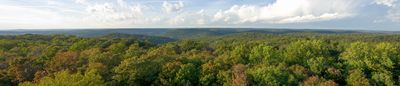
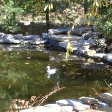
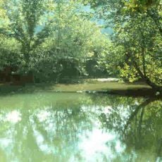
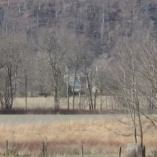
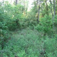
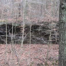
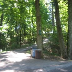
Harrison-Crawford State Forest is a large protected forest in southern Indiana along the Ohio River with extensive trails and camping areas. The terrain features dense hardwood forest, river bluffs, limestone cliffs, and tributary streams that shape the landscape.

History

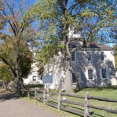
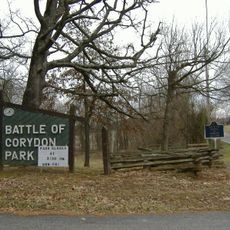
The forest was established in 1932 when state authorities purchased abandoned farmland from local owners during the Great Depression. This transformation turned degraded agricultural areas into a protected natural space that continues today.

Culture

Local residents and visitors gather here for outdoor activities that shape how people connect with the river and forest. The landscape serves as a backdrop for recreation and seasonal traditions that define the community's relationship with nature.

Practical

The forest has marked trails for hiking and horseback riding plus several campgrounds at different entry points. Visitors should expect varying terrain conditions and can use the river as a landmark for navigation throughout the area.

Did you know?

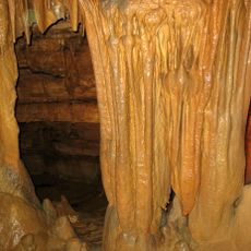
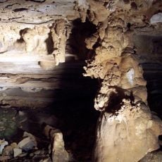
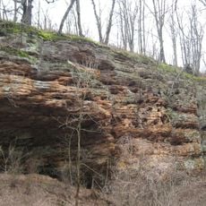
The forest contains hundreds of natural caves that remain largely hidden and accessible only to registered experienced cavers with special permits. These underground formations are part of the region's complex limestone system beneath the forest floor.

GPS coordinates
38.20000,-86.30000
Latest update
December 14, 2025 11:41

AroundUs brings together thousands of curated places, local tips, and hidden gems, enriched daily by 60,000 contributors worldwide. Discover all places nearby (United States of America).

Around this place
Marengo Cave
United States of America

Marengo Cave

19.9 km
Confederate Monument in Louisville
United States of America

Confederate Monument in Louisville

24.5 km
Wyandotte Caves
United States of America

Wyandotte Caves

3.1 km
Corydon Historic District
United States of America

Corydon Historic District

15.5 km
Doe Run Inn
United States of America

Doe Run Inn

31 km
O'Bannon Woods State Park
United States of America

O'Bannon Woods State Park

3.1 km
Harrison Spring
United States of America

Harrison Spring

8.2 km
Matthew E. Welsh Bridge
United States of America

Matthew E. Welsh Bridge

22.3 km
Rockhouse Cliffs Rockshelters
United States of America

Rockhouse Cliffs Rockshelters

28.9 km
Kintner-Withers House
United States of America

Kintner-Withers House

32.8 km
Swan's Landing Archeological Site
United States of America

Swan's Landing Archeological Site

8.1 km
Potts Creek Rockshelter
United States of America

Potts Creek Rockshelter

23.2 km
Corydon Battle Site
United States of America

Corydon Battle Site

14.9 km
Kintner-McGrain House
United States of America

Kintner-McGrain House

15.4 km
Jacob Rickenbaugh House
United States of America

Jacob Rickenbaugh House

27.3 km
Gabriel Farnsley House
United States of America

Gabriel Farnsley House

34.4 km
Simpson Memorial United Methodist Church
United States of America

Simpson Memorial United Methodist Church

33.1 km
Meade County Jail
United States of America

Meade County Jail

24.6 km
Irvington Historic District
United States of America

Irvington Historic District

35.4 km
Brandenburg Methodist Episcopal Church
United States of America

Brandenburg Methodist Episcopal Church

25.1 km
Georgetown Historic District
United States of America

Georgetown Historic District

30.3 km
Jersey Park Farm
United States of America

Jersey Park Farm

35.6 km
William Proctor House
United States of America

William Proctor House

18.7 km
Edward Yeakel House
United States of America

Edward Yeakel House

24.8 km
Brandenburg Commercial District
United States of America

Brandenburg Commercial District

24.7 km
Jones-Willis House
United States of America

Jones-Willis House

24.8 km
Corydon Capitol State Historic Site
United States of America

Corydon Capitol State Historic Site

15.4 km
Doe Run Creek Historic District
United States of America

Doe Run Creek Historic District

31.5 km
Show the full map
« Harrison–Crawford State Forest - Protected forest in southern Indiana, US » is provided by Around Us (aroundus.com). Images and texts are derived from Wikimedia project under a Creative Commons license. You are allowed to copy, distribute, and modify copies of this page, under the conditions set by the license, as long as this note is clearly visible.

Discover hidden gems everywhere you go!

From secret cafés to breathtaking viewpoints, skip the crowded tourist spots and find places that match your style. Our app makes it easy with voice search, smart filtering, route optimization, and insider tips from travelers worldwide. Download now for the complete mobile experience.

Around Us App Screenshot

A unique approach to discovering new places

Le Figaro

All the places worth exploring

France Info

A tailor-made excursion in just a few clicks

20 Minutes

Around Us
Travel Guide & Maps
Download

Send to your phone

QR Code
1

Open the camera app on your mobile.

2

Point at the QR code with your camera. A notification will appear.

3

Tap the notification to open the link.