Enable Location

We need your location to show you interesting places around you

Discover nearby places

Find interesting locations and hidden gems around you

Precise directions

Get accurate directions and distances to places

Your location is never shared with other users. It's only used when you tap the location button.

Manlius Village Historic District

Log in to your account

Start exploring — it's free

Trusted by 61,539 travelers worldwide

Continue with Google
Continue with Apple
or

We will send you a code to connect

By continuing, you accept our Terms and Conditions and our Privacy Policy

Check your inbox

We've sent a pincode in your inbox. Please enter the code below.

Manlius Village Historic District, Historic district in Manlius, New York, US.

Description

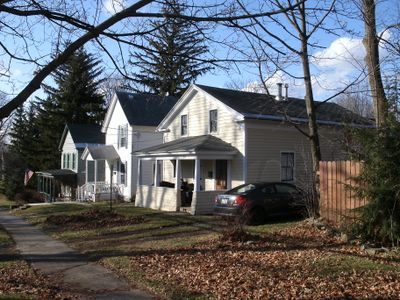
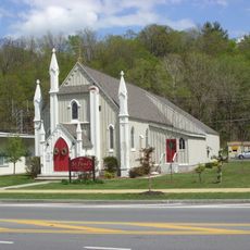
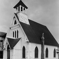
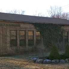
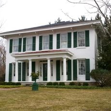
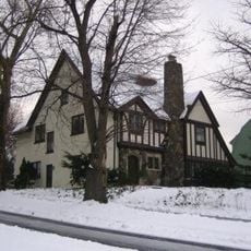
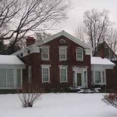
Manlius Village Historic District is a 15-acre area containing roughly 50 buildings that represent different periods of construction throughout the 1800s. The ensemble includes four churches and one commercial block distributed across Pleasant, Franklin, North, Clinton, and East Seneca Streets, with the majority of residential structures aligned along Seneca Street.

History

The district traces its origins to the village's founding in 1813 and received its National Register of Historic Places designation in 1973. This formal recognition acknowledged the importance of the structures in documenting the early settlement and growth of the community.

Culture

Smith Hall, constructed in the early 1800s, serves as a Masonic Temple with wall murals depicting Masonic symbols and scenes. These painted decorations reflect the craftsmanship and traditions that community members have valued in this space for generations.

Practical

The district is best explored on foot, allowing visitors to appreciate the architectural details at a leisurely pace as they move through the streets. Comfortable walking shoes are recommended, and visitors should be prepared for variable weather throughout the year when planning their visit.

Did you know?

Smith Hall contains detailed Masonic murals that remained concealed beneath wall coverings for many decades before being rediscovered in the early 1900s. This hidden artistic layer reveals how much visual history is embedded within these structures and awaits discovery beneath their exteriors.

Location
Architectural style
Renaissance Revival architecture
GPS coordinates
43.00310,-75.97530
Latest update
December 14, 2025 17:02

AroundUs brings together thousands of curated places, local tips, and hidden gems, enriched daily by 60,000 contributors worldwide. Discover all places nearby (New York).

Around this place
Green Lakes State Park
United States of America

Green Lakes State Park

5.1 km
Chittenango Falls State Park
United States of America

Chittenango Falls State Park

10.5 km
Old Erie Canal State Historic Park
United States of America

Old Erie Canal State Historic Park

8.8 km
Round Lake National Natural Landmark
United States of America

Round Lake National Natural Landmark

5.1 km
St. Paul's Church
United States of America

St. Paul's Church

9.9 km
Wellington House
United States of America

Wellington House

4.7 km
Ashton House
United States of America

Ashton House

12 km
Fuller House
United States of America

Fuller House

12 km
Dr. John Ives House
United States of America

Dr. John Ives House

7.7 km
Notleymere
United States of America

Notleymere

11 km
Saint Mark's Church
United States of America

Saint Mark's Church

8 km
Kelly House
United States of America

Kelly House

12.4 km
Drover's Tavern
United States of America

Drover's Tavern

6.2 km
Mycenae Schoolhouse
United States of America

Mycenae Schoolhouse

5.9 km
Poehlman House
United States of America

Poehlman House

11.9 km
Southwood Two-Teacher School
United States of America

Southwood Two-Teacher School

11 km
Levi Snell House
United States of America

Levi Snell House

4.4 km
Sanderson House at 112 Scottholm Terrace
United States of America

Sanderson House at 112 Scottholm Terrace

12 km
Sanderson House at 301 Scottholm Boulevard
United States of America

Sanderson House at 301 Scottholm Boulevard

11.7 km
Hoeffer House
United States of America

Hoeffer House

11.9 km
Pompey Centre District No. 10 Schoolhouse
United States of America

Pompey Centre District No. 10 Schoolhouse

9.1 km
Louis and Celia Skoler Residence
United States of America

Louis and Celia Skoler Residence

11.9 km
Annas Farmhouse
United States of America

Annas Farmhouse

11 km
Harry N. Burhans House
United States of America

Harry N. Burhans House

12.1 km
Genesee Street Hill-Limestone Plaza Historic District
United States of America

Genesee Street Hill-Limestone Plaza Historic District

4.1 km
Chittenango Landing Canal Boat Museum
United States of America

Chittenango Landing Canal Boat Museum

10.5 km
Oran District No. 22 Schoolhouse
United States of America

Oran District No. 22 Schoolhouse

4.3 km
Chittenango Falls
United States of America

Chittenango Falls

11.2 km
Show the full map
« Manlius Village Historic District - Historic district in Manlius, New York, US » is provided by Around Us (aroundus.com). Images and texts are derived from Wikimedia project under a Creative Commons license. You are allowed to copy, distribute, and modify copies of this page, under the conditions set by the license, as long as this note is clearly visible.

Discover hidden gems everywhere you go!

From secret cafés to breathtaking viewpoints, skip the crowded tourist spots and find places that match your style. Our app makes it easy with voice search, smart filtering, route optimization, and insider tips from travelers worldwide. Download now for the complete mobile experience.

Around Us App Screenshot

A unique approach to discovering new places

Le Figaro

All the places worth exploring

France Info

A tailor-made excursion in just a few clicks

20 Minutes

Around Us
Travel Guide & Maps
Download

Send to your phone

QR Code
1

Open the camera app on your mobile.

2

Point at the QR code with your camera. A notification will appear.

3

Tap the notification to open the link.