Enable Location

We need your location to show you interesting places around you

Discover nearby places

Find interesting locations and hidden gems around you

Precise directions

Get accurate directions and distances to places

Your location is never shared with other users. It's only used when you tap the location button.

Old Erie Canal State Historic Park

Log in to your account

Start exploring — it's free

Trusted by 62,490 travelers worldwide

Continue with Google
Continue with Apple
or

We will send you a code to connect

By continuing, you accept our Terms and Conditions and our Privacy Policy

Check your inbox

We've sent a pincode in your inbox. Please enter the code below.

Old Erie Canal State Historic Park

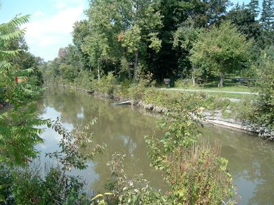
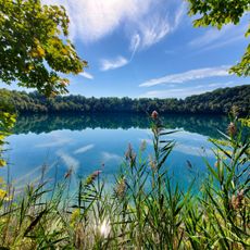
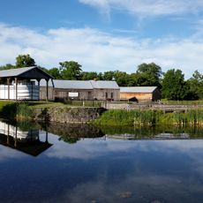
Old Erie Canal State Historic Park, State historic park between DeWitt and Rome, United States.

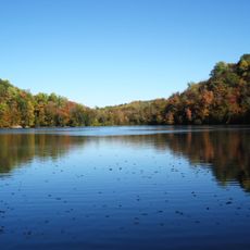
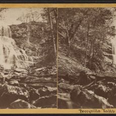
The old canal runs for dozens of kilometers and displays original waterways with stone bridges and footpaths from the 19th century. Along the route you find well-maintained structures like arches and aqueducts that show the building craft of that period.

The Erie Canal opened in 1825 and was a revolutionary connection between the Great Lakes and the Atlantic Ocean at that time. After the larger Barge Canal was built in the early 1900s, this older section was gradually abandoned.

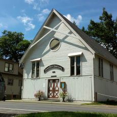
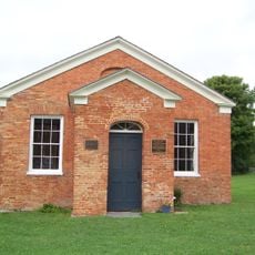
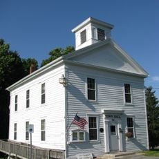
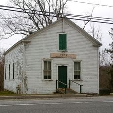
The two museums within the park tell the story of when canals were the main way to move goods and people across the region. Visitors can see how communities grew around these waterways and what daily life looked like for those who worked and lived along them.

The park offers different paths for walking and biking that are mostly flat and easy to access. Visitors should bring appropriate gear depending on the season, since the waterways can be used for ice skating and snowmobiling in winter.

The park contains a sunken canal boat from the 19th century that still speaks to the time when such vessels traveled these waterways daily. This preserved wreck is a rare chance to see the size and construction of these old transport vessels up close.

The community of curious travelers

AroundUs brings together thousands of curated places, local tips, and hidden gems, enriched daily by 60,000 contributors worldwide.

Start exploring
Location
Operator
New York State Office of Parks, Recreation and Historic Preservation
Phone
GPS coordinates
43.07310,-75.92610
Latest update
December 8, 2025 20:02
Around this place
International Boxing Hall of Fame
United States of America

International Boxing Hall of Fame

14.4 km
Green Lakes State Park
United States of America

Green Lakes State Park

4.7 km
Chittenango Falls State Park
United States of America

Chittenango Falls State Park

12.1 km
Oneida Community Mansion House
United States of America

Oneida Community Mansion House

26.1 km
Verona Beach State Park
United States of America

Verona Beach State Park

20.9 km
Farnam Mansion
United States of America

Farnam Mansion

22.6 km
Round Lake National Natural Landmark
United States of America

Round Lake National Natural Landmark

4.7 km
Gerrit Smith Estate
United States of America

Gerrit Smith Estate

22.7 km
St. Paul's Church
United States of America

St. Paul's Church

5.8 km
Sylvan Beach Union Chapel
United States of America

Sylvan Beach Union Chapel

21.2 km
Sylvan Beach Amusement Park
United States of America

Sylvan Beach Amusement Park

21 km
Green Lakes Beach
United States of America

Green Lakes Beach

3.5 km
Canastota Methodist Church
United States of America

Canastota Methodist Church

13.9 km
Mycenae Schoolhouse
United States of America

Mycenae Schoolhouse

3 km
Canastota Public Library
United States of America

Canastota Public Library

13.9 km
Canal Town Museum
United States of America

Canal Town Museum

14.2 km
Judge Nathan S. Roberts House
United States of America

Judge Nathan S. Roberts House

13.6 km
Fenner Baptist Church
United States of America

Fenner Baptist Church

16.1 km
United Church of Canastota
United States of America

United Church of Canastota

14 km
Levi Snell House
United States of America

Levi Snell House

7.9 km
Peterboro Street Elementary School
United States of America

Peterboro Street Elementary School

14.4 km
South Peterboro Street Commercial Historic District
United States of America

South Peterboro Street Commercial Historic District

14.2 km
Peterboro Land Office
United States of America

Peterboro Land Office

22.7 km
Annas Farmhouse
United States of America

Annas Farmhouse

14.1 km
Perryville Falls
United States of America

Perryville Falls

12 km
Lenox District No. 4 Schoolhouse
United States of America

Lenox District No. 4 Schoolhouse

15.4 km
Chittenango Landing Canal Boat Museum
United States of America

Chittenango Landing Canal Boat Museum

4.6 km
Oran District No. 22 Schoolhouse
United States of America

Oran District No. 22 Schoolhouse

10.5 km
Show the full map
« Old Erie Canal State Historic Park - State historic park between DeWitt and Rome, United States » is provided by Around Us (aroundus.com). Images and texts are derived from Wikimedia project under a Creative Commons license. You are allowed to copy, distribute, and modify copies of this page, under the conditions set by the license, as long as this note is clearly visible.

Discover hidden gems everywhere you go!

From secret cafés to breathtaking viewpoints, skip the crowded tourist spots and find places that match your style. Our app makes it easy with voice search, smart filtering, route optimization, and insider tips from travelers worldwide. Download now for the complete mobile experience.

Around Us App Screenshot

A unique approach to discovering new places

Le Figaro

All the places worth exploring

France Info

A tailor-made excursion in just a few clicks

20 Minutes

Around Us
Travel Guide & Maps
Download

Send to your phone

QR Code
1

Open the camera app on your mobile.

2

Point at the QR code with your camera. A notification will appear.

3

Tap the notification to open the link.