Enable Location

We need your location to show you interesting places around you

Discover nearby places

Find interesting locations and hidden gems around you

Precise directions

Get accurate directions and distances to places

Your location is never shared with other users. It's only used when you tap the location button.

Mulberry Hill

Log in to your account

Start exploring — it's free

Trusted by 63,950 travelers worldwide

Continue with Google
Continue with Apple
or

We will send you a code to connect

By continuing, you accept our Terms and Conditions and our Privacy Policy

Check your inbox

We've sent a pincode in your inbox. Please enter the code below.

Discussion Reviews 1 Photos
1.4k Popularity

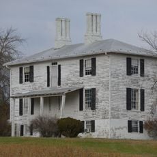
Mulberry Hill, human settlement in Virginia, United States of America

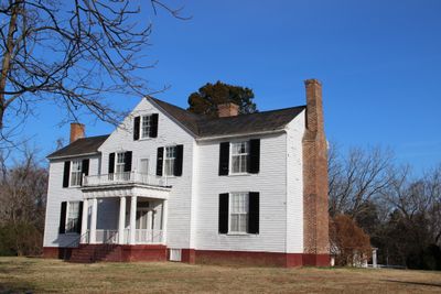
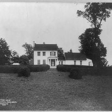
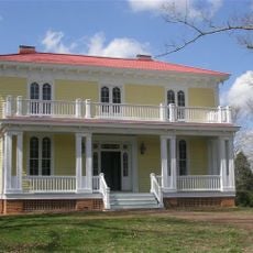
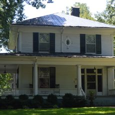
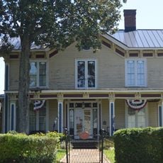
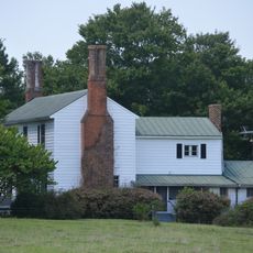
Mulberry Hill is a historic plantation in Virginia featuring a main house that evolved over roughly a hundred years. The building began as a one-story structure, later expanded into a two-story residence with a hip roof, and received its current appearance around 1903 when architect William C. McDowell redesigned it for Eleanor Junkin Cox Latane.

The earliest sections of the house were built around 1797 for Andrew Reid, the first county clerk of Rockbridge County. The property was expanded through the 19th and early 20th centuries by successive owners including Samuel McDowell Reid, and experienced a brief military occupation by Union soldiers in June 1864 during the Civil War.

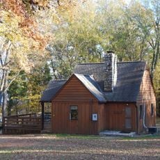
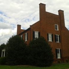
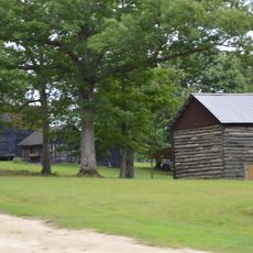
The name Mulberry Hill references the mulberry trees that once grew on the grounds. The main house and outbuildings reflect the social structure of plantation life, showing the physical separation between the owner's residence and the spaces where workers lived and labored.

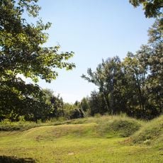
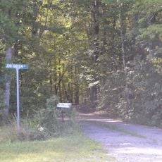
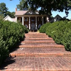
The main house is generally not open to the public as it remains a private residence. You can view the building from the nearby road and enjoy the exterior and gardens, which are oriented toward views of House Mountain.

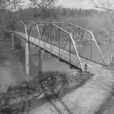
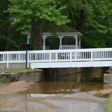
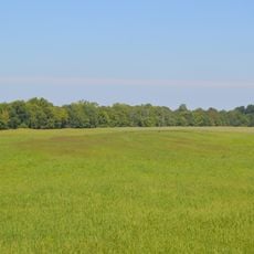
Union soldiers used the grounds in 1864 as a strategic outpost because of its elevated position overlooking the surrounding landscape. They positioned guns on the property and attempted to shell a nearby bridge, though the attack was unsuccessful.

The community of curious travelers

AroundUs brings together thousands of curated places, local tips, and hidden gems, enriched daily by 60,000 contributors worldwide.

Start exploring
Location
GPS coordinates
36.90810,-78.69690
Latest update
February 9, 2026 07:47
Around this place
Red Hill Patrick Henry National Memorial
United States of America

Red Hill Patrick Henry National Memorial

22.6 km
Staunton River State Park
United States of America

Staunton River State Park

23.6 km
Black Walnut
United States of America

Black Walnut

5.5 km
Staunton River Battlefield State Park
United States of America

Staunton River Battlefield State Park

2.5 km
Roanoke Plantation
United States of America

Roanoke Plantation

1.6 km
Annefield
United States of America

Annefield

7 km
Clarkton Bridge
United States of America

Clarkton Bridge

19.2 km
Four Locust Farm
United States of America

Four Locust Farm

25.5 km
Charlotte County Courthouse
United States of America

Charlotte County Courthouse

17.2 km
Halifax County Courthouse
United States of America

Halifax County Courthouse

26.1 km
E. L. Evans House
United States of America

E. L. Evans House

29.1 km
Buffalo Springs Historical Archeological District
United States of America

Buffalo Springs Historical Archeological District

29.1 km
MacCallum More and Hudgins House Historic District
United States of America

MacCallum More and Hudgins House Historic District

24.4 km
The Cove
United States of America

The Cove

9.5 km
Seaton
United States of America

Seaton

27.2 km
Charlotte Court House Historic District
United States of America

Charlotte Court House Historic District

17.2 km
Shadow Lawn
United States of America

Shadow Lawn

24.6 km
Wade Archeological Site
United States of America

Wade Archeological Site

2.5 km
Brookneal Historic District
United States of America

Brookneal Historic District

27.1 km
Red Fox Farm
United States of America

Red Fox Farm

28.5 km
Eubank Hall
United States of America

Eubank Hall

20.6 km
Town of Halifax Court House Historic District
United States of America

Town of Halifax Court House Historic District

26 km
Cat Rock Sluice of the Roanoke Navigation
United States of America

Cat Rock Sluice of the Roanoke Navigation

27.9 km
Reedy Creek Site
United States of America

Reedy Creek Site

28.7 km
Toombs Tobacco Farm
United States of America

Toombs Tobacco Farm

16.6 km
Salem School
United States of America

Salem School

16.3 km
Watkins House
United States of America

Watkins House

25.1 km
Mountain Road Historic District
United States of America

Mountain Road Historic District

26.5 km
Show the full map
Reviews
Share your experience

No review yet

Discussions
Start a discussion...

No discussion yet

« Mulberry Hill - human settlement in Virginia, United States of America » is provided by Around Us (aroundus.com). Images and texts are derived from Wikimedia project under a Creative Commons license. You are allowed to copy, distribute, and modify copies of this page, under the conditions set by the license, as long as this note is clearly visible.

Discover hidden gems everywhere you go!

From secret cafés to breathtaking viewpoints, skip the crowded tourist spots and find places that match your style. Our app makes it easy with voice search, smart filtering, route optimization, and insider tips from travelers worldwide. Download now for the complete mobile experience.

Around Us App Screenshot

A unique approach to discovering new places

Le Figaro

All the places worth exploring

France Info

A tailor-made excursion in just a few clicks

20 Minutes

Around Us
Travel Guide & Maps
Download

Send to your phone

QR Code
1

Open the camera app on your mobile.

2

Point at the QR code with your camera. A notification will appear.

3

Tap the notification to open the link.