Enable Location

We need your location to show you interesting places around you

Discover nearby places

Find interesting locations and hidden gems around you

Precise directions

Get accurate directions and distances to places

Your location is never shared with other users. It's only used when you tap the location button.

Myles Standish State Forest

Log in to your account

Start exploring — it's free

Trusted by 61,814 travelers worldwide

Continue with Google
Continue with Apple
or

We will send you a code to connect

By continuing, you accept our Terms and Conditions and our Privacy Policy

Check your inbox

We've sent a pincode in your inbox. Please enter the code below.

Myles Standish State Forest

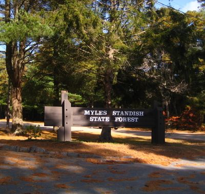
Myles Standish State Forest, Nature reserve and forest in Carver, Massachusetts, United States.

Description

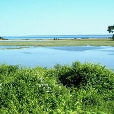
Myles Standish State Forest is a nature reserve and forest in Carver, Massachusetts, containing pine barrens, oak forests, wetlands, and kettle ponds shaped by glacial activity. The landscape spreads across thousands of acres with distinct natural zones that support different plants and wildlife.

History

The forest was established in 1916 and saw significant development during the 1930s through a major tree-planting program. This period shaped the forest's structure and appearance as visitors know it today.

Culture

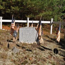
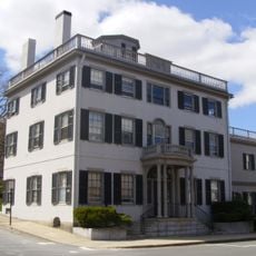
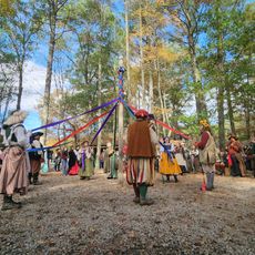
The land holds deep roots with the Wampanoag people, who shaped and lived on these grounds long before others arrived. Their presence remains woven into the forest's story and identity today.

Practical

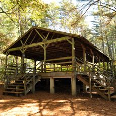
The forest has four camping areas, a swimming pond, paved bike paths, and forest trails suitable for different activity levels. Visitors should prepare for varied terrain and pay attention to wet areas and boggy sections when exploring.

Did you know?

The forest is home to uncommon wildlife species and specialized habitats with unusual environmental conditions. These distinct natural pockets result from glacial history and create rare opportunities to see species found nowhere else nearby.

Location
GPS coordinates
41.86755,-70.66406
Latest update
December 8, 2025 19:55

AroundUs brings together thousands of curated places, local tips, and hidden gems, enriched daily by 60,000 contributors worldwide. Discover all places nearby (Massachusetts).

Around this place
Plymouth Rock
United States of America

Plymouth Rock

10.1 km
Edaville Railroad
United States of America

Edaville Railroad

9.3 km
Water Wizz
United States of America

Water Wizz

12.3 km
Burial Hill
United States of America

Burial Hill

9.9 km
Plimoth Patuxet
United States of America

Plimoth Patuxet

8.6 km
Cole's Hill
United States of America

Cole's Hill

10 km
Richard Sparrow House
United States of America

Richard Sparrow House

9.6 km
Ellisville Harbor State Park
United States of America

Ellisville Harbor State Park

10.5 km
Jabez Howland House
United States of America

Jabez Howland House

9.7 km
Plimoth Patuxet Museums
United States of America

Plimoth Patuxet Museums

8.5 km
Harlow Old Fort House
United States of America

Harlow Old Fort House

9.4 km
Mayflower House Museum
United States of America

Mayflower House Museum

10.1 km
Parting Ways
United States of America

Parting Ways

10.4 km
Jenney Grist Mill
United States of America

Jenney Grist Mill

9.6 km
Thomas Land
United States of America

Thomas Land

9.5 km
United States of America

Tremont Nail Company

12.3 km
Plymouth Village Historic District
United States of America

Plymouth Village Historic District

10 km
Tremont Nail Factory District
United States of America

Tremont Nail Factory District

12.3 km
Sgt. William Harlow Family Homestead
United States of America

Sgt. William Harlow Family Homestead

9.4 km
Plymouth Post Office Building
United States of America

Plymouth Post Office Building

9.8 km
Clifford-Warren House
United States of America

Clifford-Warren House

8.8 km
Bethel African Methodist Episcopal Church and Parsonage
United States of America

Bethel African Methodist Episcopal Church and Parsonage

10 km
Hillside
United States of America

Hillside

9.1 km
Bartlett-Russell-Hedge House
United States of America

Bartlett-Russell-Hedge House

10 km
Pinewoods Camp
United States of America

Pinewoods Camp

5.7 km
Bradford-Union Street Historic District
United States of America

Bradford-Union Street Historic District

9.8 km
King Richards Faire
United States of America

King Richards Faire

8 km
Old County Courthouse
United States of America

Old County Courthouse

9.8 km
Show the full map
« Myles Standish State Forest - Nature reserve and forest in Carver, Massachusetts, United States » is provided by Around Us (aroundus.com). Images and texts are derived from Wikimedia project under a Creative Commons license. You are allowed to copy, distribute, and modify copies of this page, under the conditions set by the license, as long as this note is clearly visible.

Discover hidden gems everywhere you go!

From secret cafés to breathtaking viewpoints, skip the crowded tourist spots and find places that match your style. Our app makes it easy with voice search, smart filtering, route optimization, and insider tips from travelers worldwide. Download now for the complete mobile experience.

Around Us App Screenshot

A unique approach to discovering new places

Le Figaro

All the places worth exploring

France Info

A tailor-made excursion in just a few clicks

20 Minutes

Around Us
Travel Guide & Maps
Download

Send to your phone

QR Code
1

Open the camera app on your mobile.

2

Point at the QR code with your camera. A notification will appear.

3

Tap the notification to open the link.