Enable Location

We need your location to show you interesting places around you

Discover nearby places

Find interesting locations and hidden gems around you

Precise directions

Get accurate directions and distances to places

Your location is never shared with other users. It's only used when you tap the location button.

Fort Philip Long

Log in to your account

Start exploring — it's free

Trusted by 62,509 travelers worldwide

Continue with Google
Continue with Apple
or

We will send you a code to connect

By continuing, you accept our Terms and Conditions and our Privacy Policy

Check your inbox

We've sent a pincode in your inbox. Please enter the code below.

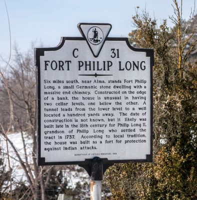
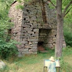
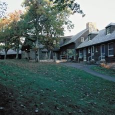
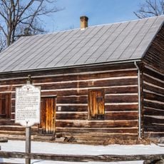
Fort Philip Long, 18th-century fort complex in Stanley, Virginia

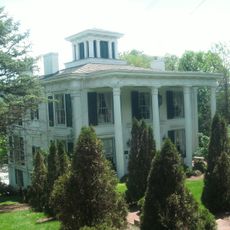
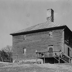
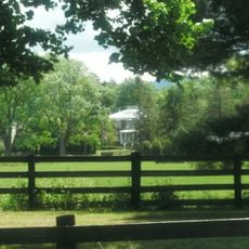
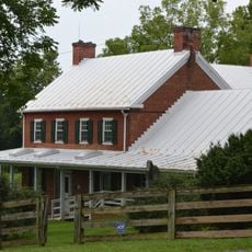
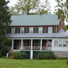
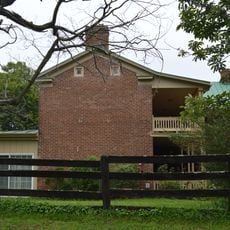
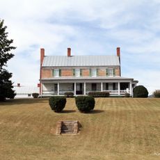
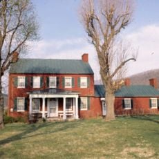
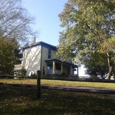
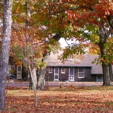
Fort Philip Long is an 18th-century fort complex in Stanley, Virginia, constructed with limestone walls and a gable roof. The property includes the original fort structure and a three-bay square brick house built in 1856 on roughly 900 acres along the Shenandoah River.

The fort was built for Philip Long II, the grandson of Philip Long who first settled the area in 1737. It served to protect families in the Massanutten region of Page County during a period of frontier tensions.

The 1856 brick farmhouse displays original Victorian wall paintings in its rooms that mimic the look of plaster molding and decorative ceiling patterns. These decorations show the taste and craftsmanship that well-to-do families of the time wanted to display in their homes.

The property sits along the Shenandoah River and is most accessible during dry conditions when the paths are easy to walk. Visitors should wear appropriate footwear and allow enough time to explore the sprawling grounds.

The cellar features two levels connected by a tunnel to a well positioned about 100 yards from the main building, showing advanced construction for its time. This underground link allowed residents to access water while remaining relatively protected from the main structure.

The community of curious travelers

AroundUs brings together thousands of curated places, local tips, and hidden gems, enriched daily by 60,000 contributors worldwide.

Start exploring
Location
Inception
1856
GPS coordinates
38.60556,-78.56222
Latest update
December 14, 2025 18:03
Around this place
Luray Caverns
United States of America

Luray Caverns

9.4 km
Skyline Drive
United States of America

Skyline Drive

10.9 km
The Great Stalacpipe Organ
United States of America

The Great Stalacpipe Organ

9.4 km
New Market Battlefield State Historical Park
United States of America

New Market Battlefield State Historical Park

11.4 km
Catherine Furnace
United States of America

Catherine Furnace

8.3 km
Aventine Hall
United States of America

Aventine Hall

10.7 km
Fort Egypt
United States of America

Fort Egypt

6.9 km
Big Meadows Lodge
United States of America

Big Meadows Lodge

13.5 km
Kanawha
United States of America

Kanawha

10.9 km
Plains Mill
United States of America

Plains Mill

13.5 km
The White House
United States of America

The White House

5.3 km
Ruffner House
United States of America

Ruffner House

11.8 km
Isaac Spitler House
United States of America

Isaac Spitler House

5.5 km
Graves Chapel and Cemetery
United States of America

Graves Chapel and Cemetery

7.2 km
New Market Historic District
United States of America

New Market Historic District

10.6 km
Page County Courthouse
United States of America

Page County Courthouse

10.7 km
Wall Brook Farm
United States of America

Wall Brook Farm

3.2 km
Abram and Sallie Printz Farm
United States of America

Abram and Sallie Printz Farm

13.7 km
Mauck's Meetinghouse
United States of America

Mauck's Meetinghouse

7.3 km
Heiston-Strickler House
United States of America

Heiston-Strickler House

11.9 km
John Beaver House
United States of America

John Beaver House

2.7 km
Massanutton Heights
United States of America

Massanutton Heights

3.6 km
Locust Grove
United States of America

Locust Grove

9.6 km
Welfley-Shuler House
United States of America

Welfley-Shuler House

13.2 km
Skyline Drive Historic District
United States of America

Skyline Drive Historic District

13.5 km
Shenandoah Heritage Village
United States of America

Shenandoah Heritage Village

9.6 km
Luray Singing Tower
United States of America

Luray Singing Tower

9.8 km
Redwell-Isabella Furnace Historic District
United States of America

Redwell-Isabella Furnace Historic District

12.3 km
Show the full map
« Fort Philip Long - 18th-century fort complex in Stanley, Virginia » is provided by Around Us (aroundus.com). Images and texts are derived from Wikimedia project under a Creative Commons license. You are allowed to copy, distribute, and modify copies of this page, under the conditions set by the license, as long as this note is clearly visible.

Discover hidden gems everywhere you go!

From secret cafés to breathtaking viewpoints, skip the crowded tourist spots and find places that match your style. Our app makes it easy with voice search, smart filtering, route optimization, and insider tips from travelers worldwide. Download now for the complete mobile experience.

Around Us App Screenshot

A unique approach to discovering new places

Le Figaro

All the places worth exploring

France Info

A tailor-made excursion in just a few clicks

20 Minutes

Around Us
Travel Guide & Maps
Download

Send to your phone

QR Code
1

Open the camera app on your mobile.

2

Point at the QR code with your camera. A notification will appear.

3

Tap the notification to open the link.