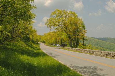
Skyline Drive, National Scenic Byway in Shenandoah National Park, Virginia, United States.
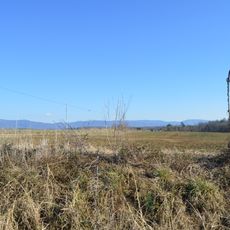
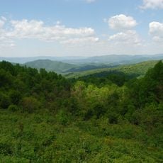
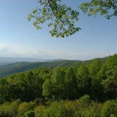
Skyline Drive is a National Scenic Byway in Shenandoah National Park, Virginia, running 105 miles (169 kilometers) along the crest of the Blue Ridge Mountains. The route passes through eight counties and offers access to 75 overlooks where travelers can view the Shenandoah Valley and Piedmont region.
Construction began in 1931 as part of a federal program to create jobs during the Great Depression and expand access to recreation areas. The road was completed in 1939, linking existing paths along the mountain range with new sections.
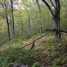
The road'Skyline s name describes how drivers can see for miles across mountain ridges and valleys from this elevated route. Local wildlife such as deer and black bears often appear near the roadway, especially during early morning and late afternoon hours.
The speed limit is set at 35 miles per hour (56 kilometers per hour), and the route may close during winter conditions or severe weather. A park entrance pass is required year-round to access the road.
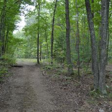
The route connects with 500 miles (805 kilometers) of hiking trails within the park, including sections of the Appalachian Trail that runs from Georgia to Maine. Mileposts along the road number the entire length from north to south, helping travelers identify their location.
Location: Madison County
Location: Warren County
Location: Rappahannock County
Location: Rockingham County
Location: Augusta County
Location: Albemarle County
Location: Page County
Location: Greene County
Inception: 1939
Website: http://nps.gov/shen
GPS coordinates: 38.54830,-78.46060
Latest update: December 4, 2025 23:05
Grand Caverns
45.8 km
Massanutten Waterpark
27.3 km
Jarman Gap
57.4 km
Bogota (Port Republic, Virginia)
38.2 km
Miller-Kite House
20.6 km
Stephen Harnsberger House
44.3 km
Longwood
40.9 km
Blackrock Springs Site
45.6 km
Archeological Site No. AU-154
48.7 km
Kite Mansion
20.4 km
Mount Fair
46.7 km
Midway
50.2 km
St. James Church
50.6 km
Coiner House
55.1 km
Haugh House
39.1 km
Paine Run Rockshelter
48.6 km
Gibson Memorial Chapel and Martha Bagby Battle House at Blue Ridge School
32.4 km
Harnsberger Octagonal Barn
47.5 km
Weyers Cave School
48.7 km
New Hope High School
54.7 km
Port Republic Historic District (Virginia)
41.9 km
Crimora School
55.6 km
Mt. Meridian Schoolhouse
47.5 km
West View Schoolhouse
50.3 km
Kyle's Mill House
38 km
Locust Grove
34 km
Eaton Hollow Overlook
28.1 km
Hensley Hollow Overlook
21.2 kmVisited this place? Tap the stars to rate it and share your experience / photos with the community! Try now! You can cancel it anytime.
Discover hidden gems everywhere you go!
From secret cafés to breathtaking viewpoints, skip the crowded tourist spots and find places that match your style. Our app makes it easy with voice search, smart filtering, route optimization, and insider tips from travelers worldwide. Download now for the complete mobile experience.
A unique approach to discovering new places❞
— Le Figaro
All the places worth exploring❞
— France Info
A tailor-made excursion in just a few clicks❞
— 20 Minutes