Chest opened
+${chestReward.xp} XP
Explorer
NOUVEAU ×${chestReward.collectible.quantity}
tapez pour fermer
Chest locked

Open chests in the app

Around Us is built for your phone — chests unlock when you walk, explore and capture nearby places.

Enable Location

We need your location to show you interesting places around you

Discover nearby places

Find interesting locations and hidden gems around you

Precise directions

Get accurate directions and distances to places

Your location is never shared with other users. It's only used when you tap the location button.

Log in to your account

Start exploring — it's free

Trusted by 73,025 travelers worldwide

Continue with Google
Continue with Apple
or

We will send you a code to connect

By continuing, you accept our Terms and Conditions and our Privacy Policy

Check your inbox

We've sent a pincode in your inbox. Please enter the code below.

Louis Blotner Radar Bomb Scoring Site
Discussion Reviews Photo
1.3k Popularity

Louis Blotner Radar Bomb Scoring Site, Military radar station in Connor, United States.

The Louis Blotner Radar Bomb Scoring Site is a military radar facility in Connor designed to evaluate aerial operations and electronic countermeasures. The installation contains specialized equipment spread across approximately 6.59 acres for testing and assessment purposes.

The facility was established in 1963 on the site of a former NIKE missile launch area and initially served as an AUTOTRACK radar station. It played a role in the region's air defense infrastructure until operations changed in the late 1970s.

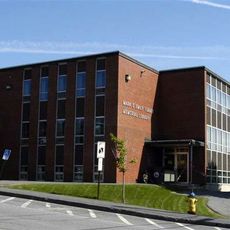
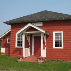
The transformation of enlisted men's barracks into a general store in 1992 represented the gradual shift from military to civilian purposes in Aroostook County.

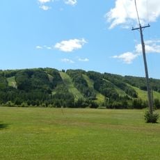
The site is located in a rural area of Aroostook County and is accessible by local roads. The flat terrain makes it easy to navigate when exploring the location.

After military withdrawal, parts of the former barracks were converted into a local store. This repurposing shows how military properties in the region gradually transitioned back to civilian use.

The community of curious travelers

AroundUs brings together thousands of curated places, local tips, and hidden gems, enriched daily by 60,000 contributors worldwide.

Start exploring
Location
GPS coordinates
47.00833,-68.01861
Latest update
December 14, 2025 17:40
Around this place
Double Eagle II
United States of America

Double Eagle II

42.5 km
Aroostook Valley Country Club
Canada

Aroostook Valley Country Club

29 km
Mars Hill
United States of America

Mars Hill

56.4 km
Fort Kent
United States of America

Fort Kent

51.2 km
United States of America

Loring Commerce Centre

11.8 km
Aroostook National Wildlife Refuge
United States of America

Aroostook National Wildlife Refuge

13 km
New Brunswick Botanical Garden
Canada

New Brunswick Botanical Garden

56.2 km
Loring Air Force Base Double Cantilever Hangar
United States of America

Loring Air Force Base Double Cantilever Hangar

12.7 km
Loring Air Force Base Arch Hangar
United States of America

Loring Air Force Base Arch Hangar

12.3 km
National Weather Service Caribou, Maine
United States of America

National Weather Service Caribou, Maine

15.6 km
Fort Fairfield - Andover Border Crossing
Canada

Fort Fairfield - Andover Border Crossing

32.2 km
Mark and Emily Turner Memorial Library
United States of America

Mark and Emily Turner Memorial Library

36.6 km
Acadian Landing Site
United States of America

Acadian Landing Site

42.9 km
Gustaf Adolph Lutheran Church
United States of America

Gustaf Adolph Lutheran Church

11 km
Musée Culturel du Mont-Carmel
United States of America

Musée Culturel du Mont-Carmel

30.9 km
Mont Farlagne
Canada

Mont Farlagne

52 km
Gray Memorial United Methodist Church and Parsonage
United States of America

Gray Memorial United Methodist Church and Parsonage

16.5 km
Acadian Village
United States of America

Acadian Village

22 km
Fort Fairfield Public Library
United States of America

Fort Fairfield Public Library

29.8 km
Philo Reed House
United States of America

Philo Reed House

30.8 km
Governor Brann School
United States of America

Governor Brann School

13.3 km
De la République Provincial Park
Canada

De la République Provincial Park

55.6 km
P'tit Sault Blockhouse
Canada

P'tit Sault Blockhouse

45.7 km
Avro Lancaster KB882
Canada

Avro Lancaster KB882

63.5 km
Cathédrale de l'Immaculée-Conception d'Edmundston
Canada

Cathédrale de l'Immaculée-Conception d'Edmundston

46.1 km
Mont Farlagne
Canada

Mont Farlagne

52 km
Isaie and Scholastique Martin House
United States of America

Isaie and Scholastique Martin House

45.5 km
Simon-Larouche Pavilion
Canada

Simon-Larouche Pavilion

46.2 km
Show the full map
Reviews
Share your experience

No review yet

Discussions
Start a discussion...

No discussion yet

« Louis Blotner Radar Bomb Scoring Site - Military radar station in Connor, United States » is provided by Around Us (aroundus.com). Images and texts are derived from Wikimedia project under a Creative Commons license. You are allowed to copy, distribute, and modify copies of this page, under the conditions set by the license, as long as this note is clearly visible.

Discover hidden gems everywhere you go!

From secret cafés to breathtaking viewpoints, skip the crowded tourist spots and find places that match your style. Our app makes it easy with voice search, smart filtering, route optimization, and insider tips from travelers worldwide. Download now for the complete mobile experience.

Around Us App Screenshot

A unique approach to discovering new places

Le Figaro

All the places worth exploring

France Info

A tailor-made excursion in just a few clicks

20 Minutes

Around Us
Travel Guide & Maps
Download

Send to your phone

QR Code
1

Open the camera app on your mobile.

2

Point at the QR code with your camera. A notification will appear.

3

Tap the notification to open the link.