Enable Location

We need your location to show you interesting places around you

Discover nearby places

Find interesting locations and hidden gems around you

Precise directions

Get accurate directions and distances to places

Your location is never shared with other users. It's only used when you tap the location button.

Rutan Hill

Log in to your account

Start exploring — it's free

Trusted by 62,441 travelers worldwide

Continue with Google
Continue with Apple
or

We will send you a code to connect

By continuing, you accept our Terms and Conditions and our Privacy Policy

Check your inbox

We've sent a pincode in your inbox. Please enter the code below.

Rutan Hill

Rutan Hill, Volcanic hill in Sussex County, New Jersey, USA

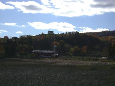
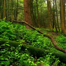
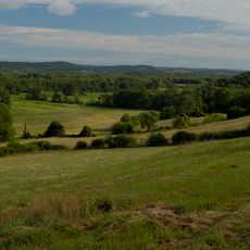
Rutan Hill is a volcanic hill located in Sussex County in northern New Jersey. The formation rises roughly 270 feet above the surrounding creek valley and reaches an elevation of 1,020 feet in this hilly landscape.

The hill was formed roughly 420 million years ago through volcanic activity during the late Ordovician period at the end of the Taconic Orogeny. These ancient geological events shaped the landscape we see today.

The area around Rutan Hill was home to indigenous peoples long before European settlers arrived. Their presence can still be felt through local stories and discoveries that visitors occasionally encounter.

Rutan Hill remains privately owned with restricted public access marked by signs throughout the grounds. Visitors should check whether access is available with special permission before planning a visit to the site.

The hill forms part of the Beemerville Alkaline Complex and hosts the largest surface expression of lamprophyric diatremes within this geological formation. This rare mineral composition makes it particularly notable for rock enthusiasts and geology researchers.

The community of curious travelers

AroundUs brings together thousands of curated places, local tips, and hidden gems, enriched daily by 60,000 contributors worldwide.

Start exploring
GPS coordinates
41.24500,-74.67600
Latest update
December 10, 2025 16:20
Around this place
High Point
United States of America

High Point

8.5 km
High Point State Park
United States of America

High Point State Park

5.5 km
Tri-States Monument
United States of America

Tri-States Monument

12.6 km
Stokes State Forest
United States of America

Stokes State Forest

12.2 km
Wallkill River National Wildlife Refuge
United States of America

Wallkill River National Wildlife Refuge

10.6 km
Space Farms Zoo and Museum
United States of America

Space Farms Zoo and Museum

4.2 km
Mid-Delaware Bridge
United States of America

Mid-Delaware Bridge

14.2 km
Milford–Montague Toll Bridge
United States of America

Milford–Montague Toll Bridge

12.5 km
Pochuck Mountain
United States of America

Pochuck Mountain

12.8 km
Hotel Fauchere and Annex
United States of America

Hotel Fauchere and Annex

13.7 km
Pike County Courthouse
United States of America

Pike County Courthouse

13.7 km
Callahan House
United States of America

Callahan House

13.1 km
First Presbyterian Church of Wantage
United States of America

First Presbyterian Church of Wantage

4.5 km
Bethany Chapel
United States of America

Bethany Chapel

13.8 km
Lawrence Mansion
United States of America

Lawrence Mansion

12.7 km
Crescent Theatre
United States of America

Crescent Theatre

7 km
Foster-Armstrong House
United States of America

Foster-Armstrong House

11.8 km
Elias Van Bunschooten House
United States of America

Elias Van Bunschooten House

3.9 km
Rutan Farm
United States of America

Rutan Farm

7.9 km
Arisbe
United States of America

Arisbe

13.1 km
Jervis Gordon Grist Mill Historic District
United States of America

Jervis Gordon Grist Mill Historic District

14.3 km
Metz Ice Plant
United States of America

Metz Ice Plant

13.1 km
Milford Theatre
United States of America

Milford Theatre

13.7 km
Old Monroe School House
United States of America

Old Monroe School House

14.8 km
High Point Monument War Veterans Memorial
United States of America

High Point Monument War Veterans Memorial

8.5 km
Milford Historic District
United States of America

Milford Historic District

13.7 km
Westbrook-Bell House
United States of America

Westbrook-Bell House

12.9 km
Nyce-Depue Farm
United States of America

Nyce-Depue Farm

14 km
Show the full map
« Rutan Hill - Volcanic hill in Sussex County, New Jersey, USA » is provided by Around Us (aroundus.com). Images and texts are derived from Wikimedia project under a Creative Commons license. You are allowed to copy, distribute, and modify copies of this page, under the conditions set by the license, as long as this note is clearly visible.

Discover hidden gems everywhere you go!

From secret cafés to breathtaking viewpoints, skip the crowded tourist spots and find places that match your style. Our app makes it easy with voice search, smart filtering, route optimization, and insider tips from travelers worldwide. Download now for the complete mobile experience.

Around Us App Screenshot

A unique approach to discovering new places

Le Figaro

All the places worth exploring

France Info

A tailor-made excursion in just a few clicks

20 Minutes

Around Us
Travel Guide & Maps
Download

Send to your phone

QR Code
1

Open the camera app on your mobile.

2

Point at the QR code with your camera. A notification will appear.

3

Tap the notification to open the link.