Enable Location

We need your location to show you interesting places around you

Discover nearby places

Find interesting locations and hidden gems around you

Precise directions

Get accurate directions and distances to places

Your location is never shared with other users. It's only used when you tap the location button.

Wallkill River National Wildlife Refuge

Log in to your account

Start exploring — it's free

Trusted by 62,449 travelers worldwide

Continue with Google
Continue with Apple
or

We will send you a code to connect

By continuing, you accept our Terms and Conditions and our Privacy Policy

Check your inbox

We've sent a pincode in your inbox. Please enter the code below.

Wallkill River National Wildlife Refuge

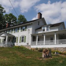
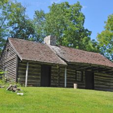
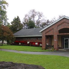
Wallkill River National Wildlife Refuge, National Wildlife Refuge in Sussex County, United States

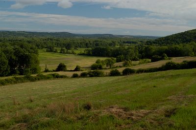
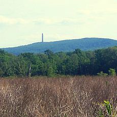
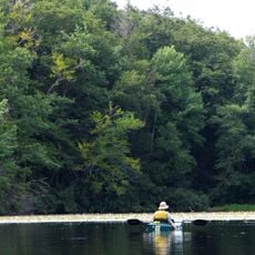
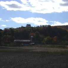
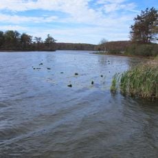
The Wallkill River National Wildlife Refuge is a protected area consisting of wetlands and marshes that provide habitat for numerous bird species and other wildlife in Sussex County. The site includes river sections, open water, and wooded areas that together create a diverse ecosystem suitable for both resident and migratory animals.

The refuge was established in 1990 through federal legislation to protect important river habitats and their wildlife. This protection came after recognition of the ecological value of the wetlands and their role in supporting migratory bird populations.

The refuge integrates with the Appalachian Trail system, offering two miles of this historic footpath within its boundaries for hikers and nature enthusiasts.

Several walking trails and observation points are available for visitors, with guided walks and wildlife viewing activities offered regularly. Sturdy footwear and insect protection are especially recommended during warmer months when the terrain can be quite wet.

The northern section contains specially designed water areas that attract ducks and other waterfowl during migration seasons. These managed ponds are crucial for the survival of many bird species traveling between their northern and southern habitats.

The community of curious travelers

AroundUs brings together thousands of curated places, local tips, and hidden gems, enriched daily by 60,000 contributors worldwide.

Start exploring
Location
Inception
1990
GPS coordinates
41.23330,-74.55000
Latest update
December 9, 2025 18:48
Around this place
Action Park
United States of America

Action Park

5.9 km
High Point
United States of America

High Point

13.5 km
High Point State Park
United States of America

High Point State Park

13.6 km
Tri-States Monument
United States of America

Tri-States Monument

18.4 km
Wawayanda State Park
United States of America

Wawayanda State Park

12.8 km
Rutan Hill
United States of America

Rutan Hill

10.6 km
Space Farms Zoo and Museum
United States of America

Space Farms Zoo and Museum

12.3 km
Pochuck Mountain
United States of America

Pochuck Mountain

3 km
Wawayanda Mountain
United States of America

Wawayanda Mountain

8.7 km
Primitive Baptist Church of Brookfield
United States of America

Primitive Baptist Church of Brookfield

18.6 km
Warwick Village Historic District
United States of America

Warwick Village Historic District

16.1 km
High Breeze Farm
United States of America

High Breeze Farm

11.2 km
General John Hathorn Stone House
United States of America

General John Hathorn Stone House

15.1 km
First Presbyterian Church of Wantage
United States of America

First Presbyterian Church of Wantage

6.2 km
Bethany Chapel
United States of America

Bethany Chapel

9.8 km
Woodlawn Farm
United States of America

Woodlawn Farm

18.7 km
Dunning House
United States of America

Dunning House

17.1 km
Lawrence Mansion
United States of America

Lawrence Mansion

9.5 km
Crescent Theatre
United States of America

Crescent Theatre

5.5 km
Jeremiah Morehouse House
United States of America

Jeremiah Morehouse House

15.3 km
Elias Van Bunschooten House
United States of America

Elias Van Bunschooten House

8 km
Rutan Farm
United States of America

Rutan Farm

16.7 km
Hulet Clark Farmstead
United States of America

Hulet Clark Farmstead

12.9 km
Wawayanda Lake
United States of America

Wawayanda Lake

11.3 km
Franklin Mineral Museum Inc
United States of America

Franklin Mineral Museum Inc

13.7 km
Old Monroe School House
United States of America

Old Monroe School House

14.8 km
High Point Monument War Veterans Memorial
United States of America

High Point Monument War Veterans Memorial

13.5 km
Lafayette Village Historic District
United States of America

Lafayette Village Historic District

19 km
Show the full map
« Wallkill River National Wildlife Refuge - National Wildlife Refuge in Sussex County, United States » is provided by Around Us (aroundus.com). Images and texts are derived from Wikimedia project under a Creative Commons license. You are allowed to copy, distribute, and modify copies of this page, under the conditions set by the license, as long as this note is clearly visible.

Discover hidden gems everywhere you go!

From secret cafés to breathtaking viewpoints, skip the crowded tourist spots and find places that match your style. Our app makes it easy with voice search, smart filtering, route optimization, and insider tips from travelers worldwide. Download now for the complete mobile experience.

Around Us App Screenshot

A unique approach to discovering new places

Le Figaro

All the places worth exploring

France Info

A tailor-made excursion in just a few clicks

20 Minutes

Around Us
Travel Guide & Maps
Download

Send to your phone

QR Code
1

Open the camera app on your mobile.

2

Point at the QR code with your camera. A notification will appear.

3

Tap the notification to open the link.