Enable Location

We need your location to show you interesting places around you

Discover nearby places

Find interesting locations and hidden gems around you

Precise directions

Get accurate directions and distances to places

Your location is never shared with other users. It's only used when you tap the location button.

Log in to your account

Start exploring — it's free

Trusted by 62,043 travelers worldwide

Continue with Google
Continue with Apple
or

We will send you a code to connect

By continuing, you accept our Terms and Conditions and our Privacy Policy

Check your inbox

We've sent a pincode in your inbox. Please enter the code below.

Wil-Cox Bridge

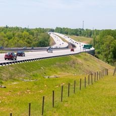
Wil-Cox Bridge, Concrete arch footbridge in Rowan County, United States

The Wil-Cox Bridge is a concrete arch structure that spans across the Yadkin River between Rowan and Davidson counties. The bridge features seven open spandrel arch sections and now serves as a pedestrian pathway.

The structure was built in 1924 and originally served as a major crossing for vehicle traffic on US 29 and US 70. It was later converted to pedestrian use when it no longer functioned as a primary road crossing.

The bridge site marks an ancient Native American settlement area and a strategic crossing point during the American Revolution in North Carolina.

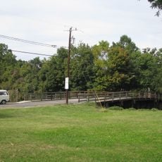
The location is now part of the Davidson County Greenway system and links visitors to the Yadkin River Park and walking paths. Plan to spend time walking and exploring the surrounding green spaces nearby.

The structure holds the distinction of being the longest concrete arch bridge of its type in North Carolina with its characteristic open spandrel design. This particular construction method makes it a notable example of engineering from the 1920s era.

The community of curious travelers

AroundUs brings together thousands of curated places, local tips, and hidden gems, enriched daily by 60,000 contributors worldwide.

Start exploring
Location
Official opening
1924
GPS coordinates
35.72280,-80.39150
Latest update
December 14, 2025 12:21
Around this place
North Carolina Transportation Museum
United States of America

North Carolina Transportation Museum

5.7 km
Salisbury National Cemetery
United States of America

Salisbury National Cemetery

10.2 km
United States of America

Boone's Cave Park

10.6 km
Salisbury High School
United States of America

Salisbury High School

10.6 km
Sacred Heart Catholic Church
United States of America

Sacred Heart Catholic Church

10.6 km
Hambley-Wallace House
United States of America

Hambley-Wallace House

10.1 km
Salisbury Historic District
United States of America

Salisbury Historic District

9.3 km
McNeely-Strachan House
United States of America

McNeely-Strachan House

9.7 km
J. C. Price High School
United States of America

J. C. Price High School

10.7 km
Yadkin River Veterans Memorial Bridge
United States of America

Yadkin River Veterans Memorial Bridge

423 m
John Steele House
United States of America

John Steele House

8.1 km
Archibald Henderson Law Office
United States of America

Archibald Henderson Law Office

9.5 km
Bernhardt House
United States of America

Bernhardt House

9.4 km
Maxwell Chambers House
United States of America

Maxwell Chambers House

9.4 km
Mount Zion Baptist Church
United States of America

Mount Zion Baptist Church

9 km
Walter McCanless House
United States of America

Walter McCanless House

8.3 km
Community Building
United States of America

Community Building

9.2 km
Monroe Street School
United States of America

Monroe Street School

10.1 km
Philip Sowers House
United States of America

Philip Sowers House

9.9 km
Grimes Mill
United States of America

Grimes Mill

8.7 km
Shaver Rental Houses District
United States of America

Shaver Rental Houses District

9.3 km
Shober Bridge
United States of America

Shober Bridge

9 km
Kesler Manufacturing Co.-Cannon Mills Co. Plant No. 7 Historic District
United States of America

Kesler Manufacturing Co.-Cannon Mills Co. Plant No. 7 Historic District

8.2 km
Salisbury Railroad Corridor Historic District
United States of America

Salisbury Railroad Corridor Historic District

9 km
North Long Street-Park Avenue Historic District
United States of America

North Long Street-Park Avenue Historic District

8.9 km
Calvin H. Wiley School
United States of America

Calvin H. Wiley School

10.9 km
Fulton Heights Historic District
United States of America

Fulton Heights Historic District

11.3 km
Ellis Street Graded School Historic District
United States of America

Ellis Street Graded School Historic District

9.1 km
Show the full map
« Wil-Cox Bridge - Concrete arch footbridge in Rowan County, United States » is provided by Around Us (aroundus.com). Images and texts are derived from Wikimedia project under a Creative Commons license. You are allowed to copy, distribute, and modify copies of this page, under the conditions set by the license, as long as this note is clearly visible.

Discover hidden gems everywhere you go!

From secret cafés to breathtaking viewpoints, skip the crowded tourist spots and find places that match your style. Our app makes it easy with voice search, smart filtering, route optimization, and insider tips from travelers worldwide. Download now for the complete mobile experience.

Around Us App Screenshot

A unique approach to discovering new places

Le Figaro

All the places worth exploring

France Info

A tailor-made excursion in just a few clicks

20 Minutes

Around Us
Travel Guide & Maps
Download

Send to your phone

QR Code
1

Open the camera app on your mobile.

2

Point at the QR code with your camera. A notification will appear.

3

Tap the notification to open the link.