Enable Location

We need your location to show you interesting places around you

Discover nearby places

Find interesting locations and hidden gems around you

Precise directions

Get accurate directions and distances to places

Your location is never shared with other users. It's only used when you tap the location button.

Rowan County

Log in to your account

Start exploring — it's free

Trusted by 62,036 travelers worldwide

Continue with Google
Continue with Apple
or

We will send you a code to connect

By continuing, you accept our Terms and Conditions and our Privacy Policy

Check your inbox

We've sent a pincode in your inbox. Please enter the code below.

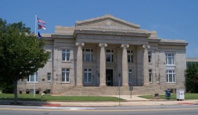
Rowan County, Administrative county in North Carolina, US.

Rowan County is an administrative county in North Carolina with Salisbury serving as its governmental center. The county comprises a mix of rural areas and organized municipal infrastructure.

The county was established in 1753 from the northern portion of Anson County and named after Matthew Rowan, who served as acting governor. This founding event established the administrative foundations that continue today.

The Waterworks Visual Arts Center showcases exhibitions featuring works from artists around the world, while the Piedmont Players stage theatrical performances year-round. These institutions shape the artistic life of the region and draw people from surrounding communities to cultural events.

The Salisbury Farmers Market operates regularly, offering fresh produce and locally-made goods to residents throughout the county and nearby areas. It serves as a practical place to find regional products and support local producers.

The first European presence in the area dates to Juan Pardo's 1567 expedition, during which explorers encountered a female leader named Guatari Mico. This early encounter reveals the complex settlement history that preceded the county's official formation by nearly two centuries.

The community of curious travelers

AroundUs brings together thousands of curated places, local tips, and hidden gems, enriched daily by 60,000 contributors worldwide.

Start exploring
Location
Inception
March 27, 1753
Capital city
Salisbury
Shares border with
Davie County, Cabarrus County, Davidson County, Montgomery County, Stanly County, Iredell County
GPS coordinates
35.64000,-80.52000
Latest update
December 17, 2025 10:50
Around this place
High Rock Lake
United States of America

High Rock Lake

24.4 km
North Carolina Transportation Museum
United States of America

North Carolina Transportation Museum

9.2 km
Salisbury National Cemetery
United States of America

Salisbury National Cemetery

4.7 km
United States of America

Boone's Cave Park

18.2 km
Cooleemee
United States of America

Cooleemee

25.8 km
Salisbury High School
United States of America

Salisbury High School

4.2 km
United States of America

Salisbury Prison

4.8 km
Lexington Memorial Hospital
United States of America

Lexington Memorial Hospital

31 km
Sacred Heart Catholic Church
United States of America

Sacred Heart Catholic Church

7.7 km
Hambley-Wallace House
United States of America

Hambley-Wallace House

4.8 km
United States of America

Wil-Cox Bridge

14.8 km
Michael Braun House
United States of America

Michael Braun House

7.4 km
Back Creek Presbyterian Church and Cemetery
United States of America

Back Creek Presbyterian Church and Cemetery

16.9 km
Salisbury Historic District
United States of America

Salisbury Historic District

5.5 km
McNeely-Strachan House
United States of America

McNeely-Strachan House

5.2 km
United States of America

Alexander Long House

11.4 km
United States of America

Junior Order United American Mechanics National Orphans Home

25.9 km
Dr. William Rainey Holt House
United States of America

Dr. William Rainey Holt House

31.1 km
United States of America

Griffith-Sowers House

9.3 km
J. C. Price High School
United States of America

J. C. Price High School

4.7 km
United States of America

Lexington Residential Historic District

31.4 km
United States of America

Bringle Ferry Bridge

26.5 km
United States of America

Third Creek Presbyterian Church and Cemetery

20 km
United States of America

Beck's Reformed Church Cemetery

29.7 km
United States of America

Farmville Plantation

24.8 km
Yadkin River Veterans Memorial Bridge
United States of America

Yadkin River Veterans Memorial Bridge

14.8 km
John Steele House
United States of America

John Steele House

6.7 km
United States of America

Zion Lutheran Church

14 km
Show the full map
Administrative divisions
« Rowan County - Administrative county in North Carolina, US » is provided by Around Us (aroundus.com). Images and texts are derived from Wikimedia project under a Creative Commons license. You are allowed to copy, distribute, and modify copies of this page, under the conditions set by the license, as long as this note is clearly visible.

Discover hidden gems everywhere you go!

From secret cafés to breathtaking viewpoints, skip the crowded tourist spots and find places that match your style. Our app makes it easy with voice search, smart filtering, route optimization, and insider tips from travelers worldwide. Download now for the complete mobile experience.

Around Us App Screenshot

A unique approach to discovering new places

Le Figaro

All the places worth exploring

France Info

A tailor-made excursion in just a few clicks

20 Minutes

Around Us
Travel Guide & Maps
Download

Send to your phone

QR Code
1

Open the camera app on your mobile.

2

Point at the QR code with your camera. A notification will appear.

3

Tap the notification to open the link.