Enable Location

We need your location to show you interesting places around you

Discover nearby places

Find interesting locations and hidden gems around you

Precise directions

Get accurate directions and distances to places

Your location is never shared with other users. It's only used when you tap the location button.

Herbert Von King Park

Log in to your account

Start exploring — it's free

Trusted by 62,501 travelers worldwide

Continue with Google
Continue with Apple
or

We will send you a code to connect

By continuing, you accept our Terms and Conditions and our Privacy Policy

Check your inbox

We've sent a pincode in your inbox. Please enter the code below.

Herbert Von King Park

Herbert Von King Park, Urban park in Bedford-Stuyvesant, US.

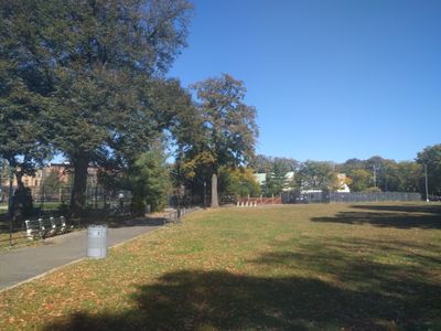
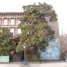
Herbert Von King Park is a 13-acre urban green space with sports fields, playgrounds, and community gathering areas throughout Brooklyn's residential neighborhood. The grounds are divided into multiple recreational zones that support different activities like baseball, basketball, and picnicking.

The green space was established in 1857 as Tompkins Park and renamed in 1985 to honor Herbert Von King, a local civil rights advocate. The name change recognized his contributions to the community.

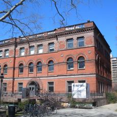
The cultural center inside hosts regular classes, performances, and exhibitions that draw neighborhood residents together. It functions as a meeting point where locals engage with artists and performers from the community.

The grounds feature baseball fields, basketball courts, dog areas, picnic spots, and water fountains spread throughout the park. Visitors should plan visits during warmer months when most facilities are fully accessible.

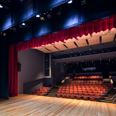
The grounds contain an outdoor sunken amphitheater that hosts summer concerts and community gatherings throughout the year. This distinctive feature makes the space particularly notable for cultural events.

The community of curious travelers

AroundUs brings together thousands of curated places, local tips, and hidden gems, enriched daily by 60,000 contributors worldwide.

Start exploring
Location
Inception
1857
GPS coordinates
40.68972,-73.94667
Latest update
December 10, 2025 16:25
Around this place
Boys High School
United States of America

Boys High School

604 m
23rd Regiment Armory
United States of America

23rd Regiment Armory

1.4 km
Broken Angel House
United States of America

Broken Angel House

1.3 km
Girls' High School
United States of America

Girls' High School

948 m
United States of America

13th Regiment Armory

935 m
Emmanuel Baptist Church
United States of America

Emmanuel Baptist Church

1.6 km
Fulton Park
United States of America

Fulton Park

1.6 km
William Ulmer Brewery
United States of America

William Ulmer Brewery

1.3 km
Magnolia grandiflora
United States of America

Magnolia grandiflora

87 m
Renaissance Apartments
United States of America

Renaissance Apartments

889 m
Pratt Institute Libraries
United States of America

Pratt Institute Libraries

1.6 km
Billie Holiday Theatre
United States of America

Billie Holiday Theatre

1.1 km
Crown Heights North Historic District
United States of America

Crown Heights North Historic District

1.5 km
Our Lady of Victory Church
United States of America

Our Lady of Victory Church

1.1 km
St. Mary's Episcopal Church
United States of America

St. Mary's Episcopal Church

1.3 km
Lincoln Club
United States of America

Lincoln Club

1.3 km
Macon Library
United States of America

Macon Library

1.2 km
Alhambra Apartments
United States of America

Alhambra Apartments

968 m
Clinton Hill Historic District
United States of America

Clinton Hill Historic District

1.6 km
Public School 71K
United States of America

Public School 71K

1.6 km
Bushwick Democratic Club House
United States of America

Bushwick Democratic Club House

1.6 km
Palisades
United States of America

Palisades

1.2 km
Shaari Zedek Synagogue
United States of America

Shaari Zedek Synagogue

1.4 km
Apostolic Faith Mission
United States of America

Apostolic Faith Mission

1.6 km
Kismet Temple
United States of America

Kismet Temple

1.3 km
Clinton Hill South Historic District
United States of America

Clinton Hill South Historic District

1.5 km
James W. and Lucy S. Elwell House
United States of America

James W. and Lucy S. Elwell House

1.5 km
Stuyvesant Heights Historic District
United States of America

Stuyvesant Heights Historic District

1.2 km
Show the full map
« Herbert Von King Park - Urban park in Bedford-Stuyvesant, US » is provided by Around Us (aroundus.com). Images and texts are derived from Wikimedia project under a Creative Commons license. You are allowed to copy, distribute, and modify copies of this page, under the conditions set by the license, as long as this note is clearly visible.

Discover hidden gems everywhere you go!

From secret cafés to breathtaking viewpoints, skip the crowded tourist spots and find places that match your style. Our app makes it easy with voice search, smart filtering, route optimization, and insider tips from travelers worldwide. Download now for the complete mobile experience.

Around Us App Screenshot

A unique approach to discovering new places

Le Figaro

All the places worth exploring

France Info

A tailor-made excursion in just a few clicks

20 Minutes

Around Us
Travel Guide & Maps
Download

Send to your phone

QR Code
1

Open the camera app on your mobile.

2

Point at the QR code with your camera. A notification will appear.

3

Tap the notification to open the link.