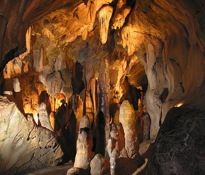
Bilsteinhöhle, Show cave in Warstein, Germany.
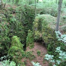
Bilsteinhöhle is a show cave in Warstein featuring an underground limestone system with multiple chambers and natural formations shaped by water action. The cave passages display various rock structures and passages that developed over geological timescales.
Forest worker Franz Kersting found the cave in 1887 during construction work, and geologist Emil Carthaus soon examined it systematically. This early investigation began the scientific documentation of the site.
The cave's name connects it to the nearby Bilstein settlement and the region's long history of human habitation. Visitors walking through today can feel this connection between the underground space and the surrounding community.
The cave maintains a cool temperature year-round of about 8 degrees Celsius, so visitors should bring warm clothing regardless of season. Access to different chambers requires varying levels of fitness, with some passages being quite narrow.
An underground river flows through the lower sections of the cave system and continues to reshape the limestone formations. This active waterway shows that the cave is still evolving and changing today.
Location: Warstein
Accessibility: Wheelchair inaccessible
Opening Hours: April-October 09:00-17:00; November-March 10:00-16:00; December 25 off
Phone: +4929022731
Website: http://bilsteintal.de
GPS coordinates: 51.42493,8.32239
Latest update: December 8, 2025 19:45
Lörmecke-Turm
3.6 km
LWL-Klinik Warstein
4.3 km
Hohler Stein
5.7 km
Oberhagen
3.9 km
Fernmeldeturm Meschede
4.8 km
Stadtkirche St. Pankratius
2.9 km
Plackweghöhe
3.7 km
Alte Kirche St. Pankratius
3.2 km
St. Pankratius
6.7 km
Steinbruch Hillenberg
2.3 km
Hoher Stein (Kallenhardt)
5.4 km
Heilig Kreuz Kirche
6 km
Saint Christophorus
3.3 km
Lörmecketal
6 km
Liethöhle und Bachschwinden des Wäschebaches
4 km
Hamorsbruch und Quellbäche
3.5 km
Church of the Beheading of St. John the Baptist, Suttrop
5.2 km
Jüdischer Friedhof
3.2 km
Hamorsbruch / Bermecke
3.4 km
Aschholter Becke
4.7 km
Talsystem Kohlweder Bach
5.5 km
Kleines Steinmecketal
6.1 km
Lörmecketalsystem
4.8 km
Schnettenberg
6.3 km
Oberes Lörmecketal
4.1 km
Am Kohlweder
6.7 km
Luchtmücke und Grünlandgewann östlich Eversberg
6.4 km
Offenland westlich Eversberg
6.3 kmVisited this place? Tap the stars to rate it and share your experience / photos with the community! Try now! You can cancel it anytime.
Discover hidden gems everywhere you go!
From secret cafés to breathtaking viewpoints, skip the crowded tourist spots and find places that match your style. Our app makes it easy with voice search, smart filtering, route optimization, and insider tips from travelers worldwide. Download now for the complete mobile experience.
A unique approach to discovering new places❞
— Le Figaro
All the places worth exploring❞
— France Info
A tailor-made excursion in just a few clicks❞
— 20 Minutes