Enable Location

We need your location to show you interesting places around you

Discover nearby places

Find interesting locations and hidden gems around you

Precise directions

Get accurate directions and distances to places

Your location is never shared with other users. It's only used when you tap the location button.

Stadsgraven

Log in to your account

Start exploring — it's free

Trusted by 61,324 travelers worldwide

Continue with Google
Continue with Apple
or

We will send you a code to connect

By continuing, you accept our Terms and Conditions and our Privacy Policy

Check your inbox

We've sent a pincode in your inbox. Please enter the code below.

Stadsgraven

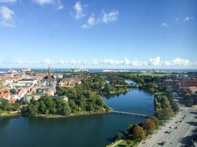
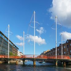
Stadsgraven, Historical moat in Christianshavn, Denmark

Description

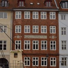
Stadsgraven is a water system running through the Christianshavn district featuring wide channels with stone embankments that separate this neighborhood from the island of Amager. The system is crossed by four vehicle causeways and two pedestrian bridges, including Dyssebroen, which connect different areas of the city.

History

The channels were created in the early 17th century under King Christian IV as part of Copenhagen's defense system against possible naval threats. A parallel inner system was built alongside to create a double water barrier within the original fortification design.

Culture

The waterway serves as a gathering point where locals walk along the banks and fish in the water, particularly during spring and autumn seasons. Waterfowl populations, especially ducks, make the channels their home at different times of year, drawing bird watchers to the area.

Practical

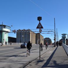
The area is easily accessible on foot, with bridges providing convenient crossing points over the channels at any time of day. The waterside paths are suitable for walking, and there is plenty of space along the banks for various activities and observation.

Did you know?

The system was designed not just for defense but has shaped daily life and infrastructure in Christianshavn through the centuries. The double water design reflects a sophisticated fortification approach that influenced how the entire neighborhood developed and functions today.

Part of
fortifications of Copenhagen
GPS coordinates
55.66860,12.59190
Latest update
December 12, 2025 09:00

AroundUs brings together thousands of curated places, local tips, and hidden gems, enriched daily by 60,000 contributors worldwide. Discover all places nearby (Copenhagen Municipality).

« Stadsgraven - Historical moat in Christianshavn, Denmark » is provided by Around Us (aroundus.com). Images and texts are derived from Wikimedia project under a Creative Commons license. You are allowed to copy, distribute, and modify copies of this page, under the conditions set by the license, as long as this note is clearly visible.

Discover hidden gems everywhere you go!

From secret cafés to breathtaking viewpoints, skip the crowded tourist spots and find places that match your style. Our app makes it easy with voice search, smart filtering, route optimization, and insider tips from travelers worldwide. Download now for the complete mobile experience.

Around Us App Screenshot

A unique approach to discovering new places

Le Figaro

All the places worth exploring

France Info

A tailor-made excursion in just a few clicks

20 Minutes

Around Us
Travel Guide & Maps
Download

Send to your phone

QR Code
1

Open the camera app on your mobile.

2

Point at the QR code with your camera. A notification will appear.

3

Tap the notification to open the link.