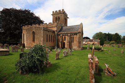
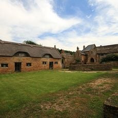
Church of St Mary the Virgin, East Stoke, Medieval parish church in Stoke Sub Hamdon, England.
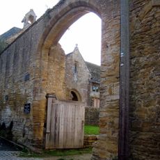
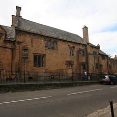
The Church of St Mary the Virgin is a medieval parish church in Stoke Sub Hamdon featuring Norman elements in its nave and chancel with detailed stone carvings throughout. The structure includes a main body with side sections that were added at different periods.
Originally dedicated to Saint Denis, the church dates from 1101 with transepts added in later centuries. These construction phases reflect the growing importance of the parish over time.
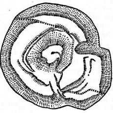
The walls hold medieval carvings with abstract corbels, a tympanum showing astrological symbols, and a scene of Saint Michael battling a dragon. These artworks reveal how the community expressed its faith and beliefs in stone.
The church hosts regular services and welcomes visitors, though conservation guidelines apply to the building. It is best to check ahead regarding visiting times and access.
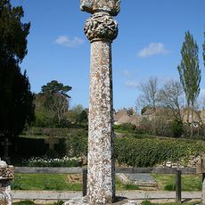
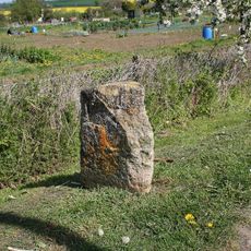
Two monuments from the 17th century in the churchyard struggle with subsidence damage and salt crystallization affecting their condition. These gravestones illustrate the challenge of preserving stone memorials in this environment.
Location: Stoke Sub Hamdon
Inception: 12 century
GPS coordinates: 50.95190,-2.73528
Latest update: December 14, 2025 18:42
Montacute Castle
935 m
Ham Hill
696 m
Stoke sub Hamdon Priory
1.1 km
Abbey Farmhouse, Montacute
1.2 km
Stoke Sub Hamdon United Reformed Church
1.2 km
The Kings Arms Inn
1.2 km
Fleur De Lis Hotel
1.1 km
Hamdon Hill War Memorial
748 m
Abbey Gate
1.2 km
Remains Of Barn About 15 Metres West Of The Priory
1.2 km
Milestone About 10 Metres East Of Gateway To Greenways (Not Included On List)
747 m
68, North Street
1.2 km
18, 22 And 24, North Street
1.1 km
Barn About 25 Metres North West Of The Priory
1.1 km
Gateway And Wall Linking The Priory And The Barn, About 14 Metres North
1.1 km
Dovecote About 50 Metres West Of The Priory
1.2 km
The Old Vicarage And Adjacent Gateway And Boundary Wall
1.2 km
Castle Farmhouse And Attached Outbuildings To North
1.2 km
Tower On St Michaels Hill
926 m
Monks House
1.2 km
No 50, With Front Boundary Railings And North Wing Wall
1.2 km
Hoods
1.1 km
Barn About 14 Metres North Of The Priory
1.1 km
29 And 30, Bishopston
1.2 km
Baytree Farmhouse
1.2 km
Medieval secular college at Parsonage Farm
1.1 km
Cross In Churchyard About 11 Metres North Of Tower, Church Of St Mary The Virgin
109 m
Milestone, Montacute Road, beside allotment gardens, N of St Michael's Hill
900 mVisited this place? Tap the stars to rate it and share your experience / photos with the community! Try now! You can cancel it anytime.
Discover hidden gems everywhere you go!
From secret cafés to breathtaking viewpoints, skip the crowded tourist spots and find places that match your style. Our app makes it easy with voice search, smart filtering, route optimization, and insider tips from travelers worldwide. Download now for the complete mobile experience.
A unique approach to discovering new places❞
— Le Figaro
All the places worth exploring❞
— France Info
A tailor-made excursion in just a few clicks❞
— 20 Minutes