Headpile Eyot, River island near Bray, England
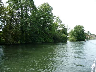
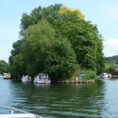
Headpile Eyot is a long, narrow river island on the Thames surrounded by thick vegetation dominated by horse chestnut and English oak trees. The island sits in the water just above Bray Lock and forms part of the chain of islands that runs through this section of the river.
Archaeological finds on the island reveal Bronze Age occupation in this section of the Thames. The discoveries suggest that humans used this area for thousands of years before recorded history.
The name Eyot derives from Old English linguistic traditions, reflecting the historical naming patterns of small islands in the River Thames.
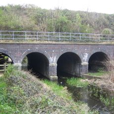
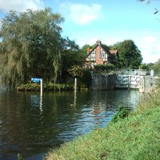
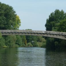
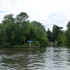
The island is surrounded by water and best viewed from the Bray Lock area or from passing boats on the river. Access to the island itself is limited, but it remains visible and worth seeing from the riverside path or from the water.
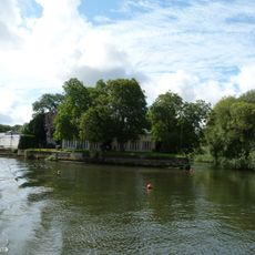
The island sits positioned between Pigeonhill Eyot and Guards Club Island, marking a natural waypoint along the river. The name Eyot itself comes from Old English and was the common way to describe small Thames islands, making it a linguistic marker of the area's ancient roots.
GPS coordinates: 51.51000,-0.69430
Latest update: December 21, 2025 16:05
Maidenhead Railway Bridge
1.3 km
Dorney Court
1.5 km
Monkey Island
1.1 km
Maidenhead Bridge
1.6 km
Skindles
1.7 km
Maidenhead Waterways
1.5 km
Bray Lock
224 m
Maidenhead Synagogue
2 km
St Michael's Church
551 m
M4 Thames Bridge
694 m
Summerleaze Footbridge
1.4 km
Queen's Eyot
1.8 km
Guards Club Island
1.4 km
Bridge Eyot
1.9 km
Bray Meadows
1.9 km
Maidenhead Library
2.1 km
Church of St James
2 km
Gardeners Arms Public House
2.1 km
Taplow House Hotel
2.1 km
The Crown Public House
607 m
Bridgwater Lodge
1.7 km
Milestone Adjacent To Western End Of Road Bridge Parapet
2 km
Jesus Hospital, Including Chaplain's House, The Almshouses And The Chapel
687 m
Dumb Bell Bridge (MLN1/22 63)
1.4 km
Oldfield Lodge
1.7 km
Brick Wall To Smythes Almhouses Numbers 79 To 85
1.9 km
Smythes Almshouses
2 km
Milestone, Bath Road; W of Railway bridge, beside petrol station, opp. Pub (was Dumb Bell Hotel)
1.4 kmVisited this place? Tap the stars to rate it and share your experience / photos with the community! Try now! You can cancel it anytime.
Discover hidden gems everywhere you go!
From secret cafés to breathtaking viewpoints, skip the crowded tourist spots and find places that match your style. Our app makes it easy with voice search, smart filtering, route optimization, and insider tips from travelers worldwide. Download now for the complete mobile experience.
A unique approach to discovering new places❞
— Le Figaro
All the places worth exploring❞
— France Info
A tailor-made excursion in just a few clicks❞
— 20 Minutes