Queen Elizabeth II Metro Bridge, Railway bridge in Newcastle upon Tyne, England
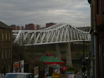
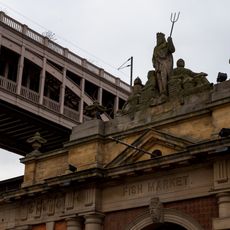
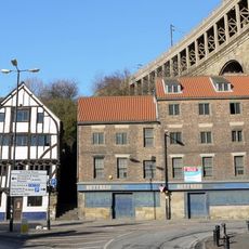
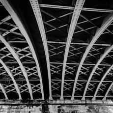
The Queen Elizabeth II Metro Bridge is a railway bridge spanning 352.7 meters across the River Tyne, connecting Newcastle with Gateshead. The structure carries two continuously welded rail tracks supported by two steel ring piers and reinforced concrete abutments on each side.
Construction began in 1976, with two sections built simultaneously from each bank and meeting in the center in August 1978. This project cost 4.9 million pounds and was a major step in developing the region's public transport infrastructure.
The bridge features Nocturne, an art installation with two shades of blue paint and LED lights that create patterns based on public photographs. This light show transforms the structure after dark into a visual artwork highlighting the connection between both cities.
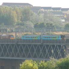
The bridge carries the Tyne and Wear Metro between Newcastle and Gateshead, with the metro line running through tunnels on both river sides. You can cross the bridge while riding the metro or view it from the riverside areas below.
The structure incorporates approximately 4,000 tonnes of fabricated steelwork, making it one of the heaviest railway bridges of its era. This massive amount of steel allowed the bridge to carry train traffic without support structures in the river itself.
Location: Tyne and Wear
Inception: 1981
Official opening: November 6, 1981
Height: 45 m
Length: 352.7 m
Longest Span: 164.7 m
Width: 10.31 m
Made from material: steel, reinforced concrete
GPS coordinates: 54.96450,-1.61390
Latest update: December 11, 2025 18:09
High Level Bridge
438 m
Swing Bridge
498 m
Redheugh Bridge
429 m
King Edward VII Bridge
206 m
Westgate House, Newcastle upon Tyne
506 m
Bridge Hotel
500 m
Royal Station Hotel
528 m
Old Tyne Bridge
530 m
Turnbull's Warehouse
428 m
Water Tower South Of Central Station
406 m
Irving House
533 m
35, Close
392 m
Former Fish Market
490 m
South postern tower facing the river, and curtain wall adjoining
527 m
Newcastle upon Tyne town defences: section of curtain wall and town ditch between Forth Street and Hanover Street
345 m
28 And 30, Close
446 m
Bridge Medical Centre
521 m
10, Castle Stairs
531 m
Clavering House
446 m
Town Wall North Of The Close And Breakneck Stairs
250 m
Bonded Warehouses
218 m
Former coppersmiths shop and warehouses with offices attached
204 m
Posts and rails on Castle Stairs
527 m
Accommodation Arch And Railway Viaduct Between High Level Bridge, Castle Garth And Central Station
486 m
32, Close
438 m
Railway Arch South West Of Black Gate
524 m
Friar House
424 m
Number 20 And Building To Rear (number 18 Now Demolished)
303 mVisited this place? Tap the stars to rate it and share your experience / photos with the community! Try now! You can cancel it anytime.
Discover hidden gems everywhere you go!
From secret cafés to breathtaking viewpoints, skip the crowded tourist spots and find places that match your style. Our app makes it easy with voice search, smart filtering, route optimization, and insider tips from travelers worldwide. Download now for the complete mobile experience.
A unique approach to discovering new places❞
— Le Figaro
All the places worth exploring❞
— France Info
A tailor-made excursion in just a few clicks❞
— 20 Minutes