King Edward VII Bridge

Log in to your account

AroundUs is a community-driven map of interesting places, built by curious explorers like you. It grows with every review, story, and photo you share.
Connect to save your favorite spots, contribute locations, and create personalized routes.
By continuing, you accept our Terms and Conditions and our Privacy Policy
Add to collection
Map
Suggest a change
Share

King Edward VII Bridge, Railway bridge in Newcastle upon Tyne, England.

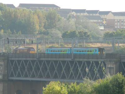
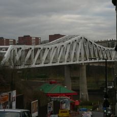
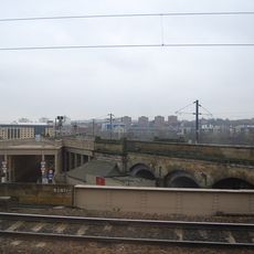
King Edward VII Bridge is a railway crossing that spans the River Tyne between Newcastle and Gateshead, supported by four large lattice steel spans resting on concrete and stone piers. The structure connects both riverbanks with a total length of around 350 meters and carries multiple railway tracks for trains to pass through.

The North Eastern Railway company commissioned the bridge in 1902 to ease congestion on the older High Level Bridge, with construction finishing in 1906. This project marked a major improvement in rail infrastructure at the time, allowing trains to move more efficiently between the two areas.

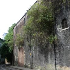
The structure displays early 20th-century industrial design with its steel trusses, granite piers, and red sandstone supports that are characteristic of that era's engineering style. These materials together show how engineers of the time combined modern steel construction with traditional stone craftsmanship.

The bridge carries trains moving between Newcastle and Gateshead, so visitors can see it while traveling by rail through the area. For those wanting to view the structure from ground level, the riverbanks on both sides offer good vantage points and walkways along the water for closer observation.

During its construction, the project used the largest aerial cableway system of that time to move building materials across the river. This innovative transport system helped speed up the work and was an engineering achievement that impressed observers at the time.

Location: Newcastle upon Tyne

Location: Gateshead

Official opening: July 10, 1906

Length: 350.8 m

Width: 15.3 m

Made from material: steel, granite, sandstone

GPS coordinates: 54.96320,-1.61620

Latest update: December 9, 2025 18:40

Photos
Around this place
High Level Bridge
United Kingdom

High Level Bridge

642 m
Centre for Life
United Kingdom

Centre for Life

554 m
St Mary's Cathedral, Newcastle upon Tyne
United Kingdom

St Mary's Cathedral, Newcastle upon Tyne

690 m
Literary and Philosophical Society of Newcastle upon Tyne
United Kingdom

Literary and Philosophical Society of Newcastle upon Tyne

694 m
Redheugh Bridge
United Kingdom

Redheugh Bridge

223 m
Queen Elizabeth II Metro Bridge
United Kingdom

Queen Elizabeth II Metro Bridge

206 m
Life Science Centre
United Kingdom

Life Science Centre

509 m
Westgate House, Newcastle upon Tyne
United Kingdom

Westgate House, Newcastle upon Tyne

650 m
Bridge Hotel
United Kingdom

Bridge Hotel

700 m
Royal Station Hotel
United Kingdom

Royal Station Hotel

667 m
Turnbull's Warehouse
United Kingdom

Turnbull's Warehouse

620 m
Water Tower South Of Central Station
United Kingdom

Water Tower South Of Central Station

485 m
Former Market Keeper's House
United Kingdom

Former Market Keeper's House

582 m
35, Close
United Kingdom

35, Close

597 m
Clavering House
United Kingdom

Clavering House

632 m
Former Fish Market
United Kingdom

Former Fish Market

696 m
Barclays Bank
United Kingdom

Barclays Bank

685 m
Bonded Warehouses
United Kingdom

Bonded Warehouses

397 m
28 And 30, Close
United Kingdom

28 And 30, Close

648 m
Former coppersmiths shop and warehouses with offices attached
United Kingdom

Former coppersmiths shop and warehouses with offices attached

361 m
Town Wall North Of The Close And Breakneck Stairs
United Kingdom

Town Wall North Of The Close And Breakneck Stairs

436 m
Motorail Terminal
United Kingdom

Motorail Terminal

617 m
1 Neville Street
United Kingdom

1 Neville Street

618 m
Newcastle upon Tyne town defences: section of curtain wall and town ditch between Forth Street and Hanover Street
United Kingdom

Newcastle upon Tyne town defences: section of curtain wall and town ditch between Forth Street and Hanover Street

513 m
Accommodation Arch And Railway Viaduct Between High Level Bridge, Castle Garth And Central Station
United Kingdom

Accommodation Arch And Railway Viaduct Between High Level Bridge, Castle Garth And Central Station

676 m
Presbytery Attached To Cathedral Of St Mary
United Kingdom

Presbytery Attached To Cathedral Of St Mary

666 m
Number 20 And Building To Rear (number 18 Now Demolished)
United Kingdom

Number 20 And Building To Rear (number 18 Now Demolished)

438 m
Friar House
United Kingdom

Friar House

612 m
Show the full map
Reviews

Visited this place? Tap the stars to rate it and share your experience / photos with the community! Try now! You can cancel it anytime.

« King Edward VII Bridge - Railway bridge in Newcastle upon Tyne, England » is provided by Around Us (aroundus.com). Images and texts are derived from Wikimedia project under a Creative Commons license. You are allowed to copy, distribute, and modify copies of this page, under the conditions set by the license, as long as this note is clearly visible.

Discover hidden gems everywhere you go!

From secret cafés to breathtaking viewpoints, skip the crowded tourist spots and find places that match your style. Our app makes it easy with voice search, smart filtering, route optimization, and insider tips from travelers worldwide. Download now for the complete mobile experience.

Around Us App Screenshot

A unique approach to discovering new places

Le Figaro

All the places worth exploring

France Info

A tailor-made excursion in just a few clicks

20 Minutes