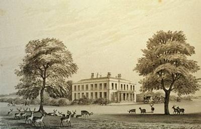
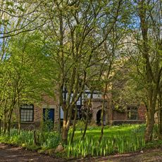
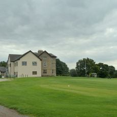
Duxbury Hall, Country house in Duxbury Woods, Lancashire, England.
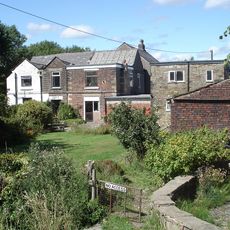
Duxbury Hall is a country house in Lancashire with a rectangular two-story structure built from local stone. The east-facing facade features a classical columned portico, and the interior contains five main reception rooms.
The original medieval building belonged to the Duxbury family until 1315, when the Standish family gained control after the Banastre Rebellion. The current house was built in 1823 and replaced earlier structures that had occupied the site.
The hall was home to the Standish family for centuries and left its mark across the Atlantic. The town of Duxbury in Massachusetts takes its name from this English estate.
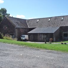
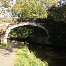
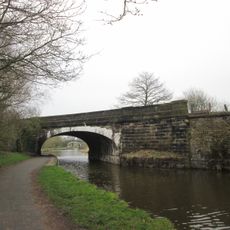
The grounds now serve as a public golf course where visitors can walk around the remaining structures. The former stables and coach house are visible from the main area, though they function as offices today.
Hidden beneath the main house in the cellars lies evidence of an earlier brick structure that once surrounded a courtyard. This discovery reveals that the site was inhabited long before the current building was constructed.
Floors above the ground: 2
GPS coordinates: 53.63060,-2.62349
Latest update: December 11, 2025 18:02
Yarrow Valley Park
840 m
Coppull Mill
2.5 km
St Paul's Church, Adlington
2.1 km
St George's Church, Chorley
2.4 km
Yarrow Bridge
1.2 km
Christ Church, Adlington
2.3 km
Canal Bridge Number 76
2.4 km
Rigshaw Bridge Number 70
2 km
Canal Bridge Number 74 At Sd 595 156 Winstanley Bridge
916 m
Canal Bridge Number 71
1.2 km
All Saints Church, Chorley
1.6 km
Red Herring (Former Office Block To Coppull Ring Mill)
2.5 km
Canal Bridge Number 72 At Sd 596 146 Idle Bridge
938 m
Chorley Library
2.3 km
Canal Bridge Number 73
864 m
Gateway To Roman Catholic Church Of St Mary
2.5 km
Lower Burgh Hall
1.8 km
Chorley Little Theatre
2.6 km
Adlington And District War Memorial
2.3 km
Barn Circa 50 Metres East Of Allanson Hall
1.9 km
Canal Bridge Number 75 At Sd 595 163
1.5 km
Allanson Hall
1.9 km
Milepost 350 Metres South East Of Junction Of Wigan Lane And Rawlinson Lane
611 m
Leeds Liverpool Canal, Railway Bridge Over Leeds Liverpool Canal At Sd 595 162
1.3 km
Hall O' Th' Hill
1.4 km
Milestone, Heath Charnock, nr Adlington
939 m
Milepost, Coppull Brow Farm; by farm
1.9 km
Milestone, opp. Supermarket, by No. 18
2.3 kmVisited this place? Tap the stars to rate it and share your experience / photos with the community! Try now! You can cancel it anytime.
Discover hidden gems everywhere you go!
From secret cafés to breathtaking viewpoints, skip the crowded tourist spots and find places that match your style. Our app makes it easy with voice search, smart filtering, route optimization, and insider tips from travelers worldwide. Download now for the complete mobile experience.
A unique approach to discovering new places❞
— Le Figaro
All the places worth exploring❞
— France Info
A tailor-made excursion in just a few clicks❞
— 20 Minutes