Enable Location

We need your location to show you interesting places around you

Discover nearby places

Find interesting locations and hidden gems around you

Precise directions

Get accurate directions and distances to places

Your location is never shared with other users. It's only used when you tap the location button.

Roseberry Topping

Log in to your account

Start exploring — it's free

Trusted by 61,770 travelers worldwide

Continue with Google
Continue with Apple
or

We will send you a code to connect

By continuing, you accept our Terms and Conditions and our Privacy Policy

Check your inbox

We've sent a pincode in your inbox. Please enter the code below.

Roseberry Topping, Summit in North York Moors National Park, England

Description

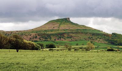
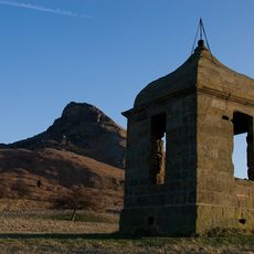
Roseberry Topping is a 320-meter sandstone hill in the North York Moors with a distinctive half-cone shape and rough cliffs that create a notable silhouette. The summit rises prominently from the surrounding terrain and serves as a recognizable landmark in the Yorkshire landscape.

History

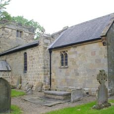
The hill shows archaeological traces of Bronze Age settlements nearby, with Iron Age remains including walled enclosures and dwelling foundations from that period. These findings suggest the area served as an important settlement location since prehistoric times.

Culture

The name comes from Old Norse roots and has been documented since 1119, reflecting the deep Viking heritage of the North Yorkshire region. Visitors can sense this historical connection through local place names and landscape features that shape the cultural memory of the area.

Practical

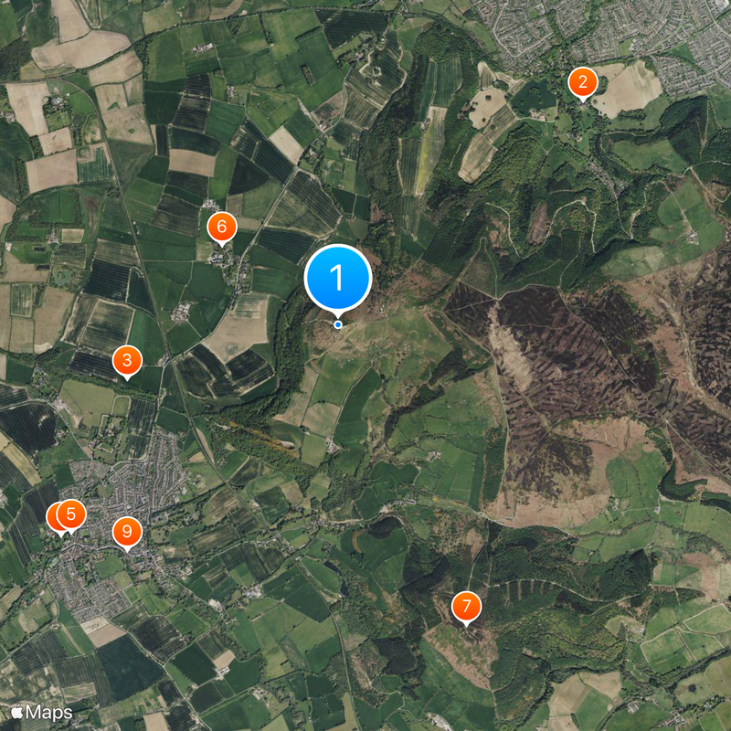
The Cleveland Way National Trail provides direct access to the summit with multiple starting points in the surrounding area. Various routes allow visitors to choose different walking distances and difficulty levels based on their fitness and time available.

Did you know?

A geological fault combined with mining operations in 1912 transformed the hill's original sugarloaf shape into its current distinctive form. This dramatic reshaping is clearly visible in the landscape and explains the mountain's unusual geometry today.

Location
Location
Elevation above the sea
320 m
Address
Roseberry Topping, Middlesbrough TS9 6QR, UK
GPS coordinates
54.50540,-1.10722
Latest update
December 14, 2025 18:28

AroundUs brings together thousands of curated places, local tips, and hidden gems, enriched daily by 60,000 contributors worldwide. Discover all places nearby (Guisborough).

Yorkshire and the Humber : historic towns, national parks and northern coasts of England

Yorkshire and the Humber brings together different sides of northern England. York shows its medieval walls, narrow streets with timber houses, and a gothic cathedral. Leeds and Sheffield show their past as centers of industry, with old factories turned into museums and new neighborhoods. Hull,...

Around this place
Hutton Hall
United Kingdom

Hutton Hall

2.8 km
Langbaurgh Ridge
United Kingdom

Langbaurgh Ridge

1.8 km
Church of All Saints
United Kingdom

Church of All Saints

2.9 km
Christ Church
United Kingdom

Christ Church

2.8 km
Church of St Oswald
United Kingdom

Church of St Oswald

1.2 km
Captain Cook Monument
United Kingdom

Captain Cook Monument

2.7 km
Captain Cook's Schoolroom
United Kingdom

Captain Cook's Schoolroom

2.6 km
Great Ayton Discovery Centre
United Kingdom

Great Ayton Discovery Centre

2.6 km
The Shooting Box At Roseberry Topping
United Kingdom

The Shooting Box At Roseberry Topping

334 m
Pair Of Boundary Stones, Approximately 2025 Metres To South Of Home Lowcross At Ngr Nz599 123
United Kingdom

Pair Of Boundary Stones, Approximately 2025 Metres To South Of Home Lowcross At Ngr Nz599 123

2 km
Percy Rigg Cross
United Kingdom

Percy Rigg Cross

2.9 km
Boundary Stone West Of Path To Captain Cook Monument
United Kingdom

Boundary Stone West Of Path To Captain Cook Monument

2.6 km
Boundary Stone, Approximately 330 Metres South West Of Pinchinthorpe Hall At Ngr Nz74137
United Kingdom

Boundary Stone, Approximately 330 Metres South West Of Pinchinthorpe Hall At Ngr Nz74137

1.3 km
Boundary Stone, Approximately 1700 Metres To South Of Home Farmhouse, Hutton Lowcross At Ngr Nz595 126
United Kingdom

Boundary Stone, Approximately 1700 Metres To South Of Home Farmhouse, Hutton Lowcross At Ngr Nz595 126

1.6 km
Boundary Stone Approximately 400 Metres To South Of Highcliff Farmhouse At Ngr Nz606 119
United Kingdom

Boundary Stone Approximately 400 Metres To South Of Highcliff Farmhouse At Ngr Nz606 119

2.8 km
Boundary Stone Approximately 1260 Metres To South Of Highcliff Farmhouse At Ngr Nz605 121
United Kingdom

Boundary Stone Approximately 1260 Metres To South Of Highcliff Farmhouse At Ngr Nz605 121

2.7 km
Boundary Stone Approximately 1300 Metres To South Of Highcliff Farmhouse At Ngr Nz603 121
United Kingdom

Boundary Stone Approximately 1300 Metres To South Of Highcliff Farmhouse At Ngr Nz603 121

2.5 km
Boundary Stone Approximately 1600 Metres To South Of Home Farmhouse, Hutton Lowcross At Ngr Nz593 127
United Kingdom

Boundary Stone Approximately 1600 Metres To South Of Home Farmhouse, Hutton Lowcross At Ngr Nz593 127

1.5 km
Boundary Stone, Approximately 1310 Metres To South Of Highcliff Farmhouse At Ngr Nz605 121
United Kingdom

Boundary Stone, Approximately 1310 Metres To South Of Highcliff Farmhouse At Ngr Nz605 121

2.6 km
Boundary Stone, Approximately 1950 Metres To South Of Home Farmhouse Hutton Lowcross At Ngr Nz595 124
United Kingdom

Boundary Stone, Approximately 1950 Metres To South Of Home Farmhouse Hutton Lowcross At Ngr Nz595 124

1.6 km
Boundary Stone, Approximately 1300 Metres To South West Of Highcliff Farmhouse At Ngr Nz600 123
United Kingdom

Boundary Stone, Approximately 1300 Metres To South West Of Highcliff Farmhouse At Ngr Nz600 123

2.2 km
Boundary Stone East Of Path To Captain Cook Monument
United Kingdom

Boundary Stone East Of Path To Captain Cook Monument

2.6 km
Boundary Stone, Approximately 1350 Metres To South Of Highcliff Farmhouse At Ngr Nz604 120
United Kingdom

Boundary Stone, Approximately 1350 Metres To South Of Highcliff Farmhouse At Ngr Nz604 120

2.6 km
Boundary Stone, Approximately 1990 Metres To South Of Home Farmhouse, Hutton Lowcross At Ngr Nz592 123
United Kingdom

Boundary Stone, Approximately 1990 Metres To South Of Home Farmhouse, Hutton Lowcross At Ngr Nz592 123

1.4 km
Boundary Stone Approximately 1225 Metres To South Of Highcliff Farmhouse At Ngr Nz605 121
United Kingdom

Boundary Stone Approximately 1225 Metres To South Of Highcliff Farmhouse At Ngr Nz605 121

2.7 km
Boundary Stone Approximately 1940 Metres To South Of Home Farmhouse Hutton Lowcross At Ngr Nz595 124
United Kingdom

Boundary Stone Approximately 1940 Metres To South Of Home Farmhouse Hutton Lowcross At Ngr Nz595 124

1.7 km
Boundary Stone, Approximately 1430 Metres To South Of Highcliff Farmhouse At Ngr Nz605 119
United Kingdom

Boundary Stone, Approximately 1430 Metres To South Of Highcliff Farmhouse At Ngr Nz605 119

2.7 km
Estate Office, Former Joiner's Workshop To West Of Home Farmhouse
United Kingdom

Estate Office, Former Joiner's Workshop To West Of Home Farmhouse

2.4 km
Show the full map
« Roseberry Topping - Summit in North York Moors National Park, England » is provided by Around Us (aroundus.com). Images and texts are derived from Wikimedia project under a Creative Commons license. You are allowed to copy, distribute, and modify copies of this page, under the conditions set by the license, as long as this note is clearly visible.

Discover hidden gems everywhere you go!

From secret cafés to breathtaking viewpoints, skip the crowded tourist spots and find places that match your style. Our app makes it easy with voice search, smart filtering, route optimization, and insider tips from travelers worldwide. Download now for the complete mobile experience.

Around Us App Screenshot

A unique approach to discovering new places

Le Figaro

All the places worth exploring

France Info

A tailor-made excursion in just a few clicks

20 Minutes

Around Us
Travel Guide & Maps
Download

Send to your phone

QR Code
1

Open the camera app on your mobile.

2

Point at the QR code with your camera. A notification will appear.

3

Tap the notification to open the link.