Enable Location

We need your location to show you interesting places around you

Discover nearby places

Find interesting locations and hidden gems around you

Precise directions

Get accurate directions and distances to places

Your location is never shared with other users. It's only used when you tap the location button.

Portfield hillfort

Log in to your account

Start exploring — it's free

Trusted by 62,450 travelers worldwide

Continue with Google
Continue with Apple
or

We will send you a code to connect

By continuing, you accept our Terms and Conditions and our Privacy Policy

Check your inbox

We've sent a pincode in your inbox. Please enter the code below.

Portfield hillfort, Iron Age hillfort in Whalley, England

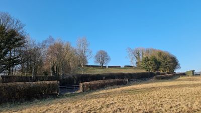
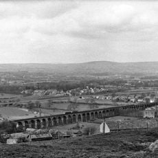
Portfield hillfort is an Iron Age fortification in Whalley, Lancashire, positioned on a south-facing promontory with steep natural slopes on its western side. The site is defended by earthen banks and ditches that follow an irregular outline, creating a fortified enclosure.

The site began as a Bronze Age defensive structure and was later reinforced during the Iron Age with additional fortified lines. This evolution reflects how local inhabitants adapted their defensive strategies across multiple centuries.

Archaeological discoveries at the site include a collection of nine Bronze Age artifacts, containing gold jewelry and bronze items found during pipeline construction in 1966.

The site is reached by footpaths from nearby roads, with no visitor facilities on the grounds. Wear sturdy footwear as the terrain is uneven and can become muddy.

Pipeline construction in 1966 uncovered nine Bronze Age objects including gold jewelry and bronze items, revealing that the site was inhabited earlier than the Iron Age fortification. This finding suggests that strategically valuable locations were reused across generations.

The community of curious travelers

AroundUs brings together thousands of curated places, local tips, and hidden gems, enriched daily by 60,000 contributors worldwide.

Start exploring
Location
Location
GPS coordinates
53.81520,-2.38750
Latest update
December 14, 2025 13:06
« Portfield hillfort - Iron Age hillfort in Whalley, England » is provided by Around Us (aroundus.com). Images and texts are derived from Wikimedia project under a Creative Commons license. You are allowed to copy, distribute, and modify copies of this page, under the conditions set by the license, as long as this note is clearly visible.

Discover hidden gems everywhere you go!

From secret cafés to breathtaking viewpoints, skip the crowded tourist spots and find places that match your style. Our app makes it easy with voice search, smart filtering, route optimization, and insider tips from travelers worldwide. Download now for the complete mobile experience.

Around Us App Screenshot

A unique approach to discovering new places

Le Figaro

All the places worth exploring

France Info

A tailor-made excursion in just a few clicks

20 Minutes

Around Us
Travel Guide & Maps
Download

Send to your phone

QR Code
1

Open the camera app on your mobile.

2

Point at the QR code with your camera. A notification will appear.

3

Tap the notification to open the link.