Enable Location

We need your location to show you interesting places around you

Discover nearby places

Find interesting locations and hidden gems around you

Precise directions

Get accurate directions and distances to places

Your location is never shared with other users. It's only used when you tap the location button.

Mount Taisen

Log in to your account

Join the adventure

Create your free account and start exploring (like 60k+ others)

We will send you a code to connect

or
Continue with Google
Continue with Apple
By continuing, you accept our Terms and Conditions and our Privacy Policy

Check your inbox

We've sent a pincode in your inbox. Please enter the code below.

Mount Taisen

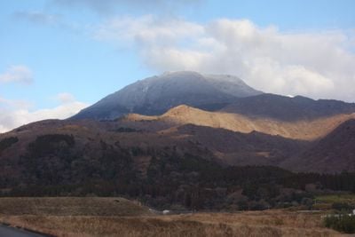
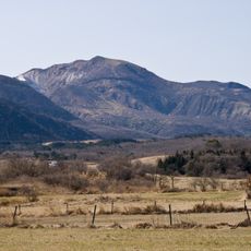
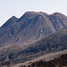
Mount Taisen, Mountain summit in Taketa, Japan

Description

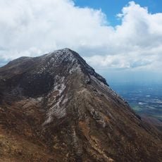
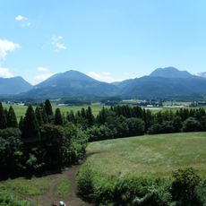
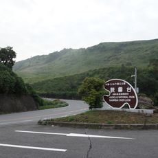
Mount Taisen is a summit within Aso-Kuju National Park that rises 1,786 meters and overlooks the Oita Prefecture landscape. The peak can be reached from several directions and features forest coverage along with volcanic formations typical of the region.

History

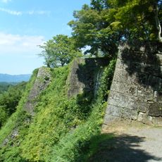
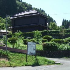
The third feudal lord of the Oka domain selected this peak as his final resting place and established the Iriyamakobyo Cemetery with views of the surrounding lands. This decision transformed the location into a significant monument of the feudal period in the region.

Culture

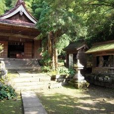
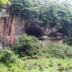
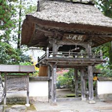
The summit connects to Gokurakuji Temple, where stone lanterns and carved steps reflect longstanding spiritual practices tied to mountain veneration. These structures show how locals have incorporated the peak into their religious life over generations.

Practical

The trail begins at Kusumi Kogen Palclub Resort and takes about four hours to reach the summit, covering roughly 26 kilometers in total distance. Sturdy footwear and plenty of water are important because sections become steep and shelter spots are limited along the route.

Did you know?

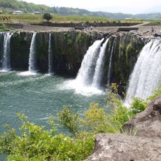
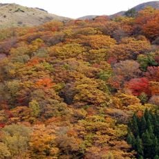
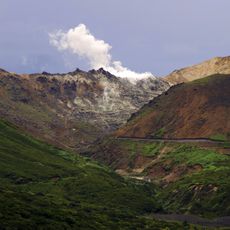
Below the summit lies Oike Pond nestled within a volcanic crater, reflecting red maple leaves and pink azaleas depending on the season. The contrast between the dark water and the bright plant colors creates a distinctive sight that visitors often miss.

Location
Elevation above the sea
1,786.2 m
GPS coordinates
33.09505,131.28068
Latest update
December 10, 2025 16:23

AroundUs brings together thousands of curated places, local tips, and hidden gems, enriched daily by 60,000 contributors worldwide. Discover all places nearby (Taketa).

« Mount Taisen - Mountain summit in Taketa, Japan » is provided by Around Us (aroundus.com). Images and texts are derived from Wikimedia project under a Creative Commons license. You are allowed to copy, distribute, and modify copies of this page, under the conditions set by the license, as long as this note is clearly visible.

Discover hidden gems everywhere you go!

From secret cafés to breathtaking viewpoints, skip the crowded tourist spots and find places that match your style. Our app makes it easy with voice search, smart filtering, route optimization, and insider tips from travelers worldwide. Download now for the complete mobile experience.

Around Us App Screenshot

A unique approach to discovering new places

Le Figaro

All the places worth exploring

France Info

A tailor-made excursion in just a few clicks

20 Minutes

Around Us
Travel Guide & Maps
Download

Send to your phone

QR Code
1

Open the camera app on your mobile.

2

Point at the QR code with your camera. A notification will appear.

3

Tap the notification to open the link.