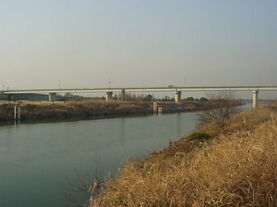
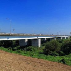
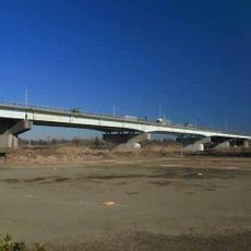
Jisui Bridge, Steel bridge in Saitama, Japan
Jisui Bridge is a steel crossing over the Arakawa River that connects communities on both sides with a modern structure. The bridge has separate pathways for pedestrians and vehicles running alongside the main road.
The original structure opened in 1934 and was named after someone who contributed to flood protection in the region. The design evolved over time to meet growing transportation needs while maintaining flood resilience.
The bridge stands as a symbol of Japanese infrastructure development, connecting communities while integrating engineering principles with flood management strategies.
The best way to experience this bridge is on foot or by bicycle to enjoy the riverside surroundings. The pathways are well-marked and easy to navigate, allowing for comfortable exploration.
The bridge structure incorporates specific design elements to withstand flooding events, with its highest span reaching 68.7 meters above the water.
The community of curious travelers
AroundUs brings together thousands of curated places, local tips, and hidden gems, enriched daily by 60,000 contributors worldwide.