Sinyaya

Log in to your account

AroundUs is a community-driven map of interesting places, built by curious explorers like you. It grows with every review, story, and photo you share.
Connect to save your favorite spots, contribute locations, and create personalized routes.
Continue with Google
Continue with Apple
Continue with X
Continue with Facebook
Continue with email
By continuing, you accept our Terms and Conditions and our Privacy Policy
Create an account
Add to collection
Map
Suggest a change
Share

Sinyaya, Protected mountain summit in Sverdlovsk Oblast, Russia

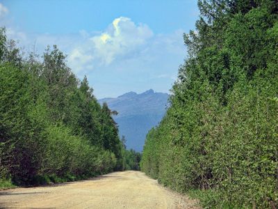
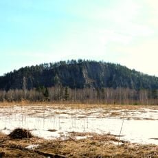
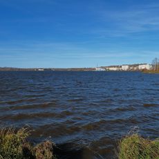
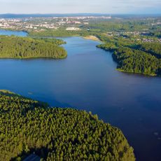
Sinyaya is a protected mountain summit in Prigorodny District that rises to 600 meters, with coniferous forests covering its slopes and exposed rock formations appearing toward the peak. The mountain is accessible from nearby settlements by way of established hiking trails.

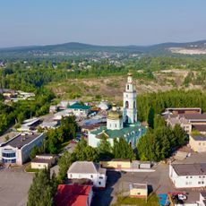
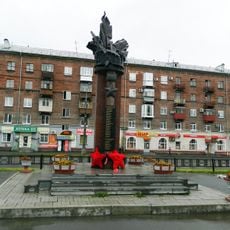
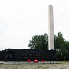
The mountain is located in Sverdlovsk Oblast, which became an independent administrative region following the establishment of Soviet administration in 1934. The region has since developed into an important center for industry and resource extraction in the Urals.

The mountain serves as a gathering place for outdoor enthusiasts from nearby towns who regularly visit for hiking and nature activities. It has become part of the local way of spending time in the open air and exploring the surrounding landscape.

Visitors should prepare for changing weather conditions, especially during winter months when extra gear and careful planning become important. Bring appropriate clothing for the varying temperatures between the base and summit, and allow enough time for a comfortable hike.

The mountain contains distinctive geological columns of stone that have been shaped over many centuries by water and weather, creating natural formations that stand out on the landscape. These features give the area a particular character that hikers notice when exploring the peak and surrounding terrain.

Location: Sverdlovsk Oblast

Location: Prigorodny District

Elevation above the sea: 600 m

GPS coordinates: 58.13195,59.63089

Latest update: December 14, 2025 20:31

Photos
Around this place
Uralskaya Superdeep Borehole
Russian Federation

Uralskaya Superdeep Borehole

27.9 km
Яланғас таш
Russian Federation

Яланғас таш

31.8 km
Blagodat
Russian Federation

Blagodat

19.7 km
Nizhny Tagil iron and steel plant
Russian Federation

Nizhny Tagil iron and steel plant

31.5 km
Nizhny Tagil Local History Museum
Russian Federation

Nizhny Tagil Local History Museum

31.5 km
Музей подносного промысла
Russian Federation

Музей подносного промысла

30.8 km
Russian Federation

Nizhniy Tagil State Museum of Fine Arts

31.5 km
Park named after Aleksey Bondin
Russian Federation

Park named after Aleksey Bondin

31.9 km
Medved kamen
Russian Federation

Medved kamen

19.3 km
Holy Trinity Cathedral
Russian Federation

Holy Trinity Cathedral

31.3 km
Ნიჟნი-ტაგილის ყაზანის ღვთისმშობლის ხატის ტაძარი
Russian Federation

Ნიჟნი-ტაგილის ყაზანის ღვთისმშობლის ხატის ტაძარი

29.2 km
Monument to metallurgists of Nizhny Tagil
Russian Federation

Monument to metallurgists of Nizhny Tagil

31.6 km
Statue of Lenin in Nizhny Tagil
Russian Federation

Statue of Lenin in Nizhny Tagil

31.4 km
Palace of Culture of the Nizhny Tagil Iron and Steel Works
Russian Federation

Palace of Culture of the Nizhny Tagil Iron and Steel Works

31.3 km
Ნიჟნი-ტაგილის სერგი რადონეჟელის ტაძარი
Russian Federation

Ნიჟნი-ტაგილის სერგი რადონეჟელის ტაძარი

30.8 km
Verkhne-Vyyskiy Prud
Russian Federation

Verkhne-Vyyskiy Prud

24 km
Upper Provision Warehouse
Russian Federation

Upper Provision Warehouse

31.5 km
Lower Provision Warehouse
Russian Federation

Lower Provision Warehouse

31.6 km
Խորհրդային Միության հերոս և Փառքի շքանշանի ասպետ տագիլցիների հուշարձան
Russian Federation

Խորհրդային Միության հերոս և Փառքի շքանշանի ասպետ տագիլցիների հուշարձան

30.5 km
Nizhnetagilskaya Filarmoniya
Russian Federation

Nizhnetagilskaya Filarmoniya

30.9 km
Музей баявой славы металургаў
Russian Federation

Музей баявой славы металургаў

31.5 km
Upper Tura Reservoir
Russian Federation

Upper Tura Reservoir

27.4 km
Kushvinskiy Prud
Russian Federation

Kushvinskiy Prud

17.7 km
P. P. Bazhov Youth Theatre
Russian Federation

P. P. Bazhov Youth Theatre

29.3 km
Nizhnevyyskiy Prud
Russian Federation

Nizhnevyyskiy Prud

27.7 km
Աղայի տուն
Russian Federation

Աղայի տուն

30.8 km
Гісторыка-тэхнічны музей «Дом Чарапанавых»
Russian Federation

Гісторыка-тэхнічны музей «Дом Чарапанавых»

29 km
Saint Alexander Nevsky Church
Russian Federation

Saint Alexander Nevsky Church

28.6 km
Show the full map
Reviews

Visited this place? Tap the stars to rate it and share your experience / photos with the community! Try now! You can cancel it anytime.

« Sinyaya - Protected mountain summit in Sverdlovsk Oblast, Russia » is provided by Around Us (aroundus.com). Images and texts are derived from Wikimedia project under a Creative Commons license. You are allowed to copy, distribute, and modify copies of this page, under the conditions set by the license, as long as this note is clearly visible.

Discover hidden gems everywhere you go!

From secret cafés to breathtaking viewpoints, skip the crowded tourist spots and find places that match your style. Our app makes it easy with voice search, smart filtering, route optimization, and insider tips from travelers worldwide. Download now for the complete mobile experience.

Around Us App Screenshot

A unique approach to discovering new places

Le Figaro

All the places worth exploring

France Info

A tailor-made excursion in just a few clicks

20 Minutes