Fourth principal meridian, Geographic reference line in central Illinois, United States
The Fourth Principal Meridian is a north-south reference line that runs through several counties in Illinois, serving as a fundamental framework for land surveys and property boundaries. It was used to define ownership clearly and to divide large land areas in an orderly way.
Established in 1815, this meridian played a key role in systematic land surveying during the westward expansion of the United States in the 19th century. It allowed settlers and authorities to distribute territory quickly and fairly.
The meridian shaped the development of communities and agricultural patterns across Illinois by providing a structured framework for land distribution and settlement.
Surveyors and administrators still use this meridian's coordinates to define property lines and measure land. You can search for physical markers along or near the river that indicate its exact path.
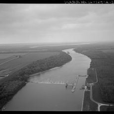
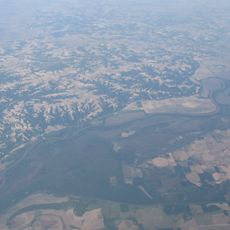
The starting point of this meridian sits on the western bank of the Illinois River in Schuyler County and marks the exact beginning of all surveys in the region. This spot was chosen because it offered a stable and easily recognizable geographic position.
The community of curious travelers
AroundUs brings together thousands of curated places, local tips, and hidden gems, enriched daily by 60,000 contributors worldwide.