Enable Location

We need your location to show you interesting places around you

Discover nearby places

Find interesting locations and hidden gems around you

Precise directions

Get accurate directions and distances to places

Your location is never shared with other users. It's only used when you tap the location button.

High-water mark of the Confederacy

Log in to your account

Join the adventure

Create your free account and start exploring (like 60k+ others)

We will send you a code to connect

or
Continue with Google
Continue with Apple
By continuing, you accept our Terms and Conditions and our Privacy Policy

Check your inbox

We've sent a pincode in your inbox. Please enter the code below.

High-water mark of the Confederacy

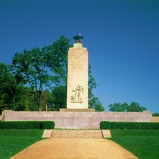
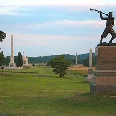
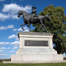
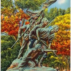
High-water mark of the Confederacy, Civil War memorial site at Cemetery Ridge, Gettysburg, United States

Description

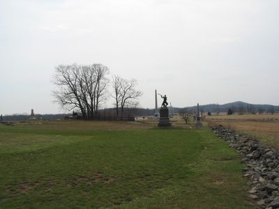
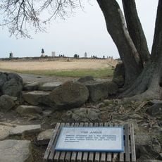
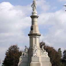
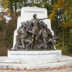
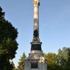
The High-Water Mark monument stands on Cemetery Ridge at the exact location where Confederate forces reached their northernmost advance during the assault. Stone markers throughout the area indicate the positions of both Union and Confederate troops at this critical moment.

History

The site marks the Confederate Army's northernmost limit during their assault on July 3, 1863, when thousands of soldiers advanced across open ground. After this failed attack, the course of the war turned decisively in the Union's favor.

Culture

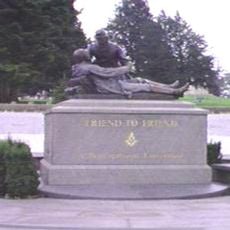
The monument represents a turning point in American history and stands as a symbol of national unity after the Civil War. Visitors can understand how this location became central to the country's healing process.

Practical

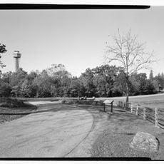
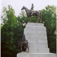
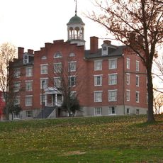
The memorial is accessible via Hancock Avenue within Gettysburg National Military Park with several pathways for exploration. Guided tours from the Gettysburg Tour Center help visitors understand the layout and significance of the positions.

Did you know?

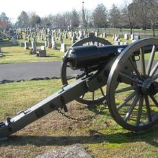
Stone walls and fortifications built by both armies during the battle remain visible on the ground today. These physical structures allow visitors to trace the actual battle lines and grasp the tactical challenges soldiers faced.

Location
GPS coordinates
39.81250,-77.23583
Latest update
December 20, 2025 02:02

AroundUs brings together thousands of curated places, local tips, and hidden gems, enriched daily by 60,000 contributors worldwide. Discover all places nearby (Adams County).

Around this place
Eisenhower National Historic Site
United States of America

Eisenhower National Historic Site

3.2 km
The Angle
United States of America

The Angle

111 m
Sachs Covered Bridge
United States of America

Sachs Covered Bridge

3.8 km
Gettysburg National Military Park Museum and Visitor Center
United States of America

Gettysburg National Military Park Museum and Visitor Center

844 m
The Pennsylvania State Memorial
United States of America

The Pennsylvania State Memorial

548 m
Eternal Light Peace Memorial
United States of America

Eternal Light Peace Memorial

4.1 km
Gettysburg National Tower
United States of America

Gettysburg National Tower

530 m
Soldiers' National Monument
United States of America

Soldiers' National Monument

900 m
Evergreen Cemetery
United States of America

Evergreen Cemetery

1.1 km
Gettysburg Battlefield Historic District
United States of America

Gettysburg Battlefield Historic District

643 m
72nd Pennsylvania Infantry Monument
United States of America

72nd Pennsylvania Infantry Monument

47 m
McPherson Ridge
United States of America

McPherson Ridge

3.3 km
Friend to Friend Masonic Memorial
United States of America

Friend to Friend Masonic Memorial

1 km
High Water Mark of the Rebellion Monument
United States of America

High Water Mark of the Rebellion Monument

11 m
Virginia Monument
United States of America

Virginia Monument

1.3 km
North Carolina Monument
United States of America

North Carolina Monument

1.2 km
Adams County Courthouse
United States of America

Adams County Courthouse

1.9 km
Evergreen Cemetery gatehouse
United States of America

Evergreen Cemetery gatehouse

1.1 km
Pennsylvania Hall
United States of America

Pennsylvania Hall

2.5 km
11th Mississippi Infantry Monument
United States of America

11th Mississippi Infantry Monument

1.2 km
Schmucker Hall
United States of America

Schmucker Hall

2.3 km
Gettysburg National Museum
United States of America

Gettysburg National Museum

628 m
United States of America

Gettysburg Rostrum

689 m
Alabama State Monument
United States of America

Alabama State Monument

3.3 km
New York State Monument
United States of America

New York State Monument

1 km
Winfield Scott Hancock
United States of America

Winfield Scott Hancock

550 m
Sheads House
United States of America

Sheads House

2.5 km
Rock Creek-White Run Union Hospital Complex
United States of America

Rock Creek-White Run Union Hospital Complex

4.1 km
Show the full map
« High-water mark of the Confederacy - Civil War memorial site at Cemetery Ridge, Gettysburg, United States » is provided by Around Us (aroundus.com). Images and texts are derived from Wikimedia project under a Creative Commons license. You are allowed to copy, distribute, and modify copies of this page, under the conditions set by the license, as long as this note is clearly visible.

Discover hidden gems everywhere you go!

From secret cafés to breathtaking viewpoints, skip the crowded tourist spots and find places that match your style. Our app makes it easy with voice search, smart filtering, route optimization, and insider tips from travelers worldwide. Download now for the complete mobile experience.

Around Us App Screenshot

A unique approach to discovering new places

Le Figaro

All the places worth exploring

France Info

A tailor-made excursion in just a few clicks

20 Minutes

Around Us
Travel Guide & Maps
Download

Send to your phone

QR Code
1

Open the camera app on your mobile.

2

Point at the QR code with your camera. A notification will appear.

3

Tap the notification to open the link.