Enable Location

We need your location to show you interesting places around you

Discover nearby places

Find interesting locations and hidden gems around you

Precise directions

Get accurate directions and distances to places

Your location is never shared with other users. It's only used when you tap the location button.

The Angle

Log in to your account

Start exploring — it's free

Trusted by 61,561 travelers worldwide

Continue with Google
Continue with Apple
or

We will send you a code to connect

By continuing, you accept our Terms and Conditions and our Privacy Policy

Check your inbox

We've sent a pincode in your inbox. Please enter the code below.

The Angle

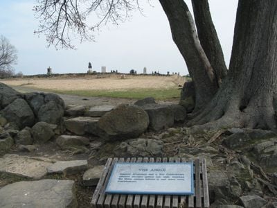
The Angle, Civil War battlefield site in Gettysburg, Pennsylvania, United States.

Description

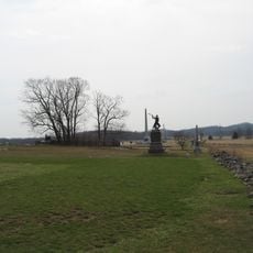
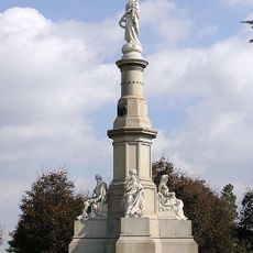
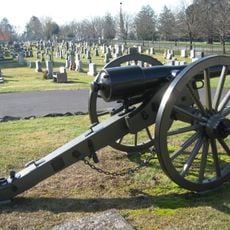
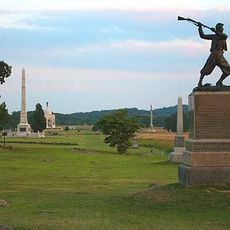
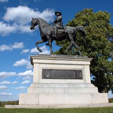
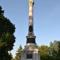
The Angle sits along Cemetery Ridge within Gettysburg National Military Park, marked by a low stone wall flanked by monuments and a wooded area known as the Copse of Trees. This location formed the center of intense fighting during the battle.

History

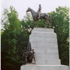
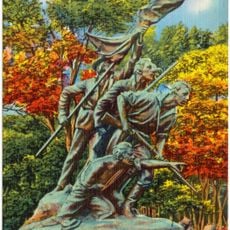
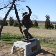
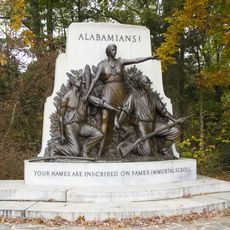
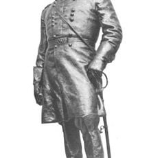
In July 1863, General Armistead led Confederate troops across the stone wall during a major assault that became the climax of the multi-day battle. The Southern forces could not hold their position, and this moment marked a turning point in the war.

Culture

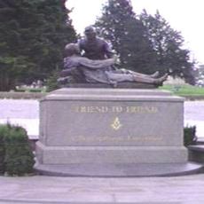
Veterans from both sides met at this spot in 1887, 1913, and 1938 to shake hands across the stone wall, symbolizing healing between North and South. These gatherings turned the location into a place where old enemies acknowledged their shared experience.

Practical

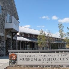
The site is easily reached via Hancock Avenue and lies within walking distance of eight other historical markers around the park. Plan to spend time walking and exploring the stone wall and surrounding monuments at your own pace.

Did you know?

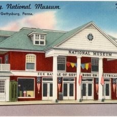
A massive painted panorama of the battle was displayed in a tent here in 1894, drawing thousands of visitors who wanted to see the fighting unfold up close. This temporary exhibition turned the location into a center of remembrance long before formal monuments were built.

Location
GPS coordinates
39.81340,-77.23640
Latest update
December 7, 2025 20:44

AroundUs brings together thousands of curated places, local tips, and hidden gems, enriched daily by 60,000 contributors worldwide. Discover all places nearby (Pennsylvania).

Around this place
High-water mark of the Confederacy
United States of America

High-water mark of the Confederacy

111 m
Eisenhower National Historic Site
United States of America

Eisenhower National Historic Site

3.2 km
Sachs Covered Bridge
United States of America

Sachs Covered Bridge

3.8 km
Gettysburg National Military Park Museum and Visitor Center
United States of America

Gettysburg National Military Park Museum and Visitor Center

909 m
The Pennsylvania State Memorial
United States of America

The Pennsylvania State Memorial

654 m
Eternal Light Peace Memorial
United States of America

Eternal Light Peace Memorial

3.9 km
Gettysburg National Tower
United States of America

Gettysburg National Tower

530 m
Soldiers' National Monument
United States of America

Soldiers' National Monument

836 m
Evergreen Cemetery
United States of America

Evergreen Cemetery

1 km
Gettysburg Battlefield Historic District
United States of America

Gettysburg Battlefield Historic District

620 m
72nd Pennsylvania Infantry Monument
United States of America

72nd Pennsylvania Infantry Monument

79 m
McPherson Ridge
United States of America

McPherson Ridge

3.2 km
Friend to Friend Masonic Memorial
United States of America

Friend to Friend Masonic Memorial

930 m
High Water Mark of the Rebellion Monument
United States of America

High Water Mark of the Rebellion Monument

121 m
Virginia Monument
United States of America

Virginia Monument

1.2 km
North Carolina Monument
United States of America

North Carolina Monument

1.1 km
Adams County Courthouse
United States of America

Adams County Courthouse

1.8 km
Evergreen Cemetery gatehouse
United States of America

Evergreen Cemetery gatehouse

1 km
Pennsylvania Hall
United States of America

Pennsylvania Hall

2.4 km
11th Mississippi Infantry Monument
United States of America

11th Mississippi Infantry Monument

1.1 km
Schmucker Hall
United States of America

Schmucker Hall

2.2 km
Gettysburg National Museum
United States of America

Gettysburg National Museum

560 m
United States of America

Gettysburg Rostrum

632 m
Alabama State Monument
United States of America

Alabama State Monument

3.4 km
New York State Monument
United States of America

New York State Monument

961 m
Winfield Scott Hancock
United States of America

Winfield Scott Hancock

656 m
Sheads House
United States of America

Sheads House

2.4 km
David Wills House
United States of America

David Wills House

2 km
Show the full map
« The Angle - Civil War battlefield site in Gettysburg, Pennsylvania, United States » is provided by Around Us (aroundus.com). Images and texts are derived from Wikimedia project under a Creative Commons license. You are allowed to copy, distribute, and modify copies of this page, under the conditions set by the license, as long as this note is clearly visible.

Discover hidden gems everywhere you go!

From secret cafés to breathtaking viewpoints, skip the crowded tourist spots and find places that match your style. Our app makes it easy with voice search, smart filtering, route optimization, and insider tips from travelers worldwide. Download now for the complete mobile experience.

Around Us App Screenshot

A unique approach to discovering new places

Le Figaro

All the places worth exploring

France Info

A tailor-made excursion in just a few clicks

20 Minutes

Around Us
Travel Guide & Maps
Download

Send to your phone

QR Code
1

Open the camera app on your mobile.

2

Point at the QR code with your camera. A notification will appear.

3

Tap the notification to open the link.