Hodgen's Cemetery Mound

Log in to your account

AroundUs is a community-driven map of interesting places, built by curious explorers like you. It grows with every review, story, and photo you share.
Connect to save your favorite spots, contribute locations, and create personalized routes.
Continue with Google
Continue with Apple
Continue with X
Continue with Facebook
Continue with email
By continuing, you accept our Terms and Conditions and our Privacy Policy
Create an account
Add to collection
Map
Suggest a change
Share

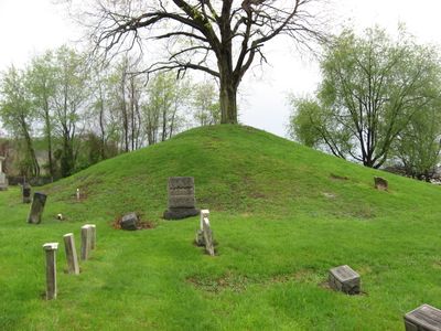
Hodgen's Cemetery Mound, Archaeological site in Tiltonsville, United States

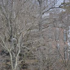
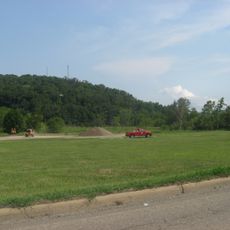
Hodgens Cemetery Mound is an archaeological site located along the Ohio River shoreline in Jefferson County, featuring a cone-shaped earthwork with a tree growing from its top. The mound is encircled by gravestones from later burials, creating a layered record of use across multiple time periods.

The mound was constructed as a burial site by the Adena culture between 500 BCE and 100 CE, representing their distinctive building practices. In the 1800s, European settlers began adding their own graves to the location, layering new burial practices over the ancient earthwork.

The site blends indigenous burial traditions with 19th century American settlement, as settlers used it as a family cemetery after its original purpose. Visitors can observe how different periods of burial practices coexist in the same place, with modern gravestones surrounding the ancient earthwork.

The site sits directly on the Ohio River shoreline, making it accessible but requiring awareness of the water's proximity. The terrain is relatively open and walkable, though visitors should take care to respect the burial grounds and gravestones present there.

The southwestern side of the mound bears visible marks from modern grave digging, revealing the ongoing tension between archaeological preservation and cemetery use. These disturbances serve as a tangible reminder of how the site has been repurposed across different eras.

Location: Ohio

GPS coordinates: 40.17440,-80.69470

Latest update: December 14, 2025 13:04

Photos
Around this place
Fort Henry Bridge
United States of America

Fort Henry Bridge

11.7 km
Mount de Chantal Visitation Academy
United States of America

Mount de Chantal Visitation Academy

11.7 km
Aetnaville Bridge
United States of America

Aetnaville Bridge

11.1 km
Pike Island Locks and Dam
United States of America

Pike Island Locks and Dam

2.8 km
Mount Pleasant Historic District
United States of America

Mount Pleasant Historic District

8.8 km
Johnson Camden McKinley House
United States of America

Johnson Camden McKinley House

9.7 km
Friends Meetinghouse
United States of America

Friends Meetinghouse

9.2 km
Stratford Springs
United States of America

Stratford Springs

9.3 km
North Wheeling Historic District
United States of America

North Wheeling Historic District

11.4 km
Concord Hicksite Friends Meeting House
United States of America

Concord Hicksite Friends Meeting House

10.2 km
Edemar
United States of America

Edemar

11.8 km
Benjamin Lundy House
United States of America

Benjamin Lundy House

9.3 km
Woodsdale-Edgewood Neighborhood Historic District
United States of America

Woodsdale-Edgewood Neighborhood Historic District

11 km
Carter Farm
United States of America

Carter Farm

10.4 km
Mount Saint Joseph
United States of America

Mount Saint Joseph

7.4 km
William Miles Tiernan House
United States of America

William Miles Tiernan House

10.7 km
Henry K. List House
United States of America

Henry K. List House

11.6 km
H. C. Ogden House
United States of America

H. C. Ogden House

9.7 km
Elm Hill
United States of America

Elm Hill

9 km
Central School
United States of America

Central School

9.2 km
Stringer Stone House
United States of America

Stringer Stone House

1.7 km
Shaw Hall
United States of America

Shaw Hall

8 km
Woodridge
United States of America

Woodridge

11.8 km
Robert C. Woods House
United States of America

Robert C. Woods House

11.8 km
Fischer-Lasch Farmhouse
United States of America

Fischer-Lasch Farmhouse

9.8 km
Shotwell Hall, West Liberty State College
United States of America

Shotwell Hall, West Liberty State College

7.9 km
Oglebay Park
United States of America

Oglebay Park

8.6 km
Benjamin Lundy Home
United States of America

Benjamin Lundy Home

9.3 km
Show the full map
Reviews

Visited this place? Tap the stars to rate it and share your experience / photos with the community! Try now! You can cancel it anytime.

« Hodgen's Cemetery Mound - Archaeological site in Tiltonsville, United States » is provided by Around Us (aroundus.com). Images and texts are derived from Wikimedia project under a Creative Commons license. You are allowed to copy, distribute, and modify copies of this page, under the conditions set by the license, as long as this note is clearly visible.

Discover hidden gems everywhere you go!

From secret cafés to breathtaking viewpoints, skip the crowded tourist spots and find places that match your style. Our app makes it easy with voice search, smart filtering, route optimization, and insider tips from travelers worldwide. Download now for the complete mobile experience.

Around Us App Screenshot

A unique approach to discovering new places

Le Figaro

All the places worth exploring

France Info

A tailor-made excursion in just a few clicks

20 Minutes