Kangaroo Lake State Natural Area

Log in to your account

AroundUs is a community-driven map of interesting places, built by curious explorers like you. It grows with every review, story, and photo you share.
Connect to save your favorite spots, contribute locations, and create personalized routes.
Continue with Google
Continue with Apple
Continue with X
Continue with Facebook
Continue with email
By continuing, you accept our Terms and Conditions and our Privacy Policy
Create an account

Kangaroo Lake State Natural Area

Add to collection
Map
Suggest a change
Share

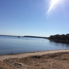
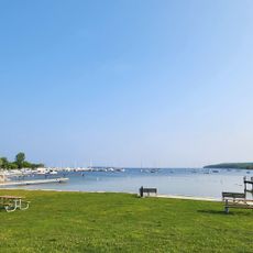
Kangaroo Lake State Natural Area, Protected natural area in Door County, United States

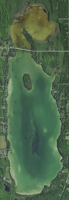
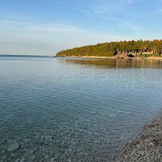
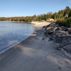
Kangaroo Lake State Natural Area covers 357 acres around the northern section of the lake with marshes, forests, and rock formations as the main features. A ridge drops roughly 130 feet to where Peil Creek flows into the water, creating varied terrain throughout the protected land.

The Wisconsin Department of Natural Resources established this protected area in 2002 to preserve the natural shoreline and diverse ecological systems found here. The landscape itself carries traces of ancient glacial Lake Algonquin, which shaped the terrain thousands of years before protection efforts began.

The name reflects early settlers' interpretations of the landscape, though local fauna such as beavers and herons are the true inhabitants you'll encounter today. These animals shape how the wetlands and forests function as living ecosystems.

A 2.4 kilometer looped hiking trail winds through the area and is open from sunrise to sunset year-round for visitor exploration. Sturdy footwear is wise since the ground becomes slippery in wetter sections, especially during spring and after rain.

The area shelters the world's largest breeding population of the endangered Hine's Emerald Dragonfly species. This rare insect depends on the specific freshwater wetland conditions that this location provides in abundance.

Location: Door County

Inception: 2002

GPS coordinates: 45.05170,-87.16080

Latest update: December 14, 2025 14:42

Photos
Around this place
Peninsula State Park
United States of America

Peninsula State Park

11.9 km
Cana Island
United States of America

Cana Island

9.7 km
Cana Island Light
United States of America

Cana Island Light

9.9 km
Baileys Harbor Range Lights
United States of America

Baileys Harbor Range Lights

3.9 km
The Ridges Sanctuary
United States of America

The Ridges Sanctuary

4.1 km
Eagle Bluff Light
United States of America

Eagle Bluff Light

14.3 km
United States of America

Mero Site

13.1 km
Baileys Harbor Light
United States of America

Baileys Harbor Light

5 km
Alexander Noble House
United States of America

Alexander Noble House

10.8 km
Church of the Atonement
United States of America

Church of the Atonement

11 km
Cupola House
United States of America

Cupola House

9.4 km
Ephraim Moravian Church
United States of America

Ephraim Moravian Church

11.5 km
Free Evangelical Lutheran Church-Bethania Scandinavian Evangelical Lutheran Congregation
United States of America

Free Evangelical Lutheran Church-Bethania Scandinavian Evangelical Lutheran Congregation

11.6 km
Gibraltar District School No. 2
United States of America

Gibraltar District School No. 2

11.6 km
Albert Zahn House
United States of America

Albert Zahn House

3.6 km
Freeman and Jesse Thorp House and Cottages
United States of America

Freeman and Jesse Thorp House and Cottages

10.6 km
Ephraim Village Hall
United States of America

Ephraim Village Hall

11.7 km
Peter Peterson House
United States of America

Peter Peterson House

11.8 km
Baileys Harbor Town Hall-McArdle Library
United States of America

Baileys Harbor Town Hall-McArdle Library

3.3 km
Globe Hotel
United States of America

Globe Hotel

3.2 km
Egg Harbor Fun Park
United States of America

Egg Harbor Fun Park

10.4 km
Pebble Beach
United States of America

Pebble Beach

14.8 km
Baileys Harbor Range Rear Light
United States of America

Baileys Harbor Range Rear Light

3.8 km
Baileys Harbor Range Front Light
United States of America

Baileys Harbor Range Front Light

3.8 km
Village of Ephraim Public Beach
United States of America

Village of Ephraim Public Beach

11 km
Egg Harbor Beach
United States of America

Egg Harbor Beach

9.8 km
Nicolet Bay Beach
United States of America

Nicolet Bay Beach

13.6 km
Fish Creek Public Beach
United States of America

Fish Creek Public Beach

10.6 km
Show the full map
Reviews

Visited this place? Tap the stars to rate it and share your experience / photos with the community! Try now! You can cancel it anytime.

« Kangaroo Lake State Natural Area - Protected natural area in Door County, United States » is provided by Around Us (aroundus.com). Images and texts are derived from Wikimedia project under a Creative Commons license. You are allowed to copy, distribute, and modify copies of this page, under the conditions set by the license, as long as this note is clearly visible.

Discover hidden gems everywhere you go!

From secret cafés to breathtaking viewpoints, skip the crowded tourist spots and find places that match your style. Our app makes it easy with voice search, smart filtering, route optimization, and insider tips from travelers worldwide. Download now for the complete mobile experience.

Around Us App Screenshot

A unique approach to discovering new places

Le Figaro

All the places worth exploring

France Info

A tailor-made excursion in just a few clicks

20 Minutes