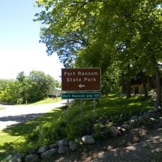
Kulm Wetland Management District, Wetland Management District in south-central North Dakota, United States.
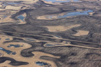
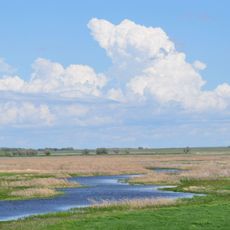
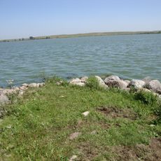
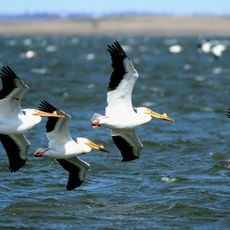
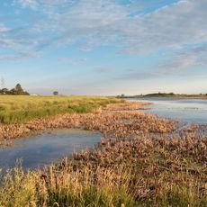
The Kulm Wetland Management District spans across 45,683 acres of land, managing 201 waterfowl production areas in Dickey, LaMoure, Logan, and McIntosh counties.
Established in July 1971, this district became a vital component of the Prairie Pothole Region, supporting numerous species of waterfowl and migratory birds.
The district continues traditional land management practices through prescribed fires and rotational grazing, methods that reflect the natural cycles of prairie ecosystems.
Visitors can access over 200 waterfowl production areas for hunting, fishing, trapping, wildlife photography, and nature walking throughout the protected lands.
The James River flows through the eastern section, creating a migration corridor where waterfowl breeding densities exceed 100 pairs per square mile.
Location: North Dakota
Website: https://fws.gov/refuge/kulm_wmd
GPS coordinates: 46.30000,-98.93333
Latest update: March 8, 2025 20:13
North Dakota is a Great Plains state with a history shaped by trading posts, military forts, and Native American settlements. The region stretches from the Missouri River to the Canadian border, preserving sites that tell stories from the 19th century alongside Cold War relics and natural areas. Visitors find military installations turned into museums, archaeological sites, and parks that protect bison, prairie, and forest.The locations include Theodore Roosevelt National Park with its badlands formations, Fort Union Trading Post from the fur trade era, and Knife River Indian Villages National Historic Site, where earth lodge foundations recall earlier communities. The Enchanted Highway displays large metal sculptures along the road, while Nekoma Missile Site and Ronald Reagan Minuteman Missile Site provide views into the missile defense systems of the 1970s. State parks like Fort Ransom and Icelandic preserve river valleys and woodlands. Museums in Fargo and Minot showcase aviation history. The Center of North America Monument in Rugby marks a geographic midpoint, and Bonanzaville USA displays historical buildings from pioneer times.
World's Largest Buffalo
68 km
Sand Lake National Wildlife Refuge
78.8 km
Fort Ransom State Park
81.2 km
Basilica of St. James
69.3 km
Beaver Lake State Park
54 km
Chase Lake National Wildlife Refuge
89.4 km
Stutsman County Courthouse and Sheriff's Residence/Jail
69.4 km
Lisbon Bridge
97.6 km
Aurland United Norwegian Lutheran Church
71.3 km
Lisbon Opera House
97.5 km
Alfred E. Dickey Free Library
69.7 km
First Presbyterian Church of Steele
97.3 km
Grace Episcopal Church
70.2 km
Ransom County Courthouse
97.2 km
Finnish Apostolic Lutheran Church
59.1 km
Ellendale Opera House
45.6 km
Voorhees Chapel
70.7 km
Kidder County Courthouse
97.2 km
Elizabeth Apartments
70.2 km
McIntosh County Courthouse
44.8 km
Dickey County Courthouse
45.7 km
McPherson County Courthouse
64.2 km
Ipswich State Bank
96.4 km
T. J. Walker Historic District
80.8 km
Franklin School
69.8 km
Stephen William Brown Stone House
46.5 km
Sand Lake National Wildlife Refuge
79.2 km
LaMoure County Courthouse
49.9 kmReviews
Visited this place? Tap the stars to rate it and share your experience / photos with the community! Try now! You can cancel it anytime.
Discover hidden gems everywhere you go!
From secret cafés to breathtaking viewpoints, skip the crowded tourist spots and find places that match your style. Our app makes it easy with voice search, smart filtering, route optimization, and insider tips from travelers worldwide. Download now for the complete mobile experience.
A unique approach to discovering new places❞
— Le Figaro
All the places worth exploring❞
— France Info
A tailor-made excursion in just a few clicks❞
— 20 Minutes