My Lady's Manor

Log in to your account

AroundUs is a community-driven map of interesting places, built by curious explorers like you. It grows with every review, story, and photo you share.
Connect to save your favorite spots, contribute locations, and create personalized routes.
Continue with Google
Continue with Apple
Continue with X
Continue with Facebook
Continue with email
By continuing, you accept our Terms and Conditions and our Privacy Policy
Create an account
Add to collection
Map
Suggest a change
Share

My Lady's Manor, Historic district in Monkton, Baltimore County and Jarrettsville, Harford County, United States.

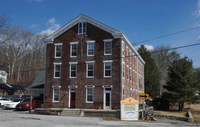
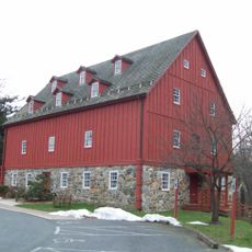
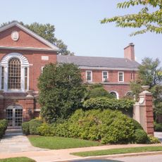
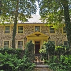
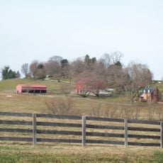
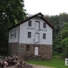
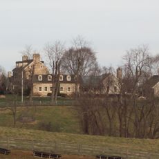
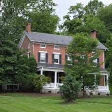
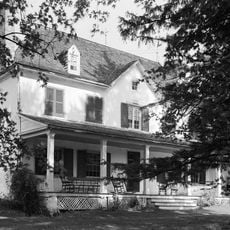
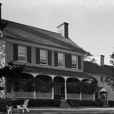
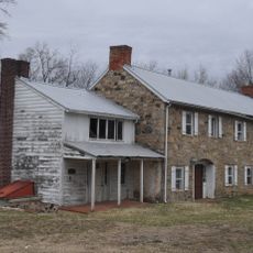
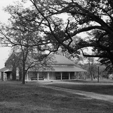
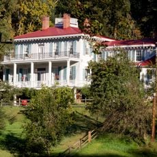
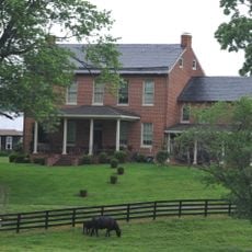
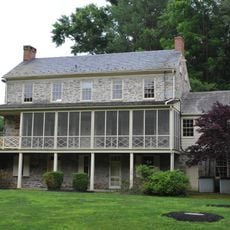
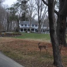
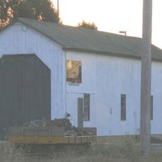
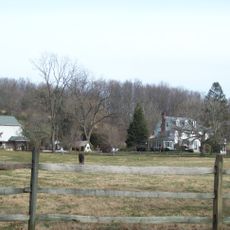
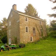
My Lady's Manor is a historic district spanning thousands of acres of farmland with over 60 primary buildings and numerous secondary structures across Baltimore and Harford Counties. The district encompasses the village of Monkton and surrounding areas with a mix of farmhouses, outbuildings, and an 18th-century church woven through the landscape.

Lord Baltimore Charles Calvert established this large estate in 1713 as a gift for his wife Margaret, but it was seized during the American Revolution. After the war, Maryland sold the land to Revolutionary War veterans and tenant farmers in 1782, fundamentally reshaping its ownership.

The name comes from Margaret Brent, wife of Charles Calvert, and many farmhouses display the typical architecture of the early 1700s with their distinctive center halls. St. James Church still anchors the community and remains a gathering place for local residents.

The district spreads across two counties, and Monkton serves as the natural reference point for exploring the sites. The buildings are scattered across a wide area, so a car is necessary to view the principal historical structures.

The estate underwent an unusual transformation from a royal land grant to a community of small farmers and war veterans, making it a rare example of post-Revolutionary land redistribution. This democratic reshaping shaped the area's character and created a landscape of independent farms still visible today.

Location: Maryland

GPS coordinates: 39.58750,-76.57110

Latest update: December 12, 2025 09:06

Photos
Around this place
Gunpowder Falls State Park
United States of America

Gunpowder Falls State Park

12 km
Prettyboy Reservoir
United States of America

Prettyboy Reservoir

15.8 km
Rocks State Park
United States of America

Rocks State Park

14.2 km
Hunt Valley Towne Centre
United States of America

Hunt Valley Towne Centre

12.3 km
Baltimore Country Club
United States of America

Baltimore Country Club

18 km
Ladew Topiary Gardens
United States of America

Ladew Topiary Gardens

5.1 km
Eagle's Nest
United States of America

Eagle's Nest

13 km
Worthington Valley Historic District
United States of America

Worthington Valley Historic District

18.6 km
Ivory Mills
United States of America

Ivory Mills

10.1 km
Stone Hall
United States of America

Stone Hall

14 km
Hidden Valley Farm
United States of America

Hidden Valley Farm

9.2 km
Bon Air
United States of America

Bon Air

15.9 km
Prospect Hill
United States of America

Prospect Hill

13 km
Graystone Lodge
United States of America

Graystone Lodge

18.9 km
Little Falls Meetinghouse
United States of America

Little Falls Meetinghouse

16.6 km
Valley Road Bridge, Stewartstown Railroad
United States of America

Valley Road Bridge, Stewartstown Railroad

19 km
Glencoe
United States of America

Glencoe

6.8 km
Col. John Streett House
United States of America

Col. John Streett House

14.1 km
Gladden Farm
United States of America

Gladden Farm

15.3 km
Rockdale
United States of America

Rockdale

15.4 km
Stewartstown Engine House, Stewartstown Railroad
United States of America

Stewartstown Engine House, Stewartstown Railroad

18.7 km
Western Run-Belfast Road Historic District
United States of America

Western Run-Belfast Road Historic District

12.4 km
Baltimore County School No. 7
United States of America

Baltimore County School No. 7

11.9 km
Payne's Folly
United States of America

Payne's Folly

16.5 km
Lacrosse Museum and National Hall of Fame
United States of America

Lacrosse Museum and National Hall of Fame

9.7 km
Kilgore Falls
United States of America

Kilgore Falls

17 km
Paper Mill Road Bridge
United States of America

Paper Mill Road Bridge

10.5 km
Loch Raven Reservoir
United States of America

Loch Raven Reservoir

15.3 km
Show the full map
Reviews

Visited this place? Tap the stars to rate it and share your experience / photos with the community! Try now! You can cancel it anytime.

« My Lady's Manor - Historic district in Monkton, Baltimore County and Jarrettsville, Harford County, United States » is provided by Around Us (aroundus.com). Images and texts are derived from Wikimedia project under a Creative Commons license. You are allowed to copy, distribute, and modify copies of this page, under the conditions set by the license, as long as this note is clearly visible.

Discover hidden gems everywhere you go!

From secret cafés to breathtaking viewpoints, skip the crowded tourist spots and find places that match your style. Our app makes it easy with voice search, smart filtering, route optimization, and insider tips from travelers worldwide. Download now for the complete mobile experience.

Around Us App Screenshot

A unique approach to discovering new places

Le Figaro

All the places worth exploring

France Info

A tailor-made excursion in just a few clicks

20 Minutes