Chest opened
+${chestReward.xp} XP
Explorer
NOUVEAU ×${chestReward.collectible.quantity}
tapez pour fermer
Chest locked

Open chests in the app

Around Us is built for your phone — chests unlock when you walk, explore and capture nearby places.

Enable Location

We need your location to show you interesting places around you

Discover nearby places

Find interesting locations and hidden gems around you

Precise directions

Get accurate directions and distances to places

Your location is never shared with other users. It's only used when you tap the location button.

Log in to your account

Start exploring — it's free

Trusted by 72,993 travelers worldwide

Continue with Google
Continue with Apple
or

We will send you a code to connect

By continuing, you accept our Terms and Conditions and our Privacy Policy

Check your inbox

We've sent a pincode in your inbox. Please enter the code below.

Pohatcong Creek
Discussion Reviews Photo
1.2k Popularity

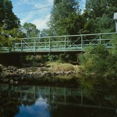
Pohatcong Creek, Tributary in Warren County, New Jersey.

Pohatcong Creek is a tributary that flows through Warren County from the mountains near Hackettstown toward the southwest. It travels through valleys along the northwestern side of Pohatcong Mountain before joining the Delaware River near Phillipsburg.

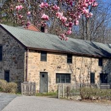
The waterway served as a transportation route for early American settlers and Native American groups in the region. Access to water helped communities develop through trade and settlement along its banks.

The name comes from the Munsee language and refers to how water moves along the waterway. Other places in the region share this same name, showing how the indigenous language is tied to the local landscape.

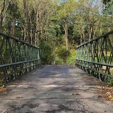
The area around the creek can be explored on foot at various points along its course. Be prepared for changing water levels and wet ground, particularly after rainfall.

A monitoring station has been collecting water quality and flow data continuously since 1999. This scientific measurement helps track changes in the waterway over many years.

The community of curious travelers

AroundUs brings together thousands of curated places, local tips, and hidden gems, enriched daily by 60,000 contributors worldwide.

Start exploring
Location
GPS coordinates
40.73650,-75.02800
Latest update
December 14, 2025 18:02
Around this place
Merrill Creek Reservoir
United States of America

Merrill Creek Reservoir

6.2 km
Shippen Manor
United States of America

Shippen Manor

8.1 km
United States of America

Musconetcong Mountain

8.8 km
Oxford Furnace
United States of America

Oxford Furnace

7.9 km
United States of America

Pohatcong Mountain

1.1 km
Asbury Historic District
United States of America

Asbury Historic District

4.4 km
New Hampton Pony Pratt Truss Bridge
United States of America

New Hampton Pony Pratt Truss Bridge

5.7 km
Port Colden Historic District
United States of America

Port Colden Historic District

6.9 km
Glen Gardner Pony Pratt Truss Bridge
United States of America

Glen Gardner Pony Pratt Truss Bridge

8.1 km
First Methodist Episcopal Church
United States of America

First Methodist Episcopal Church

5 km
United States of America

Scotts Mountain

4.7 km
Imlaydale Historic District
United States of America

Imlaydale Historic District

5.6 km
United States of America

Oxford Mountain

7.7 km
Spruce Run Evangelical Lutheran Zion Church
United States of America

Spruce Run Evangelical Lutheran Zion Church

9.4 km
Van Nest–Hoff–Vannatta Farmstead
United States of America

Van Nest–Hoff–Vannatta Farmstead

9.1 km
New Hampton Historic District
United States of America

New Hampton Historic District

5.8 km
Oxford Industrial Historic District
United States of America

Oxford Industrial Historic District

7.5 km
United States of America

County House Mountain

9.8 km
United States of America

Musconetcong Wild and Scenic River

4.8 km
Asbury United Methodist Church
United States of America

Asbury United Methodist Church

4.6 km
United States of America

Angens Pond Dam

3.4 km
1760 Joseph Turner House
United States of America

1760 Joseph Turner House

10.6 km
Bowerstown Historic District
United States of America

Bowerstown Historic District

4.8 km
Pleasant Valley Historic District
United States of America

Pleasant Valley Historic District

2.3 km
United States of America

Fairway Valley Golf Club

5.9 km
United States of America

Harkers Hollow Golf Club

9.3 km
United States of America

Hall Christmas Tree Farm

9.1 km
United States of America

Overlook

2.9 km
Show the full map
Reviews
Share your experience

No review yet

Discussions
Start a discussion...

No discussion yet

« Pohatcong Creek - Tributary in Warren County, New Jersey » is provided by Around Us (aroundus.com). Images and texts are derived from Wikimedia project under a Creative Commons license. You are allowed to copy, distribute, and modify copies of this page, under the conditions set by the license, as long as this note is clearly visible.

Discover hidden gems everywhere you go!

From secret cafés to breathtaking viewpoints, skip the crowded tourist spots and find places that match your style. Our app makes it easy with voice search, smart filtering, route optimization, and insider tips from travelers worldwide. Download now for the complete mobile experience.

Around Us App Screenshot

A unique approach to discovering new places

Le Figaro

All the places worth exploring

France Info

A tailor-made excursion in just a few clicks

20 Minutes

Around Us
Travel Guide & Maps
Download

Send to your phone

QR Code
1

Open the camera app on your mobile.

2

Point at the QR code with your camera. A notification will appear.

3

Tap the notification to open the link.