Enable Location

We need your location to show you interesting places around you

Discover nearby places

Find interesting locations and hidden gems around you

Precise directions

Get accurate directions and distances to places

Your location is never shared with other users. It's only used when you tap the location button.

Log in to your account

Start exploring — it's free

Trusted by 62,351 travelers worldwide

Continue with Google
Continue with Apple
or

We will send you a code to connect

By continuing, you accept our Terms and Conditions and our Privacy Policy

Check your inbox

We've sent a pincode in your inbox. Please enter the code below.

Musconetcong Mountain

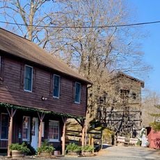
Musconetcong Mountain, Mountain summit in Hunterdon County, New Jersey, United States.

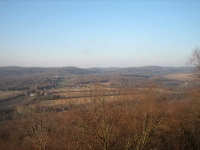
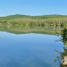
Musconetcong Mountain is a long ridge formation in Hunterdon County that runs parallel to the Musconetcong River, featuring rocky peaks and varied elevations across its length. The highest point, known as Point Mountain, rises above the surrounding landscape and serves as the prominent center of this mountain chain.

During the last Ice Age, glacial processes shaped the mountain's geological structure, creating the distinctive rocky outcrops visible today. These ancient forces determined the current landscape and the physical characteristics of this ridge formation.

The mountain area serves as a natural classroom for environmental education programs, where students learn about local ecosystems and wildlife conservation efforts.

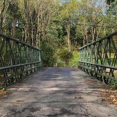
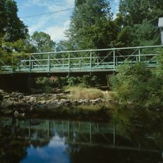
Multiple trail networks crisscross the mountain area with parking available at trailheads in Alexandria, Holland, and Lebanon Townships. Visitors should expect varying ground conditions and weather impacts depending on the season.

Its location within the Central Delaware Valley American Viticultural Area creates specific climate conditions that shape both native vegetation and agricultural use in unexpected ways. Few visitors realize that this ridge influences local water patterns and supports agricultural regions that thrive due to these hidden geographic advantages.

The community of curious travelers

AroundUs brings together thousands of curated places, local tips, and hidden gems, enriched daily by 60,000 contributors worldwide.

Start exploring
Location
GPS coordinates
40.65843,-75.00962
Latest update
December 14, 2025 09:40
Around this place
Spruce Run Recreation Area
United States of America

Spruce Run Recreation Area

6 km
Red Mill
United States of America

Red Mill

8.5 km
Hunterdon Art Museum
United States of America

Hunterdon Art Museum

8.6 km
Mount Salem Vineyards
United States of America

Mount Salem Vineyards

7.6 km
Clinton Historic District
United States of America

Clinton Historic District

8.7 km
Main Street Bridge
United States of America

Main Street Bridge

8.6 km
Perryville Tavern
United States of America

Perryville Tavern

4.4 km
Asbury Historic District
United States of America

Asbury Historic District

4.4 km
New Hampton Pony Pratt Truss Bridge
United States of America

New Hampton Pony Pratt Truss Bridge

7.9 km
Dunham's Mill
United States of America

Dunham's Mill

8.6 km
M. C. Mulligan & Sons Quarry
United States of America

M. C. Mulligan & Sons Quarry

8.5 km
Glen Gardner Pony Pratt Truss Bridge
United States of America

Glen Gardner Pony Pratt Truss Bridge

7.3 km
Red Mill Museum Village
United States of America

Red Mill Museum Village

8.5 km
Kennedy House and Mill
United States of America

Kennedy House and Mill

8.9 km
Imlaydale Historic District
United States of America

Imlaydale Historic District

7 km
Mount Salem Methodist Episcopal Church
United States of America

Mount Salem Methodist Episcopal Church

6.3 km
Old Grandin Library
United States of America

Old Grandin Library

8.8 km
New Hampton Historic District
United States of America

New Hampton Historic District

7.7 km
Case Farmstead
United States of America

Case Farmstead

3.3 km
Mechlin's Corner Tavern
United States of America

Mechlin's Corner Tavern

5.6 km
Rockhill Agricultural Historic District
United States of America

Rockhill Agricultural Historic District

8.1 km
Music Hall
United States of America

Music Hall

8.5 km
Bethlehem United Presbyterian Church
United States of America

Bethlehem United Presbyterian Church

7.7 km
Asbury United Methodist Church
United States of America

Asbury United Methodist Church

4.3 km
Spruce Run Reservoir
United States of America

Spruce Run Reservoir

6.6 km
1760 Joseph Turner House
United States of America

1760 Joseph Turner House

4.2 km
Van Syckel Corner District
United States of America

Van Syckel Corner District

2.9 km
Little York Historic District
United States of America

Little York Historic District

7.6 km
Show the full map
« Musconetcong Mountain - Mountain summit in Hunterdon County, New Jersey, United States » is provided by Around Us (aroundus.com). Images and texts are derived from Wikimedia project under a Creative Commons license. You are allowed to copy, distribute, and modify copies of this page, under the conditions set by the license, as long as this note is clearly visible.

Discover hidden gems everywhere you go!

From secret cafés to breathtaking viewpoints, skip the crowded tourist spots and find places that match your style. Our app makes it easy with voice search, smart filtering, route optimization, and insider tips from travelers worldwide. Download now for the complete mobile experience.

Around Us App Screenshot

A unique approach to discovering new places

Le Figaro

All the places worth exploring

France Info

A tailor-made excursion in just a few clicks

20 Minutes

Around Us
Travel Guide & Maps
Download

Send to your phone

QR Code
1

Open the camera app on your mobile.

2

Point at the QR code with your camera. A notification will appear.

3

Tap the notification to open the link.