Enable Location

We need your location to show you interesting places around you

Discover nearby places

Find interesting locations and hidden gems around you

Precise directions

Get accurate directions and distances to places

Your location is never shared with other users. It's only used when you tap the location button.

Log in to your account

Start exploring — it's free

Trusted by 63,231 travelers worldwide

Continue with Google
Continue with Apple
or

We will send you a code to connect

By continuing, you accept our Terms and Conditions and our Privacy Policy

Check your inbox

We've sent a pincode in your inbox. Please enter the code below.

Ponca Fort
Discussion Reviews Photo
1.5k Popularity

Ponca Fort, Archaeological site in Knox County, Nebraska, United States

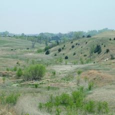
Ponca Fort is an archaeological site in Knox County, Nebraska that contains remains of earth lodges protected by defensive walls and ditches. The fortified settlement layout reveals how the community organized its living spaces within protective structures.

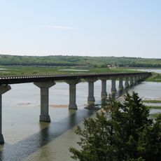
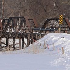
The settlement was built around 1700 at the junction of Ponca Creek and Niobrara River as a fortified community. It remained occupied until major changes came to the region around 1865.

The site carries the name of the Ponca people who made this place their home for generations. Visitors can sense how this location held significance as a center of community life.

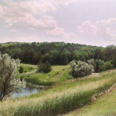
The site is located in a rural area and benefits from a visit in person to see the earthwork remains. Research information is also available through academic archives for those unable to travel there.

Excavations uncovered pottery, stone tools, and European trade goods that show how the Ponca engaged in commerce with distant peoples. These discoveries reveal long-distance trading connections that extended far beyond the local region.

The community of curious travelers

AroundUs brings together thousands of curated places, local tips, and hidden gems, enriched daily by 60,000 contributors worldwide.

Start exploring
Location
GPS coordinates
42.80806,-98.16361
Latest update
December 14, 2025 14:20
Around this place
Ashfall Fossil Beds
United States of America

Ashfall Fossil Beds

42.6 km
Niobrara Formation
United States of America

Niobrara Formation

12.2 km
Niobrara State Park
United States of America

Niobrara State Park

11.6 km
Chief Standing Bear Memorial Bridge
United States of America

Chief Standing Bear Memorial Bridge

14.8 km
United States of America

Lewis and Clark State Recreation Area

47.9 km
United States of America

Lake Andes National Wildlife Refuge

47.7 km
Z.C.B.J. Opera House
United States of America

Z.C.B.J. Opera House

25.8 km
St. Wenceslaus Catholic Church and Parish House
United States of America

St. Wenceslaus Catholic Church and Parish House

44.2 km
Niobrara River Bridge
United States of America

Niobrara River Bridge

10.5 km
Congregational Church and Manse
United States of America

Congregational Church and Manse

26.1 km
Church of Our Most Merciful Saviour
United States of America

Church of Our Most Merciful Saviour

26.9 km
St. Andrew's Episcopal Church
United States of America

St. Andrew's Episcopal Church

52 km
Old St. Wenceslaus Catholic Parish House
United States of America

Old St. Wenceslaus Catholic Parish House

44.2 km
Delmont Public School
United States of America

Delmont Public School

50.9 km
Knox County Courthouse
United States of America

Knox County Courthouse

32.3 km
Rad Sladkovsky
United States of America

Rad Sladkovsky

9.9 km
ZCBJ Hall
United States of America

ZCBJ Hall

32 km
Rouse Ranch
United States of America

Rouse Ranch

37.8 km
Verdigris Creek Bridge
United States of America

Verdigris Creek Bridge

50.3 km
Charles Mix County Courthouse
United States of America

Charles Mix County Courthouse

49.2 km
Bon Homme County Courthouse
United States of America

Bon Homme County Courthouse

31.9 km
Ponca Tribal Self-Help Community Building Historic District
United States of America

Ponca Tribal Self-Help Community Building Historic District

12.2 km
John Frydrych Farmstead
United States of America

John Frydrych Farmstead

36.9 km
Delmont State Bank
United States of America

Delmont State Bank

51.4 km
Mathias Merkwan Rubblestone Barn
United States of America

Mathias Merkwan Rubblestone Barn

46.1 km
Winnetoon Jail
United States of America

Winnetoon Jail

36.6 km
Wagner House
United States of America

Wagner House

32 km
Bazile Creek Bridge
United States of America

Bazile Creek Bridge

32.2 km
Show the full map
Reviews
Share your experience

No review yet

Discussions
Start a discussion...

No discussion yet

« Ponca Fort - Archaeological site in Knox County, Nebraska, United States » is provided by Around Us (aroundus.com). Images and texts are derived from Wikimedia project under a Creative Commons license. You are allowed to copy, distribute, and modify copies of this page, under the conditions set by the license, as long as this note is clearly visible.

Discover hidden gems everywhere you go!

From secret cafés to breathtaking viewpoints, skip the crowded tourist spots and find places that match your style. Our app makes it easy with voice search, smart filtering, route optimization, and insider tips from travelers worldwide. Download now for the complete mobile experience.

Around Us App Screenshot

A unique approach to discovering new places

Le Figaro

All the places worth exploring

France Info

A tailor-made excursion in just a few clicks

20 Minutes

Around Us
Travel Guide & Maps
Download

Send to your phone

QR Code
1

Open the camera app on your mobile.

2

Point at the QR code with your camera. A notification will appear.

3

Tap the notification to open the link.