Yellowwood State Forest, State forest in Brown County, Indiana, US
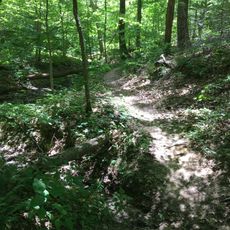
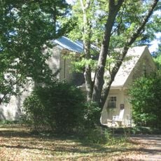
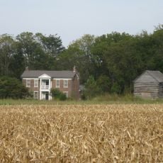
Yellowwood State Forest is a state forest in Brown County that spans thousands of acres of woodland with mixed tree species including pines, black locust, and walnut trees. The area features several lakes and a network of hiking trails winding through forest sections.
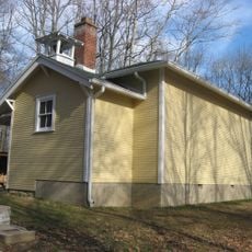
The forest started as a federal land project in the 1940s when the government worked to develop the area and later transferred ownership to the state of Indiana. Public works programs during that era built several artificial lakes and structures that still define the landscape today.
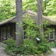
The Civilian Conservation Corps and Works Project Administration built three lakes, a shelter house, and multiple structures that remain operational today.
The forest can be accessed from two main directions: via Highway 45 from the north and Highway 46 from the south, with local roads connecting to the main forest areas. Visitors should be prepared for unpaved roads and uneven terrain when exploring the trails and lake areas.
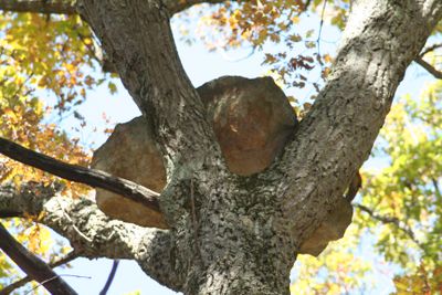
Large sandstone boulders have been discovered sitting high in the canopies of three separate trees throughout the forest, a phenomenon that puzzles visitors and researchers alike. These geological oddities offer a reminder that nature sometimes creates surprising formations that defy easy explanation.
Location: Brown County
GPS coordinates: 39.33190,-86.55720
Latest update: December 9, 2025 18:43
McCormick's Creek State Park
15.3 km
Griffy Lake
14.9 km
Morgan–Monroe State Forest
12.4 km
Honey Creek School
13.9 km
Maple Grove Road Rural Historic District
12.3 km
Martinsville Sanitarium
15.4 km
Morgan County Public Library
15.3 km
Morgan County Courthouse
15.4 km
Ennis Archaeological Site
15.1 km
Crawford-Gilpin House
15.2 km
Morgan County Sheriff's House and Jail
15.2 km
Martinsville Commercial Historic District
15.4 km
Secrest Ferry Bridge
10.3 km
Stone Arch Bridge over McCormick's Creek
14.5 km
Daniel Stout House
14.3 km
Secrest-Wampler House
12.6 km
Blackstone House and Martinsville Telephone Company Building
15.3 km
CCC Recreation Building-Nature Museum
15.3 km
Long Schoolhouse
10 km
Gosport Historic District
9.3 km
Matthews Stone Company Historic District
11.1 km
Stinesville Commercial Historic District
8.9 km
Lamb's Creek Bridge
12.4 km
Ellettsville Downtown Historic District
11.9 km
Dr. H.G. Osgood House
9.6 km
Blankenship-Hodges-Brown House
7.1 km
Low Gap Trail
11.6 km
Blackstone House and Martinsville Telephone Company Building
15.3 kmVisited this place? Tap the stars to rate it and share your experience / photos with the community! Try now! You can cancel it anytime.
Discover hidden gems everywhere you go!
From secret cafés to breathtaking viewpoints, skip the crowded tourist spots and find places that match your style. Our app makes it easy with voice search, smart filtering, route optimization, and insider tips from travelers worldwide. Download now for the complete mobile experience.
A unique approach to discovering new places❞
— Le Figaro
All the places worth exploring❞
— France Info
A tailor-made excursion in just a few clicks❞
— 20 Minutes