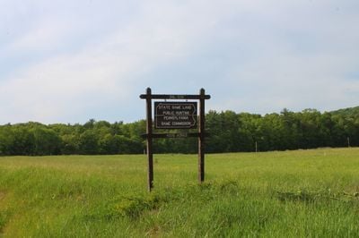
State Game Lands Number 226, Wildlife conservation area in Columbia County, US
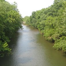
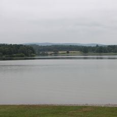
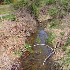
State Game Lands Number 226 is a wildlife area spanning roughly 4,335 acres of mixed forest, food plots, and waterways in Columbia County. Spruce Run and East Branch Chillisquaque Creek flow through the property, providing water corridors that support diverse animal habitats.
The land began as a rabbit conservation project during the 1960s, establishing early protocols for managing wildlife populations. Management has since broadened to include pheasant recovery and forest maintenance across the entire area.
This land serves as a working hunting ground where people practice traditional field sports while wildlife managers maintain specific animal populations. The designated zones reflect how local communities balance outdoor heritage with conservation needs.
The area offers 14 parking spots along Pennsylvania Route 442 and Route 44 for easy access to the grounds. About 4.3 miles of walking trails connect these parking areas, with routes suitable for different experience levels.
The property shelters pileated woodpeckers and ruffed grouse in specialized forest zones dominated by hemlock, white pine, and hardwoods. These specific tree combinations create habitats that draw birdwatchers and wildlife observers looking for less-common species.
Location: Columbia County
GPS coordinates: 41.13139,-76.59528
Latest update: December 14, 2025 14:20
Basilica of Saints Cyril and Methodius
18.8 km
Muncy Creek
19.5 km
Lake Chillisquaque
6.2 km
Carl E. Stotz Memorial Little League Bridge
1.1 km
Rupert Covered Bridge No. 56
19.6 km
St. James Episcopal Church
17.8 km
Jakey Hollow Natural Area
11.5 km
Creasyville Covered Bridge
14.3 km
Bloomsburg Historic District
18.6 km
Thomas Beaver Free Library and Danville YMCA
19.1 km
General William Montgomery House
18.7 km
Danville Historic District
19 km
Lairdsville Covered Bridge
9.1 km
William Kirk House
18.5 km
Sam Eckman Covered Bridge No. 92
10.2 km
Muncy Historic District
17.8 km
Warrior Run Presbyterian Church
18.1 km
Wanich Covered Bridge No. 69
13.9 km
Danville West Market Street Historic District
18.9 km
Keefer Covered Bridge No. 7
13.6 km
Welle Hess Covered Bridge No. S1
15.1 km
Hower-Slote House
17.1 km
Shoemaker Covered Bridge
5.4 km
Jud Christie Covered Bridge No. 95
12.5 km
Kramer Covered Bridge No. 113
13.7 km
Patterson Covered Bridge No. 112
15.1 km
Cox Run
12.4 km
Houseknecht Farm
6.8 kmVisited this place? Tap the stars to rate it and share your experience / photos with the community! Try now! You can cancel it anytime.
Discover hidden gems everywhere you go!
From secret cafés to breathtaking viewpoints, skip the crowded tourist spots and find places that match your style. Our app makes it easy with voice search, smart filtering, route optimization, and insider tips from travelers worldwide. Download now for the complete mobile experience.
A unique approach to discovering new places❞
— Le Figaro
All the places worth exploring❞
— France Info
A tailor-made excursion in just a few clicks❞
— 20 Minutes