Enable Location

We need your location to show you interesting places around you

Discover nearby places

Find interesting locations and hidden gems around you

Precise directions

Get accurate directions and distances to places

Your location is never shared with other users. It's only used when you tap the location button.

Bloomsburg Historic District

Log in to your account

Start exploring — it's free

Trusted by 61,835 travelers worldwide

Continue with Google
Continue with Apple
or

We will send you a code to connect

By continuing, you accept our Terms and Conditions and our Privacy Policy

Check your inbox

We've sent a pincode in your inbox. Please enter the code below.

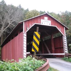
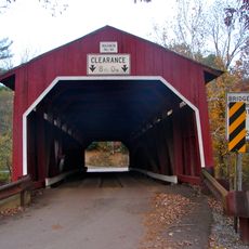
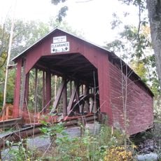
Bloomsburg Historic District, Historic district in Bloomsburg, Pennsylvania.

Description

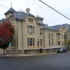
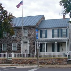
Bloomsburg Historic District is a neighborhood with buildings dating from the 19th and early 20th centuries, arranged mainly along Main Street and nearby roads. The structures display a range of architectural styles that reflect the building trends of those periods.

History

The district formed and developed starting in the 1800s with buildings that reflect Columbia County's economic and social growth during that era. It received National Register status in 1983 to protect these structures for future generations.

Culture

The buildings here show how different generations chose to design their homes and shops, from simple to ornately decorated. You can still see people living and working inside these structures today, which gives the district its everyday character.

Practical

The neighborhood is easy to explore on foot, with clear streets and wide sidewalks that make it accessible to all visitors. The best way to experience it is to walk slowly along Main Street and side streets, taking in the details of the building facades.

Did you know?

The district is home to the Columbia County Civil War Memorial, which honors the region's role during the American Civil War. This notable landmark offers visitors a window into an important chapter of local history.

Location
GPS coordinates
41.00250,-76.45360
Latest update
December 14, 2025 18:46

AroundUs brings together thousands of curated places, local tips, and hidden gems, enriched daily by 60,000 contributors worldwide. Discover all places nearby (Pennsylvania).

Around this place
Knoebels Amusement Resort
United States of America

Knoebels Amusement Resort

14.5 km
Impulse
United States of America

Impulse

14.3 km
United States of America

Bloomsburg–Berwick metropolitan area

10.1 km
Basilica of Saints Cyril and Methodius
United States of America

Basilica of Saints Cyril and Methodius

13.3 km
High Speed Thrill Coaster
United States of America

High Speed Thrill Coaster

14.2 km
Rupert Covered Bridge No. 56
United States of America

Rupert Covered Bridge No. 56

2.9 km
Twin Bridges-East Paden Covered Bridge No. 120
United States of America

Twin Bridges-East Paden Covered Bridge No. 120

14.2 km
Jakey Hollow Natural Area
United States of America

Jakey Hollow Natural Area

7.7 km
Catawissa Friends Meetinghouse
United States of America

Catawissa Friends Meetinghouse

5.5 km
Wagner Covered Bridge No. 19
United States of America

Wagner Covered Bridge No. 19

14 km
Thomas Beaver Free Library and Danville YMCA
United States of America

Thomas Beaver Free Library and Danville YMCA

13.7 km
General William Montgomery House
United States of America

General William Montgomery House

14.3 km
Twin Bridges-West Paden Covered Bridge No. 121
United States of America

Twin Bridges-West Paden Covered Bridge No. 121

14.2 km
Lake Glory
United States of America

Lake Glory

10.8 km
Davis Covered Bridge
United States of America

Davis Covered Bridge

10.2 km
Wanich Covered Bridge No. 69
United States of America

Wanich Covered Bridge No. 69

4.9 km
Parr's Mill Covered Bridge No. 10
United States of America

Parr's Mill Covered Bridge No. 10

10.8 km
Welle Hess Covered Bridge No. S1
United States of America

Welle Hess Covered Bridge No. S1

12.3 km
Rohrbach Covered Bridge No. 24
United States of America

Rohrbach Covered Bridge No. 24

12.4 km
Hollingshead Covered Bridge No. 40
United States of America

Hollingshead Covered Bridge No. 40

5.7 km
Johnson Covered Bridge No. 28
United States of America

Johnson Covered Bridge No. 28

14.1 km
East Bloomsburg Bridge
United States of America

East Bloomsburg Bridge

1.6 km
Furnace Covered Bridge No. 11
United States of America

Furnace Covered Bridge No. 11

10.7 km
Riegel Covered Bridge No. 6
United States of America

Riegel Covered Bridge No. 6

11.2 km
Fowlersville Covered Bridge
United States of America

Fowlersville Covered Bridge

12.1 km
Kramer Covered Bridge No. 113
United States of America

Kramer Covered Bridge No. 113

13.3 km
Snyder Covered Bridge No. 17
United States of America

Snyder Covered Bridge No. 17

12.3 km
Patterson Covered Bridge No. 112
United States of America

Patterson Covered Bridge No. 112

12.3 km
Show the full map
« Bloomsburg Historic District - Historic district in Bloomsburg, Pennsylvania » is provided by Around Us (aroundus.com). Images and texts are derived from Wikimedia project under a Creative Commons license. You are allowed to copy, distribute, and modify copies of this page, under the conditions set by the license, as long as this note is clearly visible.

Discover hidden gems everywhere you go!

From secret cafés to breathtaking viewpoints, skip the crowded tourist spots and find places that match your style. Our app makes it easy with voice search, smart filtering, route optimization, and insider tips from travelers worldwide. Download now for the complete mobile experience.

Around Us App Screenshot

A unique approach to discovering new places

Le Figaro

All the places worth exploring

France Info

A tailor-made excursion in just a few clicks

20 Minutes

Around Us
Travel Guide & Maps
Download

Send to your phone

QR Code
1

Open the camera app on your mobile.

2

Point at the QR code with your camera. A notification will appear.

3

Tap the notification to open the link.