Chest opened
+${chestReward.xp} XP
Explorer
NOUVEAU ×${chestReward.collectible.quantity}
tapez pour fermer
Chest locked

Open chests in the app

Around Us is built for your phone — chests unlock when you walk, explore and capture nearby places.

Enable Location

We need your location to show you interesting places around you

Discover nearby places

Find interesting locations and hidden gems around you

Precise directions

Get accurate directions and distances to places

Your location is never shared with other users. It's only used when you tap the location button.

Log in to your account

Start exploring — it's free

Trusted by 73,022 travelers worldwide

Continue with Google
Continue with Apple
or

We will send you a code to connect

By continuing, you accept our Terms and Conditions and our Privacy Policy

Check your inbox

We've sent a pincode in your inbox. Please enter the code below.

Double T State Fish and Wildlife Area
Discussion Reviews Photo
1.7k Popularity

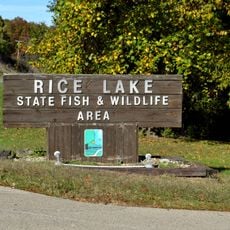
Double T State Fish and Wildlife Area, Wildlife refuge in Fulton County, Illinois, US.

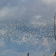
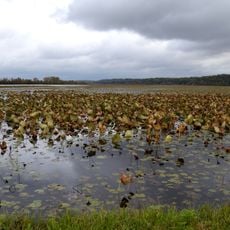
Double T State Fish and Wildlife Area is a refuge in Fulton County near Canton with a lake, wetlands, and grasslands across its roughly 1,961 acres. The main waterbody spans about 26 acres and supports diverse bird species alongside other wildlife habitats throughout the site.

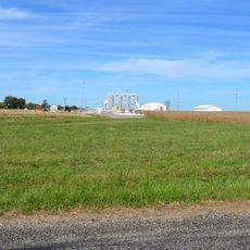
The land served as a coal strip mining site until 2001, when the Illinois Department of Natural Resources converted it into a wildlife recreation area. This transformation from industrial extraction to habitat protection represents ecological restoration of previously mined terrain.

The area serves as a gathering place for hunters during duck season in the Central Zone, where visitors congregate at designated hunting stakes. The activity follows a set rhythm across specific weekdays, giving the refuge a structured social calendar tied to seasonal hunting traditions.

Visitors should know that fishing is restricted in the waterfowl area between October and April. All hunters must obtain permits before visiting, so advance registration is important for anyone planning to hunt.

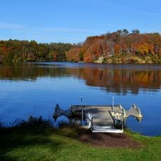
The refuge gets its name from the lake's distinctive shape resembling the pi symbol, formed within an abandoned mining excavation. This unusual shape has developed since 1983 as the excavated area filled with water, creating a memorable landmark recognizable from above.

The community of curious travelers

AroundUs brings together thousands of curated places, local tips, and hidden gems, enriched daily by 60,000 contributors worldwide.

Start exploring
GPS coordinates
40.60300,-90.09800
Latest update
December 14, 2025 13:08
Around this place
Dickson Mounds
United States of America

Dickson Mounds

28.1 km
Glasford crater
United States of America

Glasford crater

26.6 km
Chautauqua National Wildlife Refuge
United States of America

Chautauqua National Wildlife Refuge

26.7 km
Spring Lake State Fish and Wildlife Area
United States of America

Spring Lake State Fish and Wildlife Area

25.6 km
Banner Marsh State Fish and Wildlife Area
United States of America

Banner Marsh State Fish and Wildlife Area

22.8 km
Oak Hill Cemetery
United States of America

Oak Hill Cemetery

22.6 km
United States of America

Orendorf Site

7.4 km
Rice Lake State Fish and Wildlife Area
United States of America

Rice Lake State Fish and Wildlife Area

21.5 km
The Pioneers
United States of America

The Pioneers

22.5 km
Ulysses G. Orendorff House
United States of America

Ulysses G. Orendorff House

7.4 km
Pleasant Grove School
United States of America

Pleasant Grove School

22.9 km
Canton Lake
United States of America

Canton Lake

11.4 km
Seville Bridge
United States of America

Seville Bridge

21.8 km
Indian Ford Bridge
United States of America

Indian Ford Bridge

19.3 km
Hiram Palmer House
United States of America

Hiram Palmer House

13.8 km
Babylon Bend Bridge
United States of America

Babylon Bend Bridge

21.2 km
Buckeye Bridge
United States of America

Buckeye Bridge

21.9 km
Parlin Library
United States of America

Parlin Library

7.4 km
Tartar's Ferry Bridge
United States of America

Tartar's Ferry Bridge

27.6 km
London Mills Bridge
United States of America

London Mills Bridge

18.8 km
United States of America

Tampico Mounds

21.9 km
St. James Episcopal Church
United States of America

St. James Episcopal Church

23.2 km
Odd Fellows Opera Block
United States of America

Odd Fellows Opera Block

17.6 km
Chicago, Burlington & Quincy Railroad Station
United States of America

Chicago, Burlington & Quincy Railroad Station

7.4 km
East Waterford School
United States of America

East Waterford School

28.2 km
United States of America

Big Creek Park

5.4 km
Metal Highway Bridges of Fulton County TR
United States of America

Metal Highway Bridges of Fulton County TR

21.9 km
United States of America

Strode Lake

4.3 km
Show the full map
Reviews
Share your experience

No review yet

Discussions
Start a discussion...

No discussion yet

« Double T State Fish and Wildlife Area - Wildlife refuge in Fulton County, Illinois, US » is provided by Around Us (aroundus.com). Images and texts are derived from Wikimedia project under a Creative Commons license. You are allowed to copy, distribute, and modify copies of this page, under the conditions set by the license, as long as this note is clearly visible.

Discover hidden gems everywhere you go!

From secret cafés to breathtaking viewpoints, skip the crowded tourist spots and find places that match your style. Our app makes it easy with voice search, smart filtering, route optimization, and insider tips from travelers worldwide. Download now for the complete mobile experience.

Around Us App Screenshot

A unique approach to discovering new places

Le Figaro

All the places worth exploring

France Info

A tailor-made excursion in just a few clicks

20 Minutes

Around Us
Travel Guide & Maps
Download

Send to your phone

QR Code
1

Open the camera app on your mobile.

2

Point at the QR code with your camera. A notification will appear.

3

Tap the notification to open the link.