Enable Location

We need your location to show you interesting places around you

Discover nearby places

Find interesting locations and hidden gems around you

Precise directions

Get accurate directions and distances to places

Your location is never shared with other users. It's only used when you tap the location button.

Banner Marsh State Fish and Wildlife Area

Log in to your account

Start exploring — it's free

Trusted by 62,173 travelers worldwide

Continue with Google
Continue with Apple
or

We will send you a code to connect

By continuing, you accept our Terms and Conditions and our Privacy Policy

Check your inbox

We've sent a pincode in your inbox. Please enter the code below.

Banner Marsh State Fish and Wildlife Area

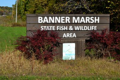
Banner Marsh State Fish and Wildlife Area, Wildlife management area in Fulton County, United States.

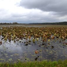
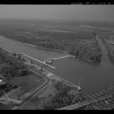
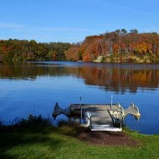
Banner Marsh is a wildlife management area along the Illinois River with deep lakes, floodplain forests, levees, shallow marshes, and extensive grasslands covering about 4,400 acres. The site contains numerous water bodies and provides varied habitats for different animal species across seasons.

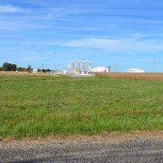
The land experienced coal strip mining from the 1880s through the 1980s, then transitioned to agricultural use. Eventually, the Illinois Department of Natural Resources acquired and restored it as a protected natural area.

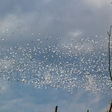
The location is recognized as an Important Bird Area and draws birdwatchers who can observe over 200 species across different seasons. The land reflects the importance of wetlands for people interested in conservation and wildlife observation.

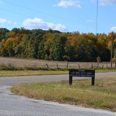
Access is through three public points with parking, boat ramps for small vessels, and restrooms on site. Visitors find designated areas for fishing and hunting with opportunities for various outdoor activities depending on the season.

The area contains dozens of lakes of different sizes, each individually named and shaping the landscape distinctly. These numerous water bodies partly resulted from earlier mining activities and now offer varied opportunities for water enthusiasts and observers.

The community of curious travelers

AroundUs brings together thousands of curated places, local tips, and hidden gems, enriched daily by 60,000 contributors worldwide.

Start exploring
Location
GPS coordinates
40.53850,-89.84170
Latest update
December 13, 2025 12:23
Around this place
Fort Crevecoeur
United States of America

Fort Crevecoeur

23.4 km
Wildlife Prairie Park
United States of America

Wildlife Prairie Park

23.2 km
Sand Ridge State Forest
United States of America

Sand Ridge State Forest

14.3 km
Glasford crater
United States of America

Glasford crater

8.4 km
Chautauqua National Wildlife Refuge
United States of America

Chautauqua National Wildlife Refuge

22.6 km
Spring Lake State Fish and Wildlife Area
United States of America

Spring Lake State Fish and Wildlife Area

7.2 km
Powerton Lake State Fish and Wildlife Area
United States of America

Powerton Lake State Fish and Wildlife Area

11.7 km
Cedar Street Bridge
United States of America

Cedar Street Bridge

25.6 km
Rice Lake State Fish and Wildlife Area
United States of America

Rice Lake State Fish and Wildlife Area

11 km
Pettingill-Morron House
United States of America

Pettingill-Morron House

26 km
John T. McNaughton Bridge
United States of America

John T. McNaughton Bridge

16 km
West Bluff Historic District
United States of America

West Bluff Historic District

25.1 km
Ulysses G. Orendorff House
United States of America

Ulysses G. Orendorff House

16.4 km
Peoria Lock and Dam
United States of America

Peoria Lock and Dam

21.1 km
John C. Proctor Recreation Center
United States of America

John C. Proctor Recreation Center

25.1 km
Tazewell County Courthouse
United States of America

Tazewell County Courthouse

16.8 km
Shade-Lohmann Bridge
United States of America

Shade-Lohmann Bridge

21.4 km
Pleasant Grove School
United States of America

Pleasant Grove School

15.5 km
Peoria Cordage Company
United States of America

Peoria Cordage Company

25.6 km
Canton Lake
United States of America

Canton Lake

11.5 km
Carl Herget Mansion
United States of America

Carl Herget Mansion

16.8 km
Hiram Palmer House
United States of America

Hiram Palmer House

21.9 km
Parlin Library
United States of America

Parlin Library

16.4 km
Lincoln Branch Peoria Public Library
United States of America

Lincoln Branch Peoria Public Library

24.9 km
Christ Church of Lower Kickapoo
United States of America

Christ Church of Lower Kickapoo

22.3 km
Pekin Federal Building
United States of America

Pekin Federal Building

16.7 km
North Eighth Street Plaza
United States of America

North Eighth Street Plaza

17.6 km
Creve Coeur Public Library District
United States of America

Creve Coeur Public Library District

24 km
Show the full map
« Banner Marsh State Fish and Wildlife Area - Wildlife management area in Fulton County, United States » is provided by Around Us (aroundus.com). Images and texts are derived from Wikimedia project under a Creative Commons license. You are allowed to copy, distribute, and modify copies of this page, under the conditions set by the license, as long as this note is clearly visible.

Discover hidden gems everywhere you go!

From secret cafés to breathtaking viewpoints, skip the crowded tourist spots and find places that match your style. Our app makes it easy with voice search, smart filtering, route optimization, and insider tips from travelers worldwide. Download now for the complete mobile experience.

Around Us App Screenshot

A unique approach to discovering new places

Le Figaro

All the places worth exploring

France Info

A tailor-made excursion in just a few clicks

20 Minutes

Around Us
Travel Guide & Maps
Download

Send to your phone

QR Code
1

Open the camera app on your mobile.

2

Point at the QR code with your camera. A notification will appear.

3

Tap the notification to open the link.