Enable Location

We need your location to show you interesting places around you

Discover nearby places

Find interesting locations and hidden gems around you

Precise directions

Get accurate directions and distances to places

Your location is never shared with other users. It's only used when you tap the location button.

Sand Ridge State Forest

Log in to your account

Start exploring — it's free

Trusted by 62,169 travelers worldwide

Continue with Google
Continue with Apple
or

We will send you a code to connect

By continuing, you accept our Terms and Conditions and our Privacy Policy

Check your inbox

We've sent a pincode in your inbox. Please enter the code below.

Sand Ridge State Forest

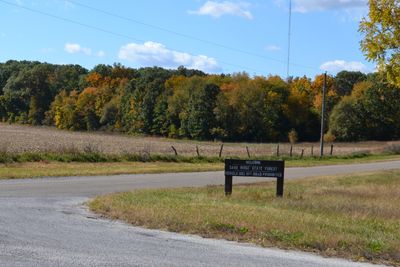
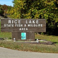
Sand Ridge State Forest, State forest in Macon County, Illinois.

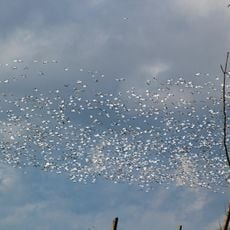
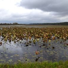
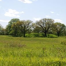
Sand Ridge State Forest is a state conservation area in Macon County, Illinois, covering about 7,200 acres with multiple habitat types. The landscape includes oak-hickory woodlands, pine plantations, and sand prairies that create varied ecosystems throughout the property.

The conservation area was established in 1939 when the Illinois Department of Natural Resources acquired around 5,500 acres of sandy farmland. The land was designated for experimental forest management and research into sustainable forestry practices.

The forest contains an archaeological site recognized on the National Register of Historic Places since 1978. Visitors can see evidence of human settlement preserved within the natural landscape.

The forest has over 44 miles of marked hiking trails and several camping areas for visitors to use. Good entry points include Pine Campground and Horseman's Park, which serve as bases for exploring different routes.

The forest's soil is about 89 percent sand, a result of deposits from the post-glacial Kankakee Torrent geological event. This sandy composition shapes the landscape character and the types of plants that thrive here.

The community of curious travelers

AroundUs brings together thousands of curated places, local tips, and hidden gems, enriched daily by 60,000 contributors worldwide.

Start exploring
Location
GPS coordinates
40.41140,-89.86610
Latest update
December 12, 2025 09:04
Around this place
Dickson Mounds
United States of America

Dickson Mounds

22.2 km
Emiquon National Wildlife Refuge
United States of America

Emiquon National Wildlife Refuge

21.4 km
Glasford crater
United States of America

Glasford crater

22.1 km
Chautauqua National Wildlife Refuge
United States of America

Chautauqua National Wildlife Refuge

12.1 km
Spring Lake State Fish and Wildlife Area
United States of America

Spring Lake State Fish and Wildlife Area

7.2 km
Powerton Lake State Fish and Wildlife Area
United States of America

Powerton Lake State Fish and Wildlife Area

20.6 km
Banner Marsh State Fish and Wildlife Area
United States of America

Banner Marsh State Fish and Wildlife Area

14.3 km
Rice Lake State Fish and Wildlife Area
United States of America

Rice Lake State Fish and Wildlife Area

7.4 km
Rockwell Mound
United States of America

Rockwell Mound

20.8 km
Ogden-Fettie Site
United States of America

Ogden-Fettie Site

22.8 km
John T. McNaughton Bridge
United States of America

John T. McNaughton Bridge

25.4 km
Ulysses G. Orendorff House
United States of America

Ulysses G. Orendorff House

21.6 km
Peoria Lock and Dam
United States of America

Peoria Lock and Dam

31.9 km
Tazewell County Courthouse
United States of America

Tazewell County Courthouse

25.5 km
Havana Water Tower
United States of America

Havana Water Tower

20.5 km
Pleasant Grove School
United States of America

Pleasant Grove School

29.7 km
Canton Lake
United States of America

Canton Lake

19.2 km
Carl Herget Mansion
United States of America

Carl Herget Mansion

25.2 km
Havana Public Library
United States of America

Havana Public Library

20.8 km
Parlin Library
United States of America

Parlin Library

21.6 km
Ayer Public Library
United States of America

Ayer Public Library

27.4 km
Scott Wike Lucas Bridge
United States of America

Scott Wike Lucas Bridge

21.6 km
Pekin Federal Building
United States of America

Pekin Federal Building

25.4 km
St. James Episcopal Church
United States of America

St. James Episcopal Church

24.2 km
Third Street Bridge
United States of America

Third Street Bridge

27.6 km
East Waterford School
United States of America

East Waterford School

22.2 km
North Eighth Street Plaza
United States of America

North Eighth Street Plaza

26.9 km
Delavan Commercial Historic District
United States of America

Delavan Commercial Historic District

27.4 km
Show the full map
« Sand Ridge State Forest - State forest in Macon County, Illinois » is provided by Around Us (aroundus.com). Images and texts are derived from Wikimedia project under a Creative Commons license. You are allowed to copy, distribute, and modify copies of this page, under the conditions set by the license, as long as this note is clearly visible.

Discover hidden gems everywhere you go!

From secret cafés to breathtaking viewpoints, skip the crowded tourist spots and find places that match your style. Our app makes it easy with voice search, smart filtering, route optimization, and insider tips from travelers worldwide. Download now for the complete mobile experience.

Around Us App Screenshot

A unique approach to discovering new places

Le Figaro

All the places worth exploring

France Info

A tailor-made excursion in just a few clicks

20 Minutes

Around Us
Travel Guide & Maps
Download

Send to your phone

QR Code
1

Open the camera app on your mobile.

2

Point at the QR code with your camera. A notification will appear.

3

Tap the notification to open the link.