Chest opened
+${chestReward.xp} XP
Explorer
NOUVEAU ×${chestReward.collectible.quantity}
tapez pour fermer
Chest locked

Open chests in the app

Around Us is built for your phone — chests unlock when you walk, explore and capture nearby places.

Enable Location

We need your location to show you interesting places around you

Discover nearby places

Find interesting locations and hidden gems around you

Precise directions

Get accurate directions and distances to places

Your location is never shared with other users. It's only used when you tap the location button.

Log in to your account

Start exploring — it's free

Trusted by 72,893 travelers worldwide

Continue with Google
Continue with Apple
or

We will send you a code to connect

By continuing, you accept our Terms and Conditions and our Privacy Policy

Check your inbox

We've sent a pincode in your inbox. Please enter the code below.

Discussion Reviews Photo
2.1k Popularity

Orendorf Site, Archaeological site in Canton, Illinois.

The Orendorf Site is an archaeological site near Canton, Illinois, spanning about 40 acres of land. The location contains four separate settlement areas from the Middle Mississippian period with different layers of artifacts and structures.

The site shows settlement activity from the Mississippian period, with inhabitants repeatedly leaving and resettling in new locations within the area. These repeated moves created distinct archaeological layers that document different time periods.

The site shows connections to the Spoon River tradition and cultural exchange with the Mississippian city of Cahokia. Visitors can observe the archaeological remains that document these ancient trade relationships and social networks.

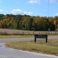
The site is a protected area that requires permits for archaeological research and other activities. Visitors should inquire ahead about public access options and what conditions apply.

What makes this location remarkable is the rare opportunity to examine four separate settlement sites side by side without artifacts from different time periods mixing together. This allows archaeologists to understand the community's development and its distinct phases more clearly.

The community of curious travelers

AroundUs brings together thousands of curated places, local tips, and hidden gems, enriched daily by 60,000 contributors worldwide.

Start exploring
Location
GPS coordinates
40.55778,-90.03417
Latest update
December 14, 2025 09:46
Around this place
Dickson Mounds
United States of America

Dickson Mounds

24.1 km
Emiquon National Wildlife Refuge
United States of America

Emiquon National Wildlife Refuge

26.4 km
Sand Ridge State Forest
United States of America

Sand Ridge State Forest

21.6 km
Glasford crater
United States of America

Glasford crater

21.7 km
Chautauqua National Wildlife Refuge
United States of America

Chautauqua National Wildlife Refuge

20.6 km
Spring Lake State Fish and Wildlife Area
United States of America

Spring Lake State Fish and Wildlife Area

18.4 km
Powerton Lake State Fish and Wildlife Area
United States of America

Powerton Lake State Fish and Wildlife Area

27.9 km
Banner Marsh State Fish and Wildlife Area
United States of America

Banner Marsh State Fish and Wildlife Area

16.4 km
Rice Lake State Fish and Wildlife Area
United States of America

Rice Lake State Fish and Wildlife Area

14.2 km
Rockwell Mound
United States of America

Rockwell Mound

29.1 km
Ogden-Fettie Site
United States of America

Ogden-Fettie Site

25.2 km
The Pioneers
United States of America

The Pioneers

25.2 km
Ulysses G. Orendorff House
United States of America

Ulysses G. Orendorff House

4 m
Havana Water Tower
United States of America

Havana Water Tower

28.7 km
Pleasant Grove School
United States of America

Pleasant Grove School

20.8 km
Canton Lake
United States of America

Canton Lake

5.2 km
Seville Bridge
United States of America

Seville Bridge

23.7 km
Indian Ford Bridge
United States of America

Indian Ford Bridge

26.6 km
Hiram Palmer House
United States of America

Hiram Palmer House

16 km
Babylon Bend Bridge
United States of America

Babylon Bend Bridge

26.8 km
Buckeye Bridge
United States of America

Buckeye Bridge

23.8 km
Havana Public Library
United States of America

Havana Public Library

29.1 km
Parlin Library
United States of America

Parlin Library

4 m
London Mills Bridge
United States of America

London Mills Bridge

26.2 km
St. James Episcopal Church
United States of America

St. James Episcopal Church

20.3 km
Odd Fellows Opera Block
United States of America

Odd Fellows Opera Block

24.1 km
East Waterford School
United States of America

East Waterford School

24.2 km
Metal Highway Bridges of Fulton County TR
United States of America

Metal Highway Bridges of Fulton County TR

23.8 km
Show the full map
Reviews
Share your experience

No review yet

Discussions
Start a discussion...

No discussion yet

« Orendorf Site - Archaeological site in Canton, Illinois » is provided by Around Us (aroundus.com). Images and texts are derived from Wikimedia project under a Creative Commons license. You are allowed to copy, distribute, and modify copies of this page, under the conditions set by the license, as long as this note is clearly visible.

Discover hidden gems everywhere you go!

From secret cafés to breathtaking viewpoints, skip the crowded tourist spots and find places that match your style. Our app makes it easy with voice search, smart filtering, route optimization, and insider tips from travelers worldwide. Download now for the complete mobile experience.

Around Us App Screenshot

A unique approach to discovering new places

Le Figaro

All the places worth exploring

France Info

A tailor-made excursion in just a few clicks

20 Minutes

Around Us
Travel Guide & Maps
Download

Send to your phone

QR Code
1

Open the camera app on your mobile.

2

Point at the QR code with your camera. A notification will appear.

3

Tap the notification to open the link.