Chest opened
+${chestReward.xp} XP
Explorer
NOUVEAU ×${chestReward.collectible.quantity}
tapez pour fermer

See the monuments around you in AR Open chests in the app

Around Us is built for your phone — point your camera at the streets and discover the monuments and places around you in augmented reality. Around Us is built for your phone — chests unlock when you walk, explore and capture nearby places.

Enable Location

We need your location to show you interesting places around you

Discover nearby places

Find interesting locations and hidden gems around you

Precise directions

Get accurate directions and distances to places

Your location is never shared with other users. It's only used when you tap the location button.

The 78

Log in to your account

Start exploring — it's free

Trusted by 85,752 travelers worldwide

Continue with Google
Continue with Apple
or

We will send you a code to connect

By continuing, you accept our Terms and Conditions and our Privacy Policy

Check your inbox

We've sent a pincode in your inbox. Please enter the code below.

Discussion Reviews 1 Photos
9.9k Popularity

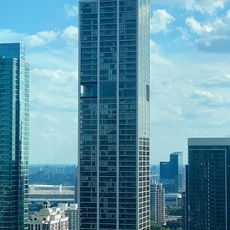
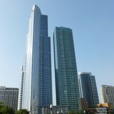
The 78, Mixed-use development project in South Loop, Chicago, United States.

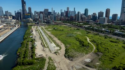
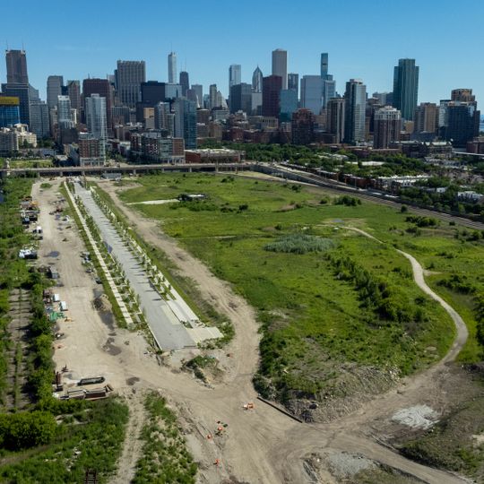
The 78 is an urban redevelopment project on a 62-acre site south of downtown Chicago that combines residential buildings, offices, retail spaces, and parks. The area stretches along the Chicago River and connects different functions within a single new district.

The site was originally railroad property before Related Midwest began transforming the location. This conversion of former rail land into a mixed-use neighborhood marks a significant shift in how this area is used.

The development creates a new neighborhood area with riverside walks and gathering spaces that give the feeling of a connected district. Visitors can use the new public spaces while experiencing proximity to the Chicago River.

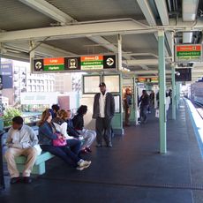
The area is easily reached through a new CTA station, existing Metra tracks, and pedestrian paths. Visitors should use the different access points from the river and surrounding streets to explore the entire site.

The project reserves twenty percent of its residential units for affordable housing and dedicates 12 acres to public space. This mix of accessibility and green space sets it apart from typical developments.

The community of curious travelers

AroundUs brings together thousands of curated places, local tips, and hidden gems, enriched daily by 60,000 contributors worldwide.
Start exploring
GPS coordinates
41.86472,-87.63222
Latest update
August 30, 2026 08:44
Around this place
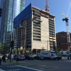
NEMA Chicago
United States of America

NEMA Chicago

0.5 mi
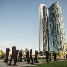
Agora
United States of America

Agora

0.5 mi
John J. Glessner House
United States of America

John J. Glessner House

0.8 mi
Henry B. Clarke House
United States of America

Henry B. Clarke House

0.7 mi
St. Luke's Hospital
United States of America

St. Luke's Hospital

0.5 mi
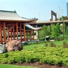
Ping Tom Memorial Park
United States of America

Ping Tom Memorial Park

0.4 mi
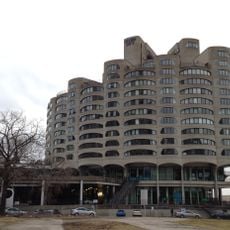
River City
United States of America

River City

0.5 mi
Pui Tak Center
United States of America

Pui Tak Center

0.9 mi
Motor Row District
United States of America

Motor Row District

0.9 mi
Second Presbyterian Church
United States of America

Second Presbyterian Church

0.7 mi
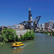
St. Charles Air Line Bridge
United States of America

St. Charles Air Line Bridge

0.3 mi
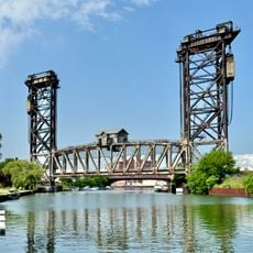
Canal Street railroad bridge
United States of America

Canal Street railroad bridge

0.7 mi
William W. Kimball House
United States of America

William W. Kimball House

0.8 mi
Coca-Cola Building
United States of America

Coca-Cola Building

0.3 mi
Ludington Building
United States of America

Ludington Building

0.4 mi
Somerset Hotel
United States of America

Somerset Hotel

0.4 mi
Joseph Rosenberg Fountain
United States of America

Joseph Rosenberg Fountain

0.5 mi
Taylor Street Bridge
United States of America

Taylor Street Bridge

0.4 mi
Maxwell-Briscoe Automobile Company Showroom
United States of America

Maxwell-Briscoe Automobile Company Showroom

0.6 mi
Reid House
United States of America

Reid House

0.9 mi
Cermak Road Bridge Historic District
United States of America

Cermak Road Bridge Historic District

0.9 mi
NEMA
United States of America

NEMA

0.5 mi
Roosevelt/Wabash
United States of America

Roosevelt/Wabash

0.3 mi
Chinese American Museum of Chicago
United States of America

Chinese American Museum of Chicago

0.9 mi
One Museum Park West
United States of America

One Museum Park West

0.5 mi
Cermak Road Bridge
United States of America

Cermak Road Bridge

0.9 mi
Clarke-Ford House
United States of America

Clarke-Ford House

0.7 mi
Chicago Public Library Chinatown Branch
United States of America

Chicago Public Library Chinatown Branch

0.8 mi
Show the full map
Reviews
Share your experience

No review yet

Discussions
Start a discussion...

No discussion yet

« The 78 - Mixed-use development project in South Loop, Chicago, United States » is provided by Around Us (aroundus.com). Images and texts are derived from Wikimedia project under a Creative Commons license. You are allowed to copy, distribute, and modify copies of this page, under the conditions set by the license, as long as this note is clearly visible.

Discover hidden gems everywhere you go!

From secret cafés to breathtaking viewpoints, skip the crowded tourist spots and find places that match your style. Our app makes it easy with voice search, smart filtering, route optimization, and insider tips from travelers worldwide. Download now for the complete mobile experience.

Around Us App Screenshot

A unique approach to discovering new places

Le Figaro

All the places worth exploring

France Info

A tailor-made excursion in just a few clicks

20 Minutes

Around Us
Travel Guide & Maps
Download

Send to your phone

QR Code
1

Open the camera app on your mobile.

2

Point at the QR code with your camera. A notification will appear.

3

Tap the notification to open the link.