Chest opened
+${chestReward.xp} XP
Explorer
NOUVEAU ×${chestReward.collectible.quantity}
tapez pour fermer
Chest locked

Open chests in the app

Around Us is built for your phone — chests unlock when you walk, explore and capture nearby places.

Enable Location

We need your location to show you interesting places around you

Discover nearby places

Find interesting locations and hidden gems around you

Precise directions

Get accurate directions and distances to places

Your location is never shared with other users. It's only used when you tap the location button.

Log in to your account

Start exploring — it's free

Trusted by 72,876 travelers worldwide

Continue with Google
Continue with Apple
or

We will send you a code to connect

By continuing, you accept our Terms and Conditions and our Privacy Policy

Check your inbox

We've sent a pincode in your inbox. Please enter the code below.

Big Stone Island Nature Area
Discussion Reviews Photo
1.4k Popularity

Big Stone Island Nature Area, Protected nature area in Roberts County, South Dakota, United States.

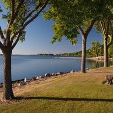
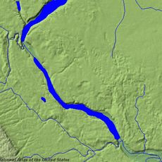
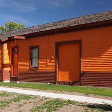
Big Stone Island Nature Area is a protected refuge located on an island within Big Stone Lake on the border between South Dakota and Minnesota. The site provides habitat for songbirds, waterfowl, and shore birds in a landscape left largely undeveloped.

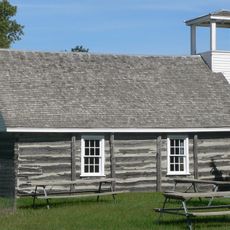
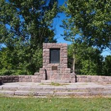
The first documented encounter with the island occurred in 1823 when an expedition found a Plains Indian village established there. Later in the 1800s, the island developed into a recreational destination with hotels and excursion boats that brought visitors from the mainland.

The island served as a gathering place for different communities throughout its history, from indigenous peoples to settlers and visitors seeking recreation. Today, walkers can sense this layered human presence when exploring the landscape and its traces of past habitation.

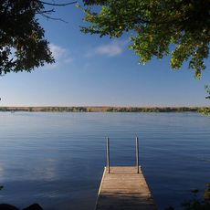
Reaching the nature area requires a boat or canoe since the island is only accessible by water from the mainland. Visitors should plan carefully for a self-sufficient visit, as the site has no facilities, trails, or services available on the island.

During World War II, military aircraft used the island as a training ground for takeoffs and landings on a temporary runway. Evidence of this wartime use remains visible today in the landscape for visitors who look closely.

The community of curious travelers

AroundUs brings together thousands of curated places, local tips, and hidden gems, enriched daily by 60,000 contributors worldwide.

Start exploring
GPS coordinates
45.34723,-96.48795
Latest update
December 14, 2025 17:04
Around this place
Big Stone Lake
United States of America

Big Stone Lake

12.2 km
Traverse Gap
United States of America

Traverse Gap

37.6 km
United States of America

Blue Cloud Abbey

33.4 km
Big Stone Lake State Park
United States of America

Big Stone Lake State Park

4.4 km
Big Stone National Wildlife Refuge
United States of America

Big Stone National Wildlife Refuge

16.1 km
Sam Brown Memorial State Wayside
United States of America

Sam Brown Memorial State Wayside

39 km
United States of America

Big Stone Wetland Management District

15.1 km
First Congregational Church of Milbank
United States of America

First Congregational Church of Milbank

17.4 km
Gethsemane Episcopal Church
United States of America

Gethsemane Episcopal Church

40.3 km
Swedish Lutheran Church of Strandburg
United States of America

Swedish Lutheran Church of Strandburg

40.9 km
Chicago, Milwaukee, St. Paul and Pacific Depot
United States of America

Chicago, Milwaukee, St. Paul and Pacific Depot

13.1 km
Browns Valley Carnegie Library
United States of America

Browns Valley Carnegie Library

38.4 km
Big Stone County Courthouse
United States of America

Big Stone County Courthouse

5.9 km
Appleton City Hall
United States of America

Appleton City Hall

40.2 km
Brown Earth Presbyterian Church
United States of America

Brown Earth Presbyterian Church

33.5 km
Alberta Teachers House
United States of America

Alberta Teachers House

42.7 km
Grant County Courthouse
United States of America

Grant County Courthouse

18.5 km
First State Bank Building
United States of America

First State Bank Building

37.2 km
Graceville Historical Marker
United States of America

Graceville Historical Marker

24.8 km
United States of America

Louis Nigg Barn

42.5 km
United States of America

Lakeside Park

5.4 km
United States of America

Lake Farley

18.1 km
United States of America

Samuel J Brown State Monument

39.2 km
United States of America

Taffe State Wildlife Management Area

20 km
United States of America

Victor State Wildlife Management Area

10.4 km
United States of America

Marsh Lake

36.5 km
United States of America

South Beach

25.4 km
United States of America

Scenic viewpoint

41.6 km
Show the full map
Reviews
Share your experience

No review yet

Discussions
Start a discussion...

No discussion yet

« Big Stone Island Nature Area - Protected nature area in Roberts County, South Dakota, United States » is provided by Around Us (aroundus.com). Images and texts are derived from Wikimedia project under a Creative Commons license. You are allowed to copy, distribute, and modify copies of this page, under the conditions set by the license, as long as this note is clearly visible.

Discover hidden gems everywhere you go!

From secret cafés to breathtaking viewpoints, skip the crowded tourist spots and find places that match your style. Our app makes it easy with voice search, smart filtering, route optimization, and insider tips from travelers worldwide. Download now for the complete mobile experience.

Around Us App Screenshot

A unique approach to discovering new places

Le Figaro

All the places worth exploring

France Info

A tailor-made excursion in just a few clicks

20 Minutes

Around Us
Travel Guide & Maps
Download

Send to your phone

QR Code
1

Open the camera app on your mobile.

2

Point at the QR code with your camera. A notification will appear.

3

Tap the notification to open the link.