Enable Location

We need your location to show you interesting places around you

Discover nearby places

Find interesting locations and hidden gems around you

Precise directions

Get accurate directions and distances to places

Your location is never shared with other users. It's only used when you tap the location button.

Dead Stream Flooding State Wildlife Management Area

Log in to your account

Start exploring — it's free

Trusted by 61,473 travelers worldwide

Continue with Google
Continue with Apple
or

We will send you a code to connect

By continuing, you accept our Terms and Conditions and our Privacy Policy

Check your inbox

We've sent a pincode in your inbox. Please enter the code below.

Dead Stream Flooding State Wildlife Management Area

Dead Stream Flooding State Wildlife Management Area, Protected wildlife area in northern Michigan, United States

Description

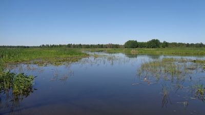
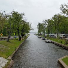
Dead Stream Flooding State Wildlife Management Area is a protected region in Michigan combining wetlands, forests, and grasslands around the Muskegon River. The landscape includes shallow water systems with natural and constructed features that support diverse plant and animal life.

History

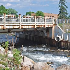
The area took shape in the 1940s with the construction of the Reedsburg Dam, which created a water system to control flooding from upstream. This infrastructure permanently altered the landscape and led to the establishment of wildlife protection in the region.

Culture

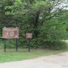
The management area supports conservation education through organized nature walks and wildlife observation programs conducted by the Michigan Department of Natural Resources.

Practical

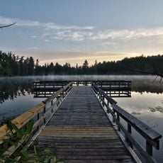
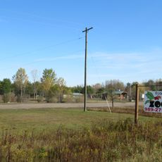
The area is reachable via U.S. Route 127 exit 194 and County Road 300, with two public boat launches for water-based activities. The timing of your visit matters depending on what you want to see or do, from bird watching to fishing.

Did you know?

The waters hold numerous submerged logs and natural obstacles that form specialized habitats for certain fish species. These conditions make the site a refuge for species like bowfin, which are uncommon in other locations.

Location
GPS coordinates
44.37944,-84.84472
Latest update
December 13, 2025 12:20

AroundUs brings together thousands of curated places, local tips, and hidden gems, enriched daily by 60,000 contributors worldwide. Discover all places nearby (Michigan).

Around this place
Hartwick Pines State Park
United States of America

Hartwick Pines State Park

43.3 km
South Higgins Lake State Park
United States of America

South Higgins Lake State Park

14.9 km
North Higgins Lake State Park
United States of America

North Higgins Lake State Park

16.5 km
Mitchell State Park
United States of America

Mitchell State Park

50.9 km
Roscommon Zoo
United States of America

Roscommon Zoo

32.1 km
Cadillac-Soo Lumber Company 3
United States of America

Cadillac-Soo Lumber Company 3

46.6 km
Charles T. Mitchell House
United States of America

Charles T. Mitchell House

46.3 km
United States of America

Houghton Lake Flats Flooding State Wildlife Management Area

3 km
Cadillac Public Library
United States of America

Cadillac Public Library

46.3 km
Frank J. Cobbs House
United States of America

Frank J. Cobbs House

46 km
Eggleston School
United States of America

Eggleston School

35.6 km
Edward E. Hartwick Memorial Building
United States of America

Edward E. Hartwick Memorial Building

42.9 km
Douglas House
United States of America

Douglas House

55.1 km
Elks Temple Building
United States of America

Elks Temple Building

46.5 km
Cobbs and Mitchell Building
United States of America

Cobbs and Mitchell Building

46.4 km
Ogemaw Hills Pathway
United States of America

Ogemaw Hills Pathway

49.4 km
M-72–Au Sable River Bridge
United States of America

M-72–Au Sable River Bridge

32.9 km
Masonic Temple Building
United States of America

Masonic Temple Building

46.5 km
Fife Lake–Union District No. 1 Schoolhouse
United States of America

Fife Lake–Union District No. 1 Schoolhouse

48 km
CoopersVille USA
United States of America

CoopersVille USA

55.6 km
Twin Birch Golf Course
United States of America

Twin Birch Golf Course

46.6 km
Cobbs and Mitchell Mill No 1 Historical Marker
United States of America

Cobbs and Mitchell Mill No 1 Historical Marker

46.6 km
Cadillac Wexford Public Library
United States of America

Cadillac Wexford Public Library

46.6 km
Missaukee County Historical Society Museum
United States of America

Missaukee County Historical Society Museum

30.4 km
Missaukee County Veterans Memorial Park
United States of America

Missaukee County Veterans Memorial Park

29.9 km
Kingsley Village Office
United States of America

Kingsley Village Office

59.4 km
Brownson Memorial Park
United States of America

Brownson Memorial Park

59.4 km
Veterans Monument
United States of America

Veterans Monument

45.5 km
Show the full map
« Dead Stream Flooding State Wildlife Management Area - Protected wildlife area in northern Michigan, United States » is provided by Around Us (aroundus.com). Images and texts are derived from Wikimedia project under a Creative Commons license. You are allowed to copy, distribute, and modify copies of this page, under the conditions set by the license, as long as this note is clearly visible.

Discover hidden gems everywhere you go!

From secret cafés to breathtaking viewpoints, skip the crowded tourist spots and find places that match your style. Our app makes it easy with voice search, smart filtering, route optimization, and insider tips from travelers worldwide. Download now for the complete mobile experience.

Around Us App Screenshot

A unique approach to discovering new places

Le Figaro

All the places worth exploring

France Info

A tailor-made excursion in just a few clicks

20 Minutes

Around Us
Travel Guide & Maps
Download

Send to your phone

QR Code
1

Open the camera app on your mobile.

2

Point at the QR code with your camera. A notification will appear.

3

Tap the notification to open the link.