South Higgins Lake State Park

Log in to your account

AroundUs is a community-driven map of interesting places, built by curious explorers like you. It grows with every review, story, and photo you share.
Connect to save your favorite spots, contribute locations, and create personalized routes.
Continue with Google
Continue with Apple
Continue with X
Continue with Facebook
Continue with email
By continuing, you accept our Terms and Conditions and our Privacy Policy
Create an account

South Higgins Lake State Park

Add to collection
Map
Suggest a change
Share

South Higgins Lake State Park, State park at Higgins Lake, Michigan, US.
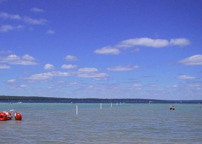
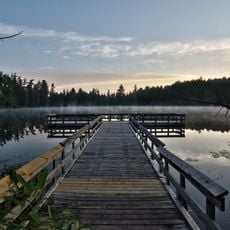
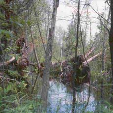
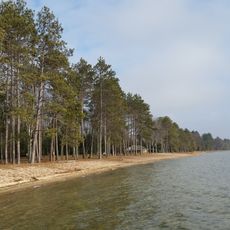
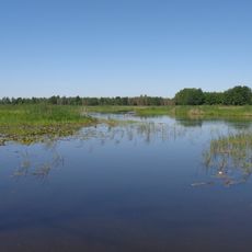
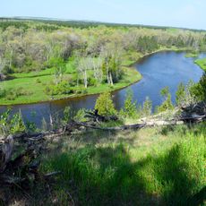
South Higgins Lake State Park is a recreation area providing access to one of Michigan's largest spring-fed lakes along with a smaller inland lake surrounded by forest. The park features sandy beaches, multiple boat launches, campgrounds, and hiking paths through woods and along shorelines.

The Michigan State Park Commission founded this park in 1927 as a public recreation area near one of the state's largest lakes. This early establishment reflected Michigan's commitment to making natural spaces accessible to the public.

The park serves as a gathering place where families and nature lovers spend time together on the water and forest trails. Seasonal programs help visitors understand Michigan's natural environment and connect with the landscape around them.
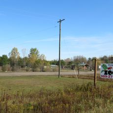
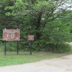
Vehicle entry requires a Recreation Passport, though some areas allow free foot access and picnicking without fees. Most visitors park near beach or boat launch areas and explore the rest on foot, making the layout easy to navigate.

The park contains two distinct lakes with opposite rules: the main lake allows motorboats and draws active water sports enthusiasts, while the smaller lake permits only non-motorized and electric boats. This separation creates two different experiences for different types of visitors.

Location: Roscommon County

Inception: 1927

Website: https://www2.dnr.state.mi.us/ParksandTrails/Details.aspx?id=496&type=SPRK

GPS coordinates: 44.42580,-84.66890

Latest update: December 11, 2025 11:04

Photos
Around this place
Hartwick Pines State Park
United States of America

Hartwick Pines State Park

35.8 km
Au Sable State Forest
United States of America

Au Sable State Forest

53.8 km
North Higgins Lake State Park
United States of America

North Higgins Lake State Park

12.1 km
Dead Stream Flooding State Wildlife Management Area
United States of America

Dead Stream Flooding State Wildlife Management Area

14.9 km
Roscommon Zoo
United States of America

Roscommon Zoo

17.4 km
Charles T. Mitchell House
United States of America

Charles T. Mitchell House

61.2 km
United States of America

Houghton Lake Flats Flooding State Wildlife Management Area

12.6 km
Cadillac Public Library
United States of America

Cadillac Public Library

61.2 km
Frank J. Cobbs House
United States of America

Frank J. Cobbs House

60.9 km
Eggleston School
United States of America

Eggleston School

29.7 km
Edward E. Hartwick Memorial Building
United States of America

Edward E. Hartwick Memorial Building

35 km
Douglas House
United States of America

Douglas House

44.4 km
Oscoda County Courthouse
United States of America

Oscoda County Courthouse

49.5 km
Elks Temple Building
United States of America

Elks Temple Building

61.4 km
Cobbs and Mitchell Building
United States of America

Cobbs and Mitchell Building

61.3 km
Ogemaw Hills Pathway
United States of America

Ogemaw Hills Pathway

36.2 km
M-72–Au Sable River Bridge
United States of America

M-72–Au Sable River Bridge

26.3 km
Masonic Temple Building
United States of America

Masonic Temple Building

61.4 km
Fife Lake–Union District No. 1 Schoolhouse
United States of America

Fife Lake–Union District No. 1 Schoolhouse

58.2 km
CoopersVille USA
United States of America

CoopersVille USA

42.6 km
Twin Birch Golf Course
United States of America

Twin Birch Golf Course

51.5 km
Au Sable National Scenic River
United States of America

Au Sable National Scenic River

60.7 km
Cobbs and Mitchell Mill No 1 Historical Marker
United States of America

Cobbs and Mitchell Mill No 1 Historical Marker

61.5 km
Cadillac Wexford Public Library
United States of America

Cadillac Wexford Public Library

61.5 km
Missaukee County Historical Society Museum
United States of America

Missaukee County Historical Society Museum

45.1 km
Missaukee County Veterans Memorial Park
United States of America

Missaukee County Veterans Memorial Park

44.6 km
Mancelona Area Historical Society Museum
United States of America

Mancelona Area Historical Society Museum

60.8 km
Veterans Monument
United States of America

Veterans Monument

56.4 km
Show the full map
Reviews

Visited this place? Tap the stars to rate it and share your experience / photos with the community! Try now! You can cancel it anytime.

« South Higgins Lake State Park - State park at Higgins Lake, Michigan, US » is provided by Around Us (aroundus.com). Images and texts are derived from Wikimedia project under a Creative Commons license. You are allowed to copy, distribute, and modify copies of this page, under the conditions set by the license, as long as this note is clearly visible.

Discover hidden gems everywhere you go!

From secret cafés to breathtaking viewpoints, skip the crowded tourist spots and find places that match your style. Our app makes it easy with voice search, smart filtering, route optimization, and insider tips from travelers worldwide. Download now for the complete mobile experience.

Around Us App Screenshot

A unique approach to discovering new places

Le Figaro

All the places worth exploring

France Info

A tailor-made excursion in just a few clicks

20 Minutes