Oscoda County Courthouse

Log in to your account

AroundUs is a community-driven map of interesting places, built by curious explorers like you. It grows with every review, story, and photo you share.
Connect to save your favorite spots, contribute locations, and create personalized routes.
By continuing, you accept our Terms and Conditions and our Privacy Policy
Add to collection
Map
Suggest a change
Share

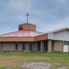
Oscoda County Courthouse, County courthouse in Mio, Michigan.

Oscoda County Courthouse is a two-story Classical Revival structure with a rectangular shape and a distinctive bay entrance crowned by a hip-roofed steeple. Two additional wings were later added to expand its capacity for administrative functions.

Construction took place between 1888 and 1889, establishing the county's administrative center, and two wings were added in 1908 to accommodate growing needs. The original structure was destroyed in 2016 and replaced by a new building in 2020.

The building served as the administrative heart of Oscoda County, handling legal proceedings and public records that shaped daily governance. Its presence reflected how communities organized their legal and governmental functions in the local landscape.

The courthouse is accessible during daytime hours when public offices are open on weekdays. Visitors should keep in mind that this is an active government building with regular business operations.

The building was destroyed by fire in 2016 but reconstructed on the same site, making it a symbol of renewal for the community. This rebuilding reflects the determination to maintain the county's administrative presence.

Location: Oscoda County

GPS coordinates: 44.64930,-84.12920

Latest update: December 14, 2025 18:43

Photos
Around this place
Hartwick Pines State Park
United States of America

Hartwick Pines State Park

44.1 km
Lumberman's Monument
United States of America

Lumberman's Monument

46.6 km
Harrisville State Park
United States of America

Harrisville State Park

66.1 km
South Higgins Lake State Park
United States of America

South Higgins Lake State Park

49.5 km
Au Sable State Forest
United States of America

Au Sable State Forest

61.2 km
North Higgins Lake State Park
United States of America

North Higgins Lake State Park

52.1 km
Negwegon State Park
United States of America

Negwegon State Park

67.5 km
St. Mary, Our Lady of Mount Carmel Cathedral
United States of America

St. Mary, Our Lady of Mount Carmel Cathedral

61.2 km
Alabaster Historic District
United States of America

Alabaster Historic District

68.1 km
Dead Stream Flooding State Wildlife Management Area
United States of America

Dead Stream Flooding State Wildlife Management Area

64.3 km
Five Channels Dam
United States of America

Five Channels Dam

41.9 km
Roscommon Zoo
United States of America

Roscommon Zoo

32.1 km
Houghton Lake Flats Flooding State Wildlife Management Area
United States of America

Houghton Lake Flats Flooding State Wildlife Management Area

62.1 km
Eggleston School
United States of America

Eggleston School

57.5 km
Edward E. Hartwick Memorial Building
United States of America

Edward E. Hartwick Memorial Building

42.7 km
Douglas House
United States of America

Douglas House

32.7 km
Frank A. and Rae E. Harris Kramer House
United States of America

Frank A. and Rae E. Harris Kramer House

60.4 km
Call of the Wild Museum
United States of America

Call of the Wild Museum

60.1 km
Ogemaw Hills Pathway
United States of America

Ogemaw Hills Pathway

34.1 km
M-72–Au Sable River Bridge
United States of America

M-72–Au Sable River Bridge

46.2 km
James A. and Lottie J.
United States of America

James A. and Lottie J.

60.2 km
Dinosaur Gardens
United States of America

Dinosaur Gardens

61.8 km
White Pine National
United States of America

White Pine National

50 km
Wurtsmith Air Museum
United States of America

Wurtsmith Air Museum

64.8 km
CoopersVille USA
United States of America

CoopersVille USA

20.3 km
Au Sable National Scenic River
United States of America

Au Sable National Scenic River

12.7 km
Kiwanis Monument
United States of America

Kiwanis Monument

47.1 km
Rollways Campground and Day Use Area
United States of America

Rollways Campground and Day Use Area

35.2 km
Show the full map
Reviews

Visited this place? Tap the stars to rate it and share your experience / photos with the community! Try now! You can cancel it anytime.

« Oscoda County Courthouse - County courthouse in Mio, Michigan » is provided by Around Us (aroundus.com). Images and texts are derived from Wikimedia project under a Creative Commons license. You are allowed to copy, distribute, and modify copies of this page, under the conditions set by the license, as long as this note is clearly visible.

Discover hidden gems everywhere you go!

From secret cafés to breathtaking viewpoints, skip the crowded tourist spots and find places that match your style. Our app makes it easy with voice search, smart filtering, route optimization, and insider tips from travelers worldwide. Download now for the complete mobile experience.

Around Us App Screenshot

A unique approach to discovering new places

Le Figaro

All the places worth exploring

France Info

A tailor-made excursion in just a few clicks

20 Minutes