Alabaster Historic District

Log in to your account

AroundUs is a community-driven map of interesting places, built by curious explorers like you. It grows with every review, story, and photo you share.
Connect to save your favorite spots, contribute locations, and create personalized routes.
Continue with Google
Continue with Apple
Continue with X
Continue with Facebook
Continue with email
By continuing, you accept our Terms and Conditions and our Privacy Policy
Create an account
Add to collection
Map
Suggest a change
Share

Alabaster Historic District, Mining historic district in Iosco County, Michigan, United States.

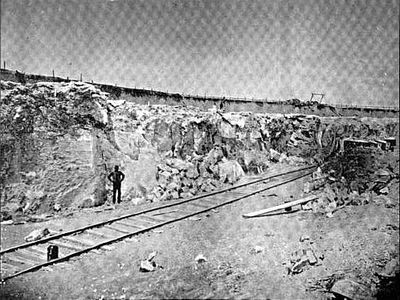
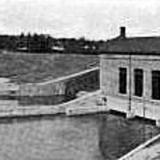
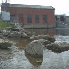
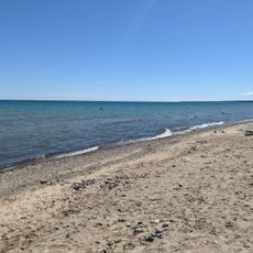
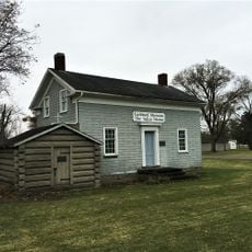
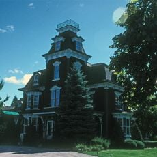
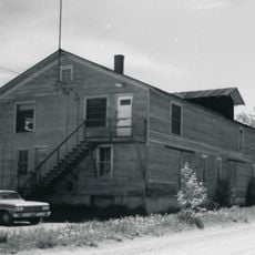
The Alabaster Historic District is a mining area in Michigan spanning 400 acres with an open pit gypsum mine, processing buildings, and administrative structures. The site contains approximately 36 buildings, including residential houses with gable roofs arranged along several roads near Lake Huron.

Gypsum mining began in 1862 when George B. Smith initiated extraction operations in this location. The mined materials later supplied the 1893 World's Columbian Exposition in Chicago, marking a significant moment for the operation.

Workers from Europe arrived to labor in the mines and built a close-knit residential community around the operation. Their homes and daily routines shaped the character of this company town throughout the industrial era.

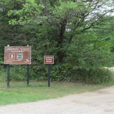
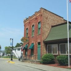
The district is easy to explore on foot with roads connecting the buildings throughout the site. The structures are grouped closely together, making it possible to view the entire area in a single visit.

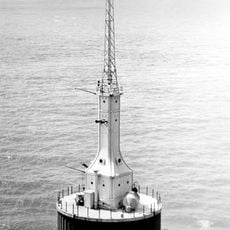
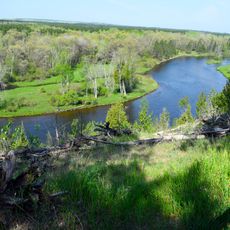
An elevated marine tramway stretching 1.5 miles extended into Saginaw Bay until the 1990s to transport mined materials across the water. This remarkable structure represents an inventive approach to solving the logistics challenge of moving gypsum to distant markets.

Location: Michigan

GPS coordinates: 44.18670,-83.56780

Latest update: December 13, 2025 11:42

Photos
Around this place
Turnip Rock
United States of America

Turnip Rock

50.4 km
Lumberman's Monument
United States of America

Lumberman's Monument

28.1 km
Port Crescent State Park
United States of America

Port Crescent State Park

45.7 km
Tawas Point State Park
United States of America

Tawas Point State Park

12.4 km
Harrisville State Park
United States of America

Harrisville State Park

55.7 km
Au Sable State Forest
United States of America

Au Sable State Forest

49.1 km
Tawas Point Light
United States of America

Tawas Point Light

12 km
Charity Island Light
United States of America

Charity Island Light

19.5 km
Grindstone City Historic District
United States of America

Grindstone City Historic District

55.5 km
Tobico Marsh
United States of America

Tobico Marsh

62 km
Port Austin Light
United States of America

Port Austin Light

48.1 km
Gravelly Shoal Light
United States of America

Gravelly Shoal Light

18.9 km
Tawas Point Camper's Beach
United States of America

Tawas Point Camper's Beach

12.5 km
Five Channels Dam
United States of America

Five Channels Dam

31.1 km
Cooke Dam
United States of America

Cooke Dam

31.8 km
St. Peter's Lutheran Church Kinde, Michigan
United States of America

St. Peter's Lutheran Church Kinde, Michigan

53.2 km
Harrisville State Park Beach
United States of America

Harrisville State Park Beach

55.7 km
Indian Mission
United States of America

Indian Mission

52.3 km
Huron City Historic District
United States of America

Huron City Historic District

61.3 km
Charles G. Learned House
United States of America

Charles G. Learned House

48.6 km
Ogemaw Hills Pathway
United States of America

Ogemaw Hills Pathway

55.5 km
Second Arenac County Courthouse
United States of America

Second Arenac County Courthouse

27.6 km
Bay Port Historic Commercial Fishing District
United States of America

Bay Port Historic Commercial Fishing District

40.2 km
Smith-Culhane House
United States of America

Smith-Culhane House

48.5 km
Winsor and Snover Bank Building
United States of America

Winsor and Snover Bank Building

48.5 km
Caseville Harbor Light
United States of America

Caseville Harbor Light

35.3 km
Wurtsmith Air Museum
United States of America

Wurtsmith Air Museum

34.6 km
Au Sable National Scenic River
United States of America

Au Sable National Scenic River

60.3 km
Show the full map
Reviews

Visited this place? Tap the stars to rate it and share your experience / photos with the community! Try now! You can cancel it anytime.

« Alabaster Historic District - Mining historic district in Iosco County, Michigan, United States » is provided by Around Us (aroundus.com). Images and texts are derived from Wikimedia project under a Creative Commons license. You are allowed to copy, distribute, and modify copies of this page, under the conditions set by the license, as long as this note is clearly visible.

Discover hidden gems everywhere you go!

From secret cafés to breathtaking viewpoints, skip the crowded tourist spots and find places that match your style. Our app makes it easy with voice search, smart filtering, route optimization, and insider tips from travelers worldwide. Download now for the complete mobile experience.

Around Us App Screenshot

A unique approach to discovering new places

Le Figaro

All the places worth exploring

France Info

A tailor-made excursion in just a few clicks

20 Minutes