Enable Location

We need your location to show you interesting places around you

Discover nearby places

Find interesting locations and hidden gems around you

Precise directions

Get accurate directions and distances to places

Your location is never shared with other users. It's only used when you tap the location button.

Tawas Point State Park

Log in to your account

Start exploring — it's free

Trusted by 62,796 travelers worldwide

Continue with Google
Continue with Apple
or

We will send you a code to connect

By continuing, you accept our Terms and Conditions and our Privacy Policy

Check your inbox

We've sent a pincode in your inbox. Please enter the code below.

Tawas Point State Park

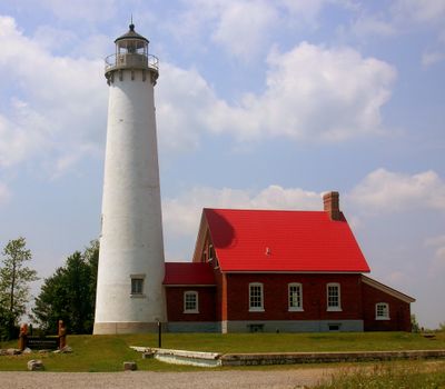
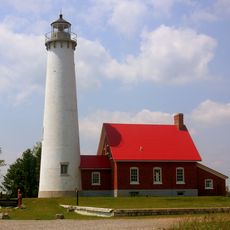
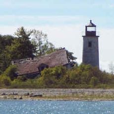
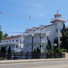
Tawas Point State Park, State park on Lake Huron sand spit, Michigan, US.

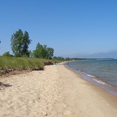
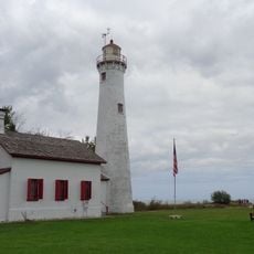
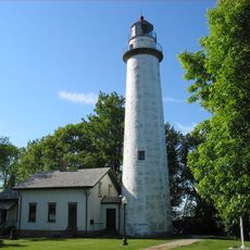
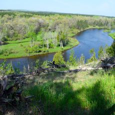
Tawas Point State Park is a coastal park stretching along Tawas Bay at the end of a long sand spit. The area features sandy beaches, coastal dunes, wetlands, and a working lighthouse marking the peninsula's tip.

The park was created in the early 1960s after the state of Michigan purchased land at this location. The lighthouse structure has marked this point on the shore for more than a century, guiding vessels through the bay.

The park hosts an annual Tawas Point Celebration Days in June featuring historical displays, traditional crafts, and period-dressed reenactors near the lighthouse.

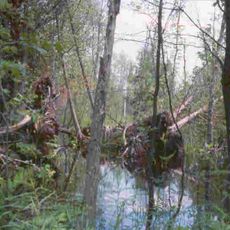
The park features a campground, picnic areas, and trails that wind through coastal terrain. Bring suitable footwear for walking on sand and along shoreline paths.

The park sits along a major bird migration route and attracts hundreds of bird species during seasonal movements. This makes it a special refuge for birdwatchers when flocks are passing through.

The community of curious travelers

AroundUs brings together thousands of curated places, local tips, and hidden gems, enriched daily by 60,000 contributors worldwide.

Start exploring
Location
Inception
1961
GPS coordinates
44.25560,-83.44610
Latest update
December 10, 2025 20:06
Around this place
Turnip Rock
United States of America

Turnip Rock

44.1 km
Lumberman's Monument
United States of America

Lumberman's Monument

24.5 km
Port Crescent State Park
United States of America

Port Crescent State Park

41.9 km
Sturgeon Point Light
United States of America

Sturgeon Point Light

52.4 km
Pointe aux Barques Light
United States of America

Pointe aux Barques Light

58.2 km
Harrisville State Park
United States of America

Harrisville State Park

45.3 km
Au Sable State Forest
United States of America

Au Sable State Forest

60.3 km
Tawas Point Light
United States of America

Tawas Point Light

347 m
Charity Island Light
United States of America

Charity Island Light

24.3 km
Grindstone City Historic District
United States of America

Grindstone City Historic District

49.2 km
Port Austin Light
United States of America

Port Austin Light

41.6 km
Gravelly Shoal Light
United States of America

Gravelly Shoal Light

27.4 km
Alabaster Historic District
United States of America

Alabaster Historic District

12.4 km
Five Channels Dam
United States of America

Five Channels Dam

28.8 km
Cooke Dam
United States of America

Cooke Dam

26.1 km
St. Peter's Lutheran Church Kinde, Michigan
United States of America

St. Peter's Lutheran Church Kinde, Michigan

50.1 km
Indian Mission
United States of America

Indian Mission

59 km
Huron City Historic District
United States of America

Huron City Historic District

55 km
Charles G. Learned House
United States of America

Charles G. Learned House

43.2 km
Second Arenac County Courthouse
United States of America

Second Arenac County Courthouse

40 km
Bay Port Historic Commercial Fishing District
United States of America

Bay Port Historic Commercial Fishing District

45.1 km
Smith-Culhane House
United States of America

Smith-Culhane House

43.1 km
Winsor and Snover Bank Building
United States of America

Winsor and Snover Bank Building

43.1 km
Caseville Harbor Light
United States of America

Caseville Harbor Light

37 km
White Pine National
United States of America

White Pine National

55.6 km
Wurtsmith Air Museum
United States of America

Wurtsmith Air Museum

23.7 km
Au Sable National Scenic River
United States of America

Au Sable National Scenic River

60.2 km
Kiwanis Monument
United States of America

Kiwanis Monument

23.7 km
Show the full map
« Tawas Point State Park - State park on Lake Huron sand spit, Michigan, US » is provided by Around Us (aroundus.com). Images and texts are derived from Wikimedia project under a Creative Commons license. You are allowed to copy, distribute, and modify copies of this page, under the conditions set by the license, as long as this note is clearly visible.

Discover hidden gems everywhere you go!

From secret cafés to breathtaking viewpoints, skip the crowded tourist spots and find places that match your style. Our app makes it easy with voice search, smart filtering, route optimization, and insider tips from travelers worldwide. Download now for the complete mobile experience.

Around Us App Screenshot

A unique approach to discovering new places

Le Figaro

All the places worth exploring

France Info

A tailor-made excursion in just a few clicks

20 Minutes

Around Us
Travel Guide & Maps
Download

Send to your phone

QR Code
1

Open the camera app on your mobile.

2

Point at the QR code with your camera. A notification will appear.

3

Tap the notification to open the link.