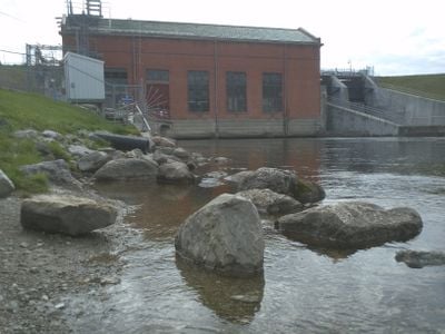
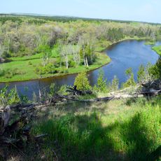
Cooke Dam, historic dam in Michigan, USA
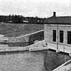
Cooke Dam is an earth-filled dam with a concrete core wall stretching across the Au Sable River, creating a small reservoir behind it. A brick powerhouse with a gable roof contains turbines and generators that convert the river's flow into electricity for local communities.
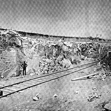
Construction began in 1909 and was completed in 1911 as part of a larger effort by Consumers Power Company to build six hydroelectric plants along the Au Sable River between 1911 and 1923. The plant helped bring electricity to growing cities like Flint, Saginaw, and Bay City in its early years.
The site is named after Andrew Cooke, a banker who helped secure funding for the project. It reflects how communities relied on water power to drive industrial growth and how people worked together to bring electricity to their towns during the early 20th century.
The dam is located about 6 miles east of Michigan Route 65 in Oscoda Township and can be reached via Bissonette Road and Cooke Dam Road. The site sits in a scenic area with trees and open space that invites walking along the River Road Scenic Byway.
The site used Tainter gates, an advanced technology at the time with steel construction that allowed large amounts of water to be released quickly during flooding. The transmission lines featured specially designed tapered steel towers and innovative insulators that became models for power grids across the country.
The community of curious travelers
AroundUs brings together thousands of curated places, local tips, and hidden gems, enriched daily by 60,000 contributors worldwide.